

Oil
Earth Resources Observation and Science (EROS) Center - Earthshots
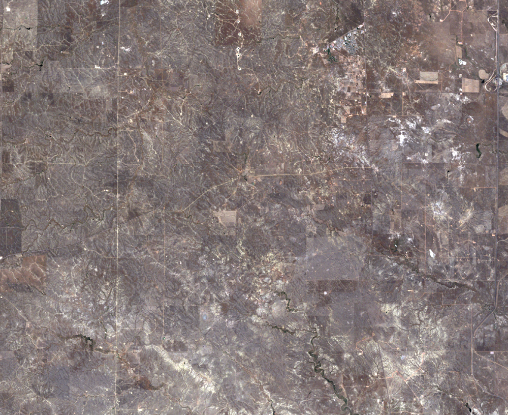
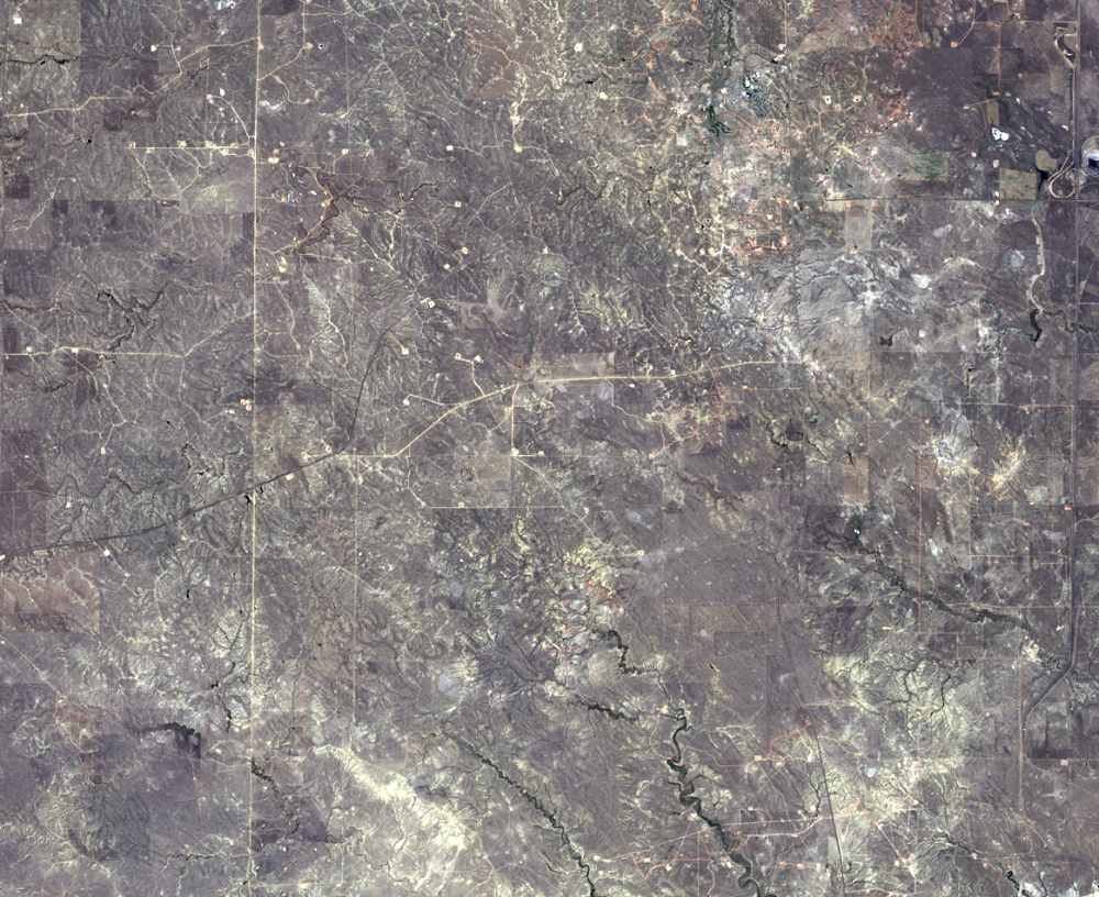
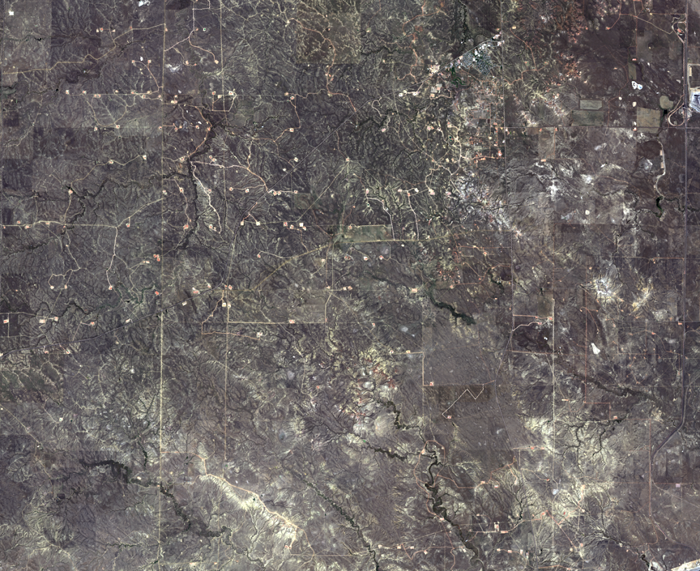
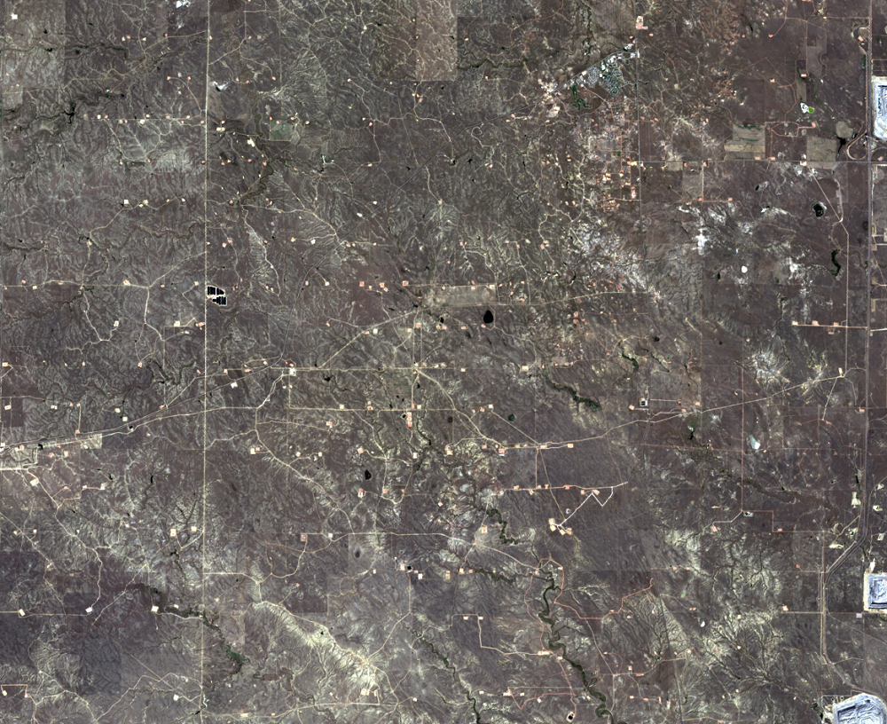
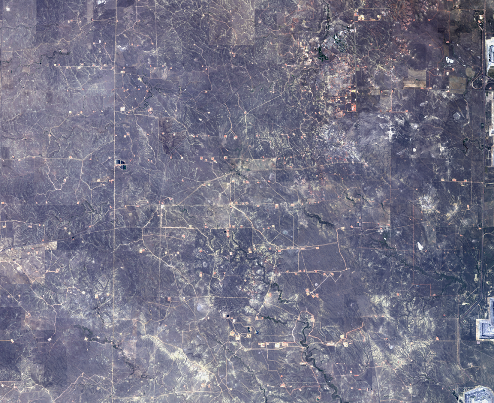
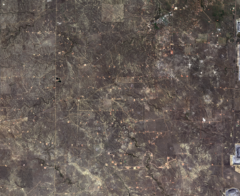
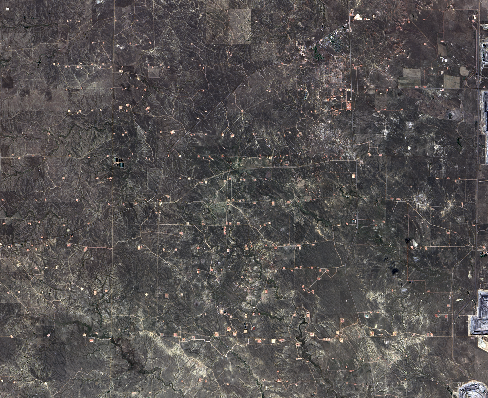
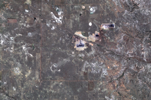
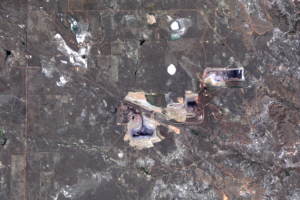
The PRB has become about more than just coal. Oil production is also increasing. Similar to the Bakken Formation in North Dakota, new technologies are allowing oil to be more economically recoverable.
Since 2009, hundreds of oil wells have been drilled in the PRB. In the second half of 2010, 219 drilling permits were received. In the first half of 2014, 1,161 permits were received.
These images show the region just west of the Black Thunder Mine. The 2014 image looks like a messy dot-to-dot drawing. The light dots, connected by crooked lines, are oil wells and the roads that lead to them.
Imagery
Every picture has a story to tell
Correlated
Additional story information
Downloads
Other Stories
Related imagery and additional content
Animations
The coal mines in the PRB advance quickly enough to see a lot of chang...
Black Thunder Mine
The Black Thunder Mine, shown in the series of Landsat images on the l...
North Antelope Rochelle Complex Mines
The North Antelope Rochelle Complex is the most productive of the PRB ...
Oil
The PRB has become about more than just coal. Oil production is also i...
The Mining Process
The mining process that takes place in the PRB is called surface minin...