

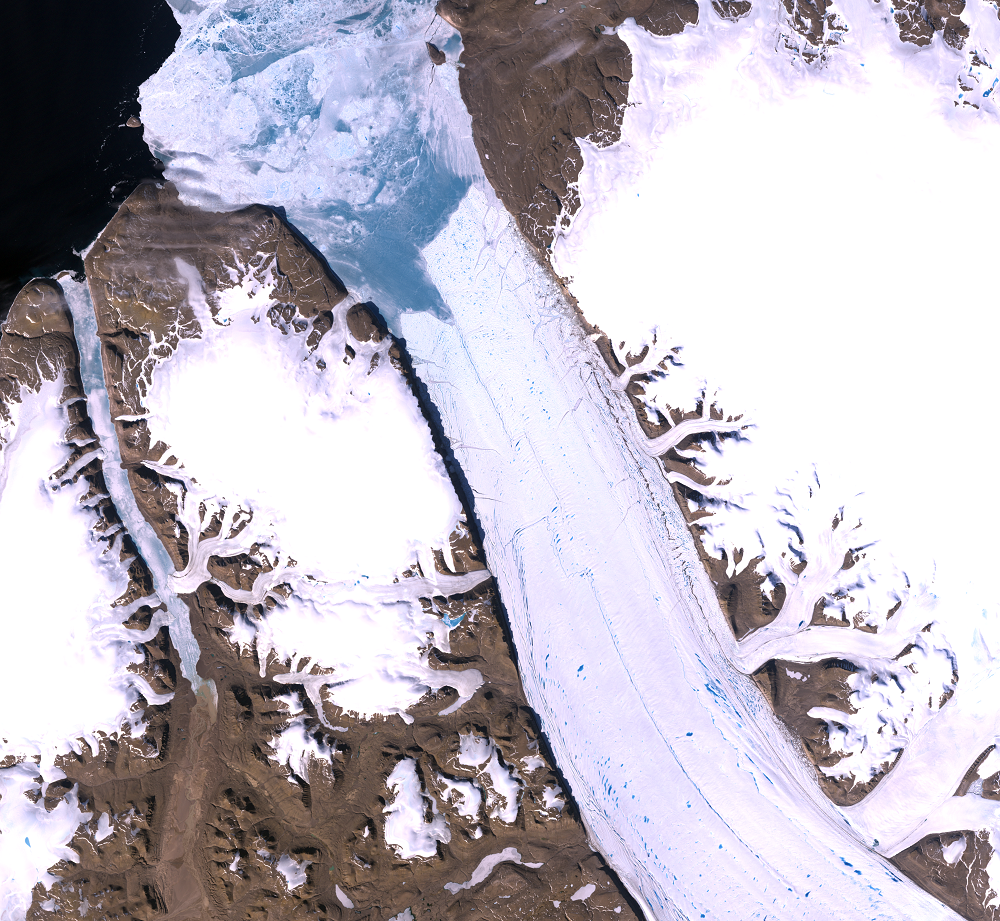
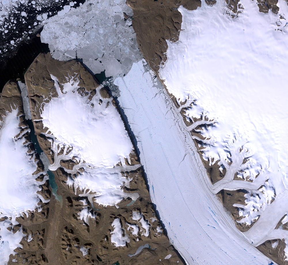
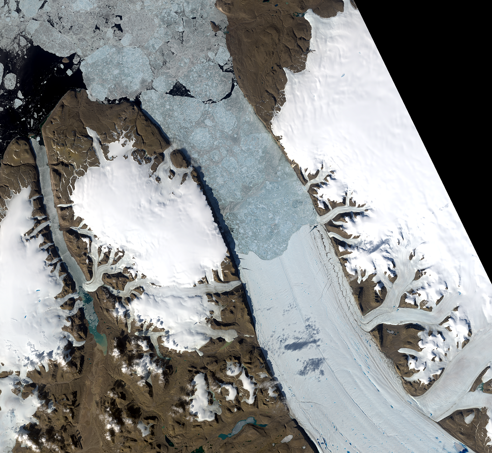
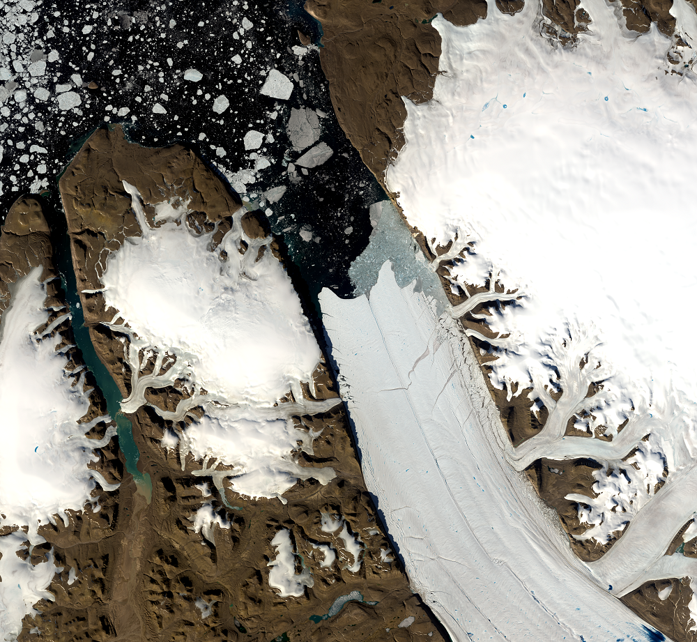
Petermann Glacier, Greenland
Earth Resources Observation and Science (EROS) Center - Earthshots
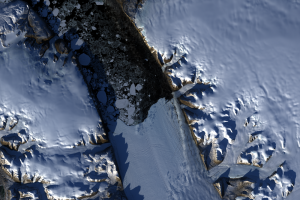
Petermann Glacier made headline news in 2010 and again in 2012 when large pieces broke off the end of the glacier and floated out to sea. Located on the northwestern coast of Greenland, Petermann Glacier covers 1,295 square kilometers. Its floating ice tongue is 15–20 kilometers wide and 70 kilometers long—the longest floating glacier in the Northern Hemisphere.
A glacier is made up of fallen snow that has been compressed into a large thickened ice mass over many thousands of years. Tidewater glaciers flow like very slow rivers to the ocean, and at the boundary between the glacier and the sea, ice breaks, or calves, from the end, creating icebergs.
This calving is normal, but it’s worth watching Petermann and other Greenland glaciers closely. Petermann is one of the major marine-terminating glaciers of Greenland. Ice loss from the Greenland Ice Sheet has increased recently. An article in Nature concluded that climate change may cause Petermann and other Greenland glaciers to contribute to sea level rise. Landsat helps glaciologists keep a close eye on this remote but significant glacier.
Imagery
Downloads
Johannessen, O.M., Babiker, M., and Miles, M.W., 2013, Unprecedented Retreat in a 50-Year Observational Record for Petermann Glacier, North Greenland: Atmospheric and Oceanic Science Letters, v. 6, no. 5, p. 259–265.
Münchow, A., Padman, L., and Dricker, H.A., 2014, Interannual changes of the floating ice shelf of Petermann Gletscher, North Greenland, from 2000 to 2012: Journal of Glaciology, v. 60, no. 221, 489–499.
NASA Goddard Space Flight Center, 2012, Petermann Ice Island 2012: NASA GSFC Web page at https://svs.gsfc.nasa.gov/11114. (Accessed September 26, 2014.)
Nick, F.M., Vieli, A., Anderson, M.L., Joughin, I., Payne, A., Edwards, T.L., Pattyn, F., and van de Wal, S.W., 2013, Future Sea-level Rise from Greenland’s Main Outlet Glaciers in a Warming Climate: Nature, v. 497, p. 235–238. (Also available online at http://www.nature.com/nature/journal/v497/n7448/abs/nature12068.html.)
Prifysgol Aberystwyth University, [n.d.], The Greenland Ice Sheet—Petermann Glacier, NW Greenland: Prifysgol Aberystwyth University Web page at http://www.aber.ac.uk/greenland/Petermann.html. (Accessed October 21, 2014.)
Riebeek, H., and Scott, M., 2010, Ice Island calves off Petermann Glacier: NASA Earth Observatory, available at http://earthobservatory.nasa.gov/IOTD/view.php?id=45112. (Accessed October 21, 2014.)
Scott, M., 2008, Crack in the Petermann Glacier: NASA Earth Observatory, available at http://earthobservatory.nasa.gov/IOTD/view.php?id=9085. (Accessed September 26, 2014.)
Scott, M., 2011, Ice Island Calves off Petermann Glacier: NASA Earth Observatory, available at http://earthobservatory.nasa.gov/NaturalHazards/view.php?id=51435. (Accessed October 21, 2014.)
Scott, M., 2012, More Ice Breaks off of Petermann Glacier: NASA Earth Observatory, available at http://earthobservatory.nasa.gov/NaturalHazards/view.php?id=78556. (Accessed September 26, 2014.)
Scott, M., 2012, Closeup of the Ice Island from Petermann Glacier: NASA Earth Observatory, available at http://earthobservatory.nasa.gov/NaturalHazards/view.php?id=78648. (Accessed October 21, 2014.)
Related Content
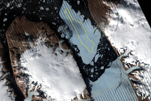
2010 Ice Break
Scientists observed rifts in Petermann Glacier throughout the first de...
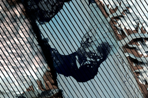
2012 Break
Just two years later, another large iceberg broke off Petermann Glacie...
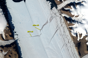
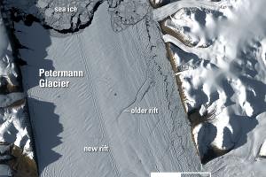
2017 Rift
A new rift formed on Petermann Glacier in 2017. An older crack to the ...
Seasonal Changes
Landsat 8 has a 16-day repeat cycle. That means it images the same spo...
The Long Dark Winter
Compare the two Landsat images from June 24, 2014, and September 19, 2...
“Nighttime” Images
Landsat 8 normally images all Earth landmasses every 16 days. However,...