

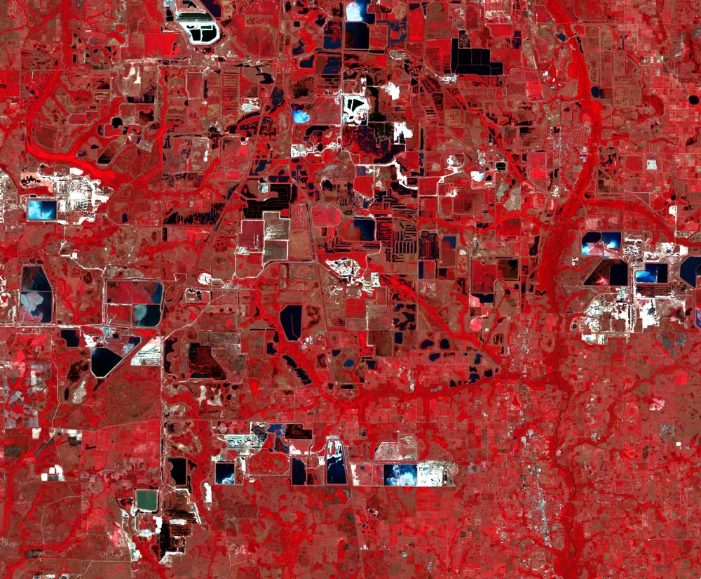
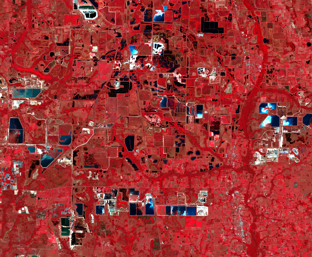
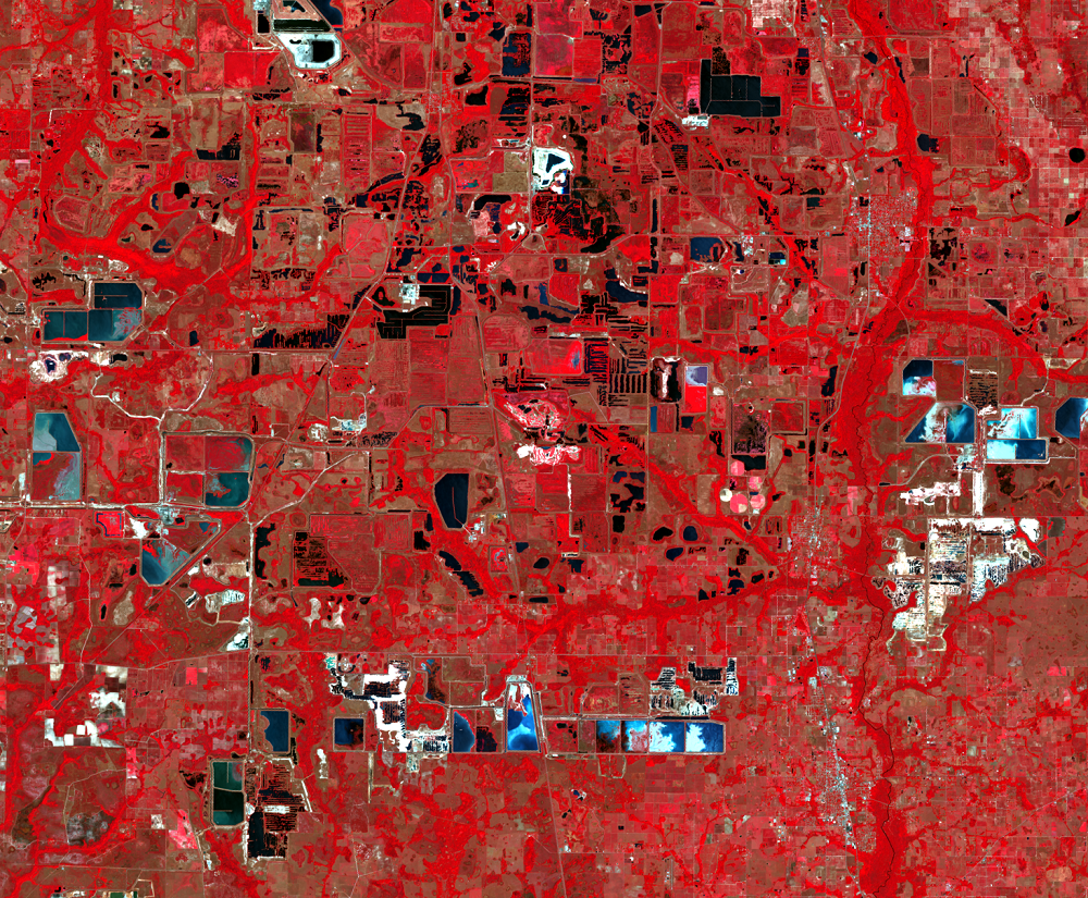
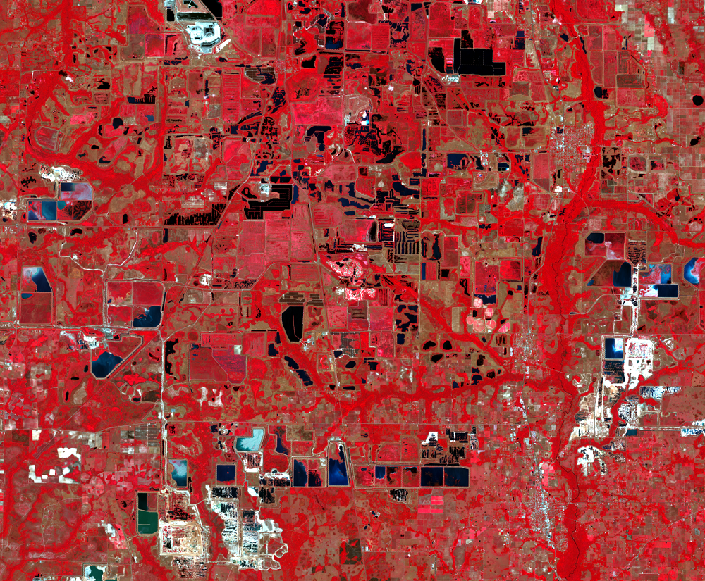
Phosphate Mines
Earth Resources Observation and Science (EROS) Center - Earthshots
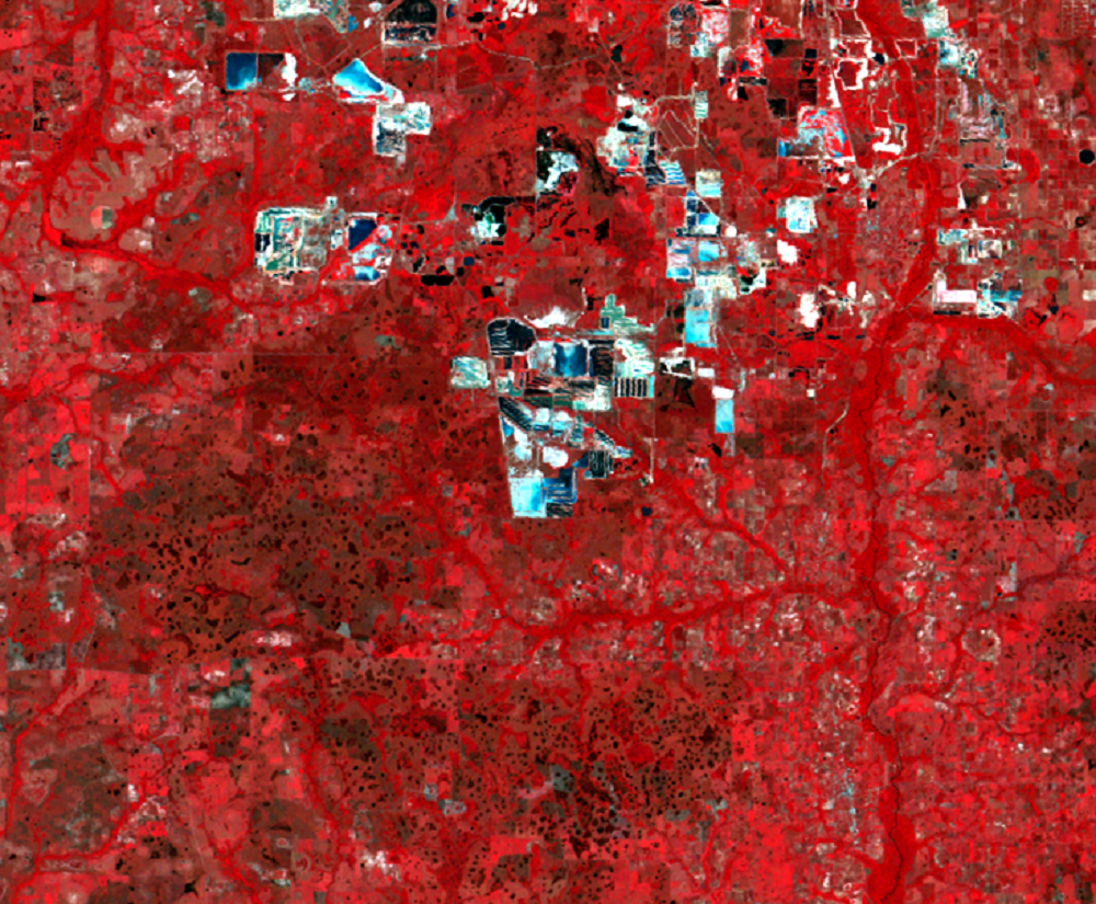
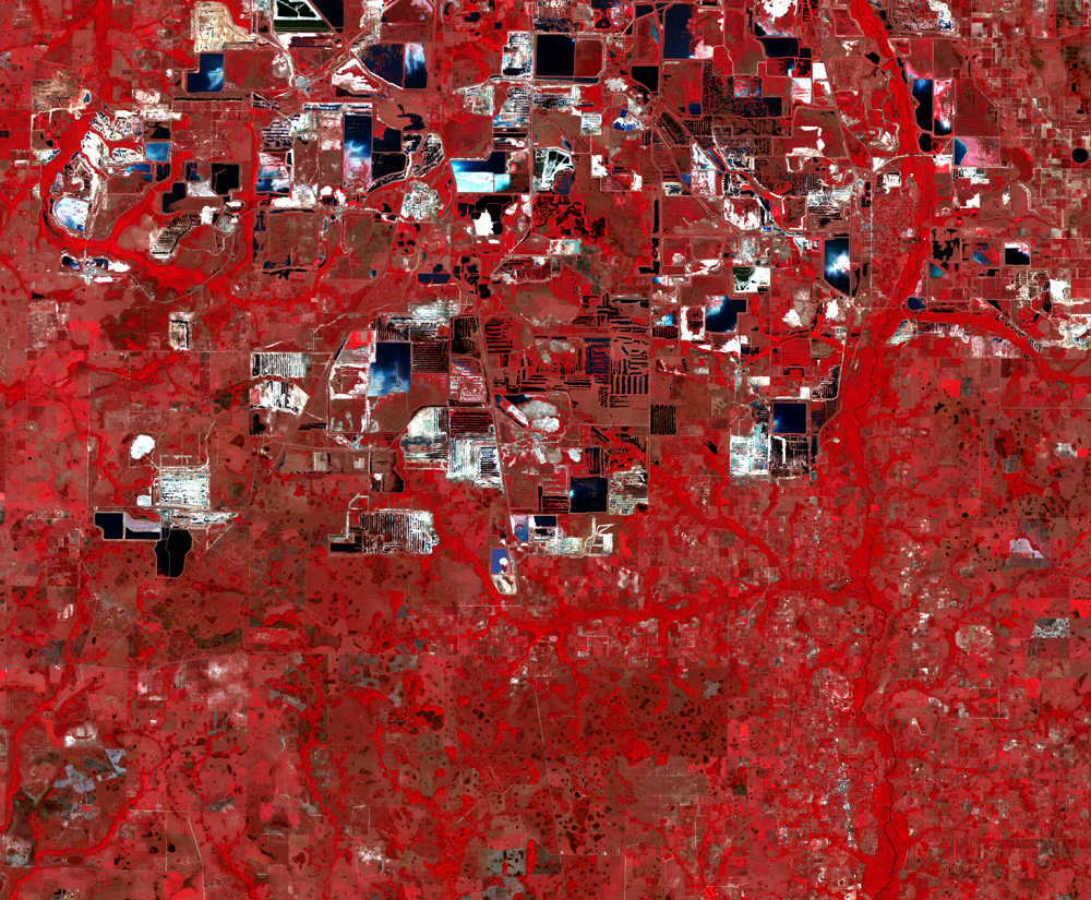
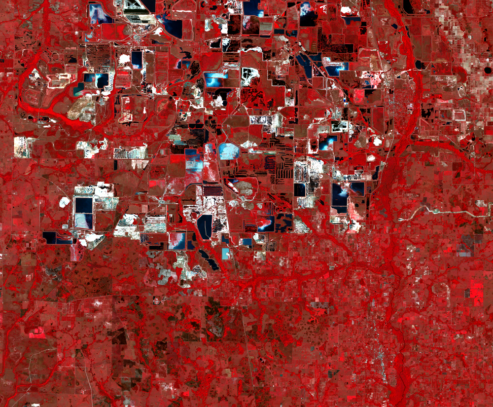
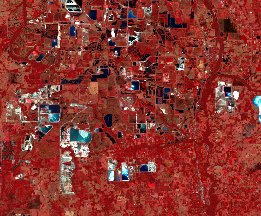
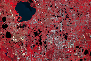
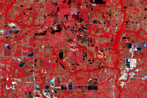
The central phosphate region of Florida has been strip mined since 1888. By the 1980s, it accounted for almost 30% of worldwide production, and almost three quarters of U.S. production. 93% of Tampa Bay's exports are phosphates. Almost all mined phosphate goes into crop fertilizer. Modern phosphate mining involves complete removal of the land—plants, animals, soil, water, even bedrock—and then its approximate reconstruction minus the phosphate.
The steps are as follows:
- The area to be mined is first stripped of vegetation and the water table is lowered, typically by digging a deep trench around the area.
- An enormous crane-like machine, dragging a giant bucket, strips away the 20–50 feet of soil and stacks it nearby in an already-mined area. Then the dragline scoops the exposed phosphate ore, mixed with sand and clay, into a pit.
- The ore in the pit is blasted by high-pressure water jets into a milkshake-like slurry.
- This slurry is pumped by pipeline to a processing plant that separates the sand, clay, and phosphate ore. The phosphate ore is shipped to another plant that processes it into fertilizer.
This process creates several byproducts besides fertilizer. Topsoil lies stacked by the mine. Sand has been separated from the phosphate ore and pumped back from the processing plant to the mine where it is used to restore the site when mining is complete. Fine-grained clay has also been separated and is more troublesome since it stays mixed with the slurry water and swells to three times its original size. Finally, every pound of manufactured fertilizer also creates five pounds of phosphogypsum waste.
Since 1975, state law has required mining companies to reassemble these byproducts back into a reclaimed semblance of the pre-mined landscape. This means bulldozing the piles of topsoil and sand into gentle slopes and replanting them with vegetation sufficient to hold a 25-year downpour as well as the pre-mined land could. Sometimes part of the clay is mixed with this bulldozed sand, but most clay gets pumped into settlement ponds, where over several decades it consolidates to an acceptable density, though still more swollen than before mining. Many of the water bodies visible in the Landsat images are settlement ponds. These aboveground ponds are contained by earthen walls that have occasionally burst, releasing billions of gallons of waste water, threatening water quality and human lives.
A more stubborn problem is the phosphogypsum. This byproduct of fertilizer manufacture is too low-grade to be used like mined gypsum in products such as wallboard. It is also acidic and contains low levels of carcinogens like radon. It is kept out of reclamation and piled in massive "gypsum stacks" up to 200 feet high. Possible uses for the phosphogypsum such as roadbuilding have been stymied by toxicity concerns. Even establishing plant cover on the stacks has been challenging.
Meanwhile, the stacks grow rapidly. Recent regulations require liners under new stacks, but in 1994 an existing stack of 80 million tons was struck by that old karstic hazard, a sinkhole. Fifteen stories deep, it dumped millions of cubic feet of water and gypsum into the aquifer.
You can see in these images the expansion of the mined area, its southward shift, and the progress of individual mines through the mining process. Look for this progression: lush vegetation (red), then perhaps bare earth (bright), then ponds (black if deep and clear, brighter blue if shallow and/or full of sediment), and finally reclaimed vegetation (red if lush, pink if not).
Imagery
Downloads
Related Content
Orlando, Florida, USA
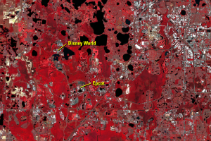
The physical growth of Orlando, Florida, especially to the east and so...
Artificial Holes
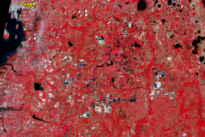
The bodies of water further south, east of Tampa, look completely diff...
Natural Holes
As rain falls through the sky it absorbs carbon dioxide, making it sli...
Phosphate Mines
The central phosphate region of Florida has been strip mined since 188...