

Pinning Points
Earth Resources Observation and Science (EROS) Center - Earthshots
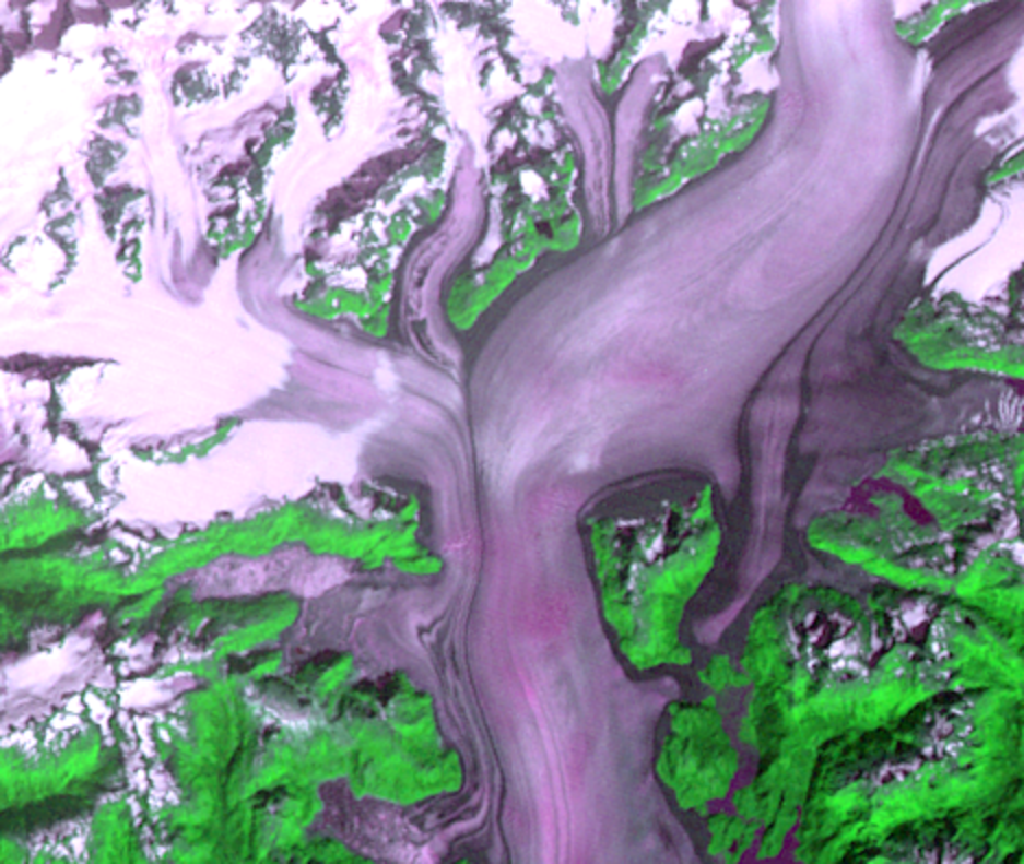
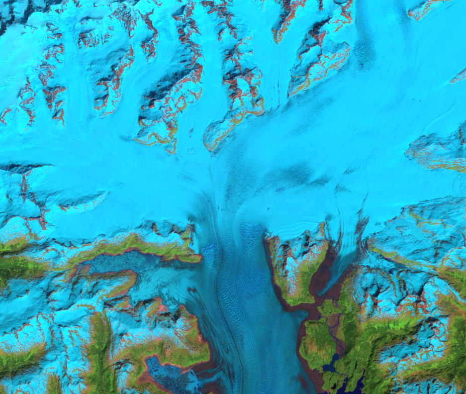
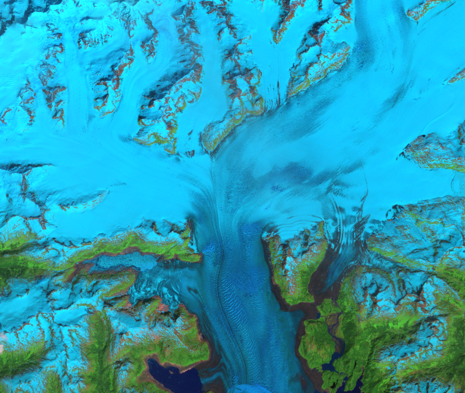
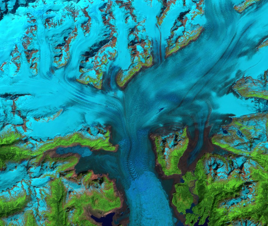
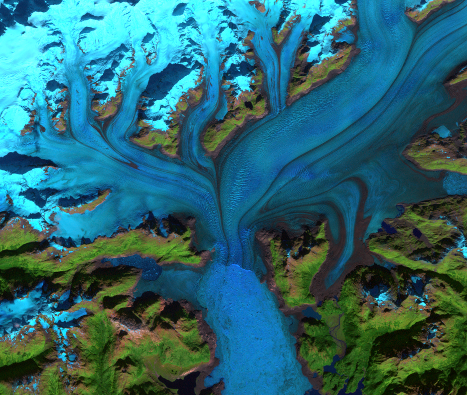
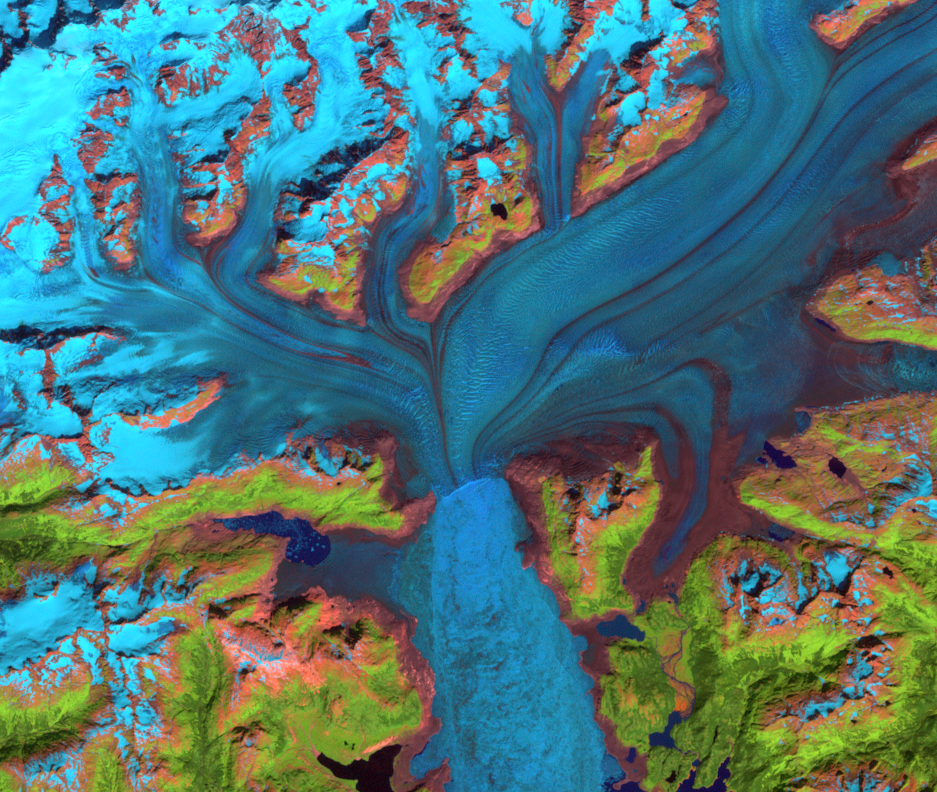
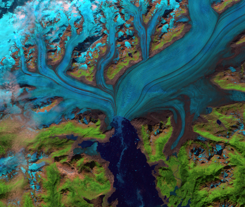
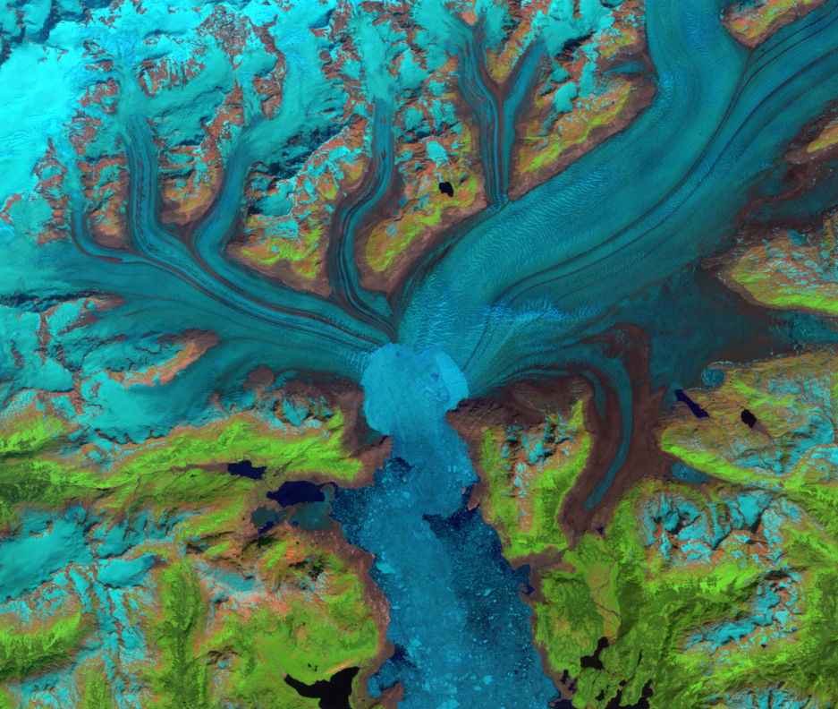
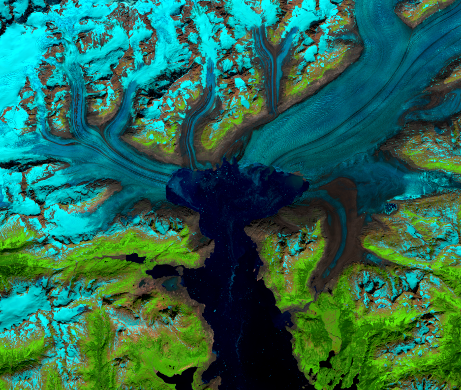
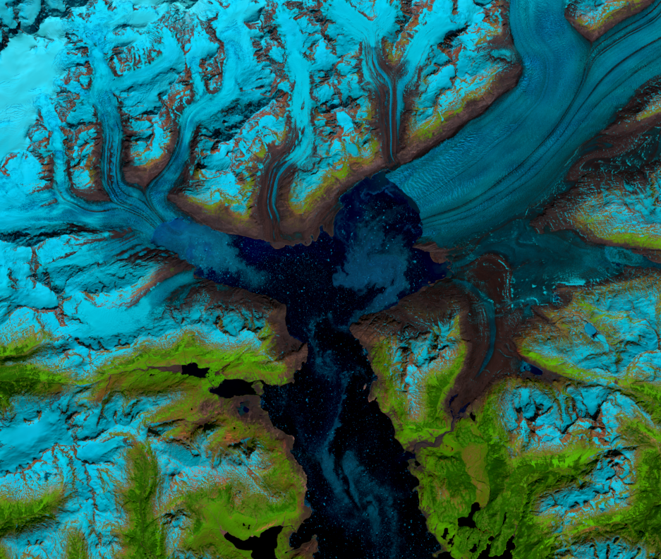
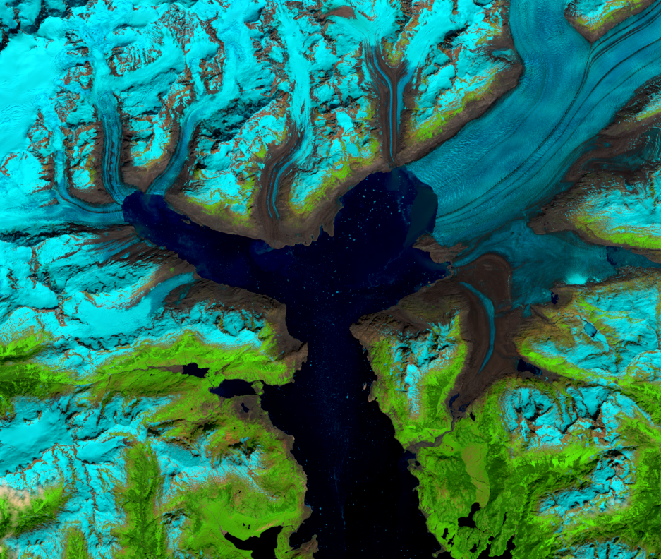
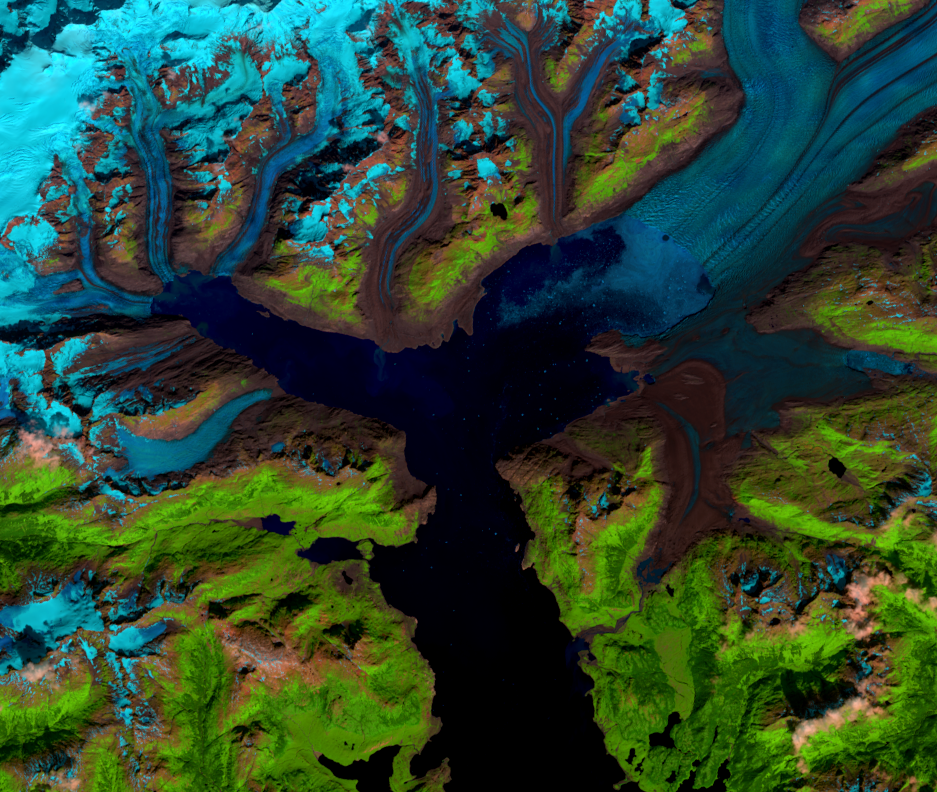
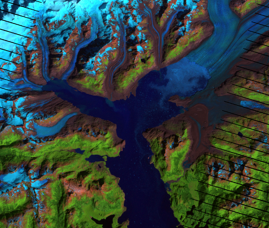
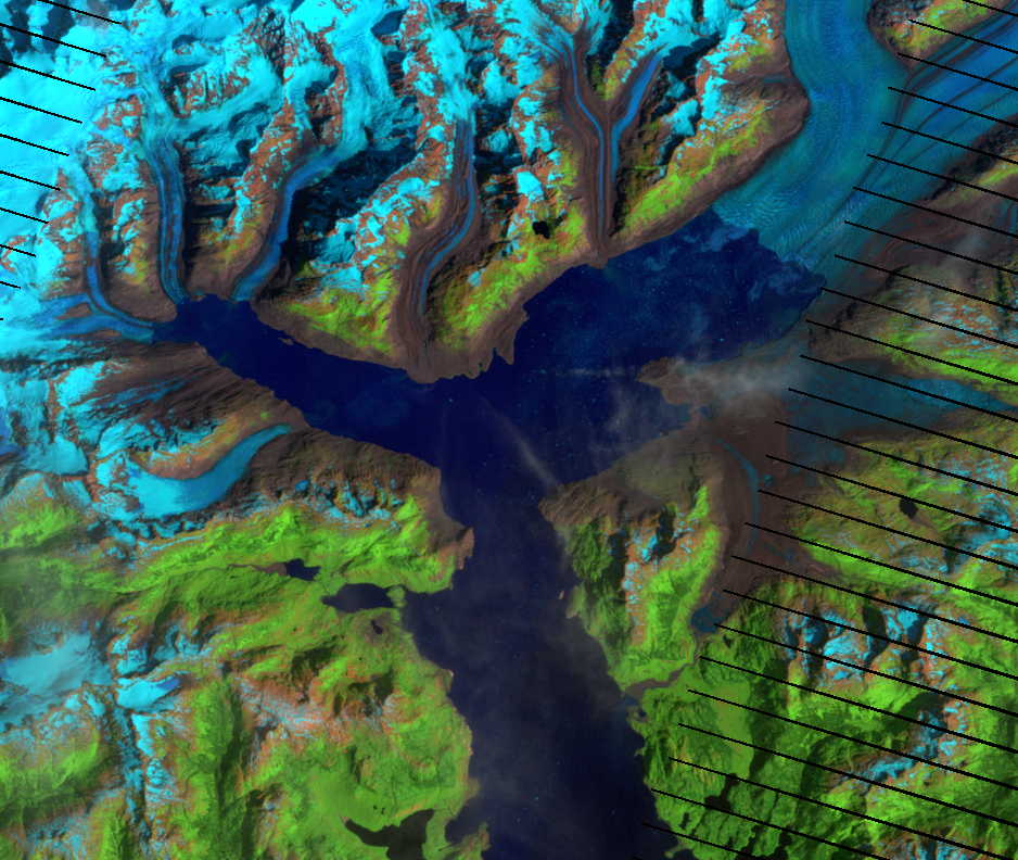
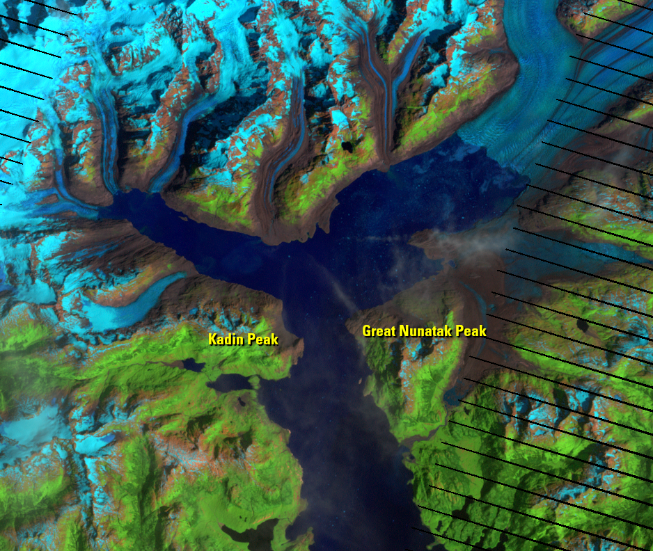
Air temperature increases can bring about long-term loss of ice mass from a tidewater glacier. An increase of less than 2 degrees Celsius over the mean annual air temperature is all it takes to trigger glacial retreat. In fact, Alaska has seen an increase in mean annual air temperature of 1.7 degrees Celsius over the past 60 years. But once a glacier has begun retreating, temperature alone does not have as much influence on its behavior. The topography of the valley the glacier is in affects it much more.
For example, the pace of Columbia’s retreat has been uneven. Its retreat slowed between 2000 and 2006 because it reached a narrow spot in its valley. This spot between Great Nunatak Peak and Kadin Peak constricted the glacier’s movement. Known as a pinning point, this topographic constriction is a place where the glacier’s trough becomes either too narrow or too shallow to continue moving at the previous rate. A pinning point can be a location of enhanced stability for the glacier.
If a glacier retreats from a pinning point, it will retreat until it reaches another pinning point upstream. A glacier that remains at a pinning point for a longer time may build another moraine.
Calving is also affected by the topography of the glacier’s valley, and calving rates increase in deeper water. Researchers found that as Columbia continues to retreat, it will reach water that is shallow enough to provide a stable position within a few years and remain stable through 2100. In this shallower water, iceberg production will be slowed.
Imagery
Every picture has a story to tell
Correlated
Additional story information
Downloads
Other Stories
Related imagery and additional content
Mélange
Landsat images show chunks of ice floating on the surface of the water...
Pinning Points
Air temperature increases can bring about long-term loss of ice mass f...