

Pune, India
Earth Resources Observation and Science (EROS) Center - Earthshots
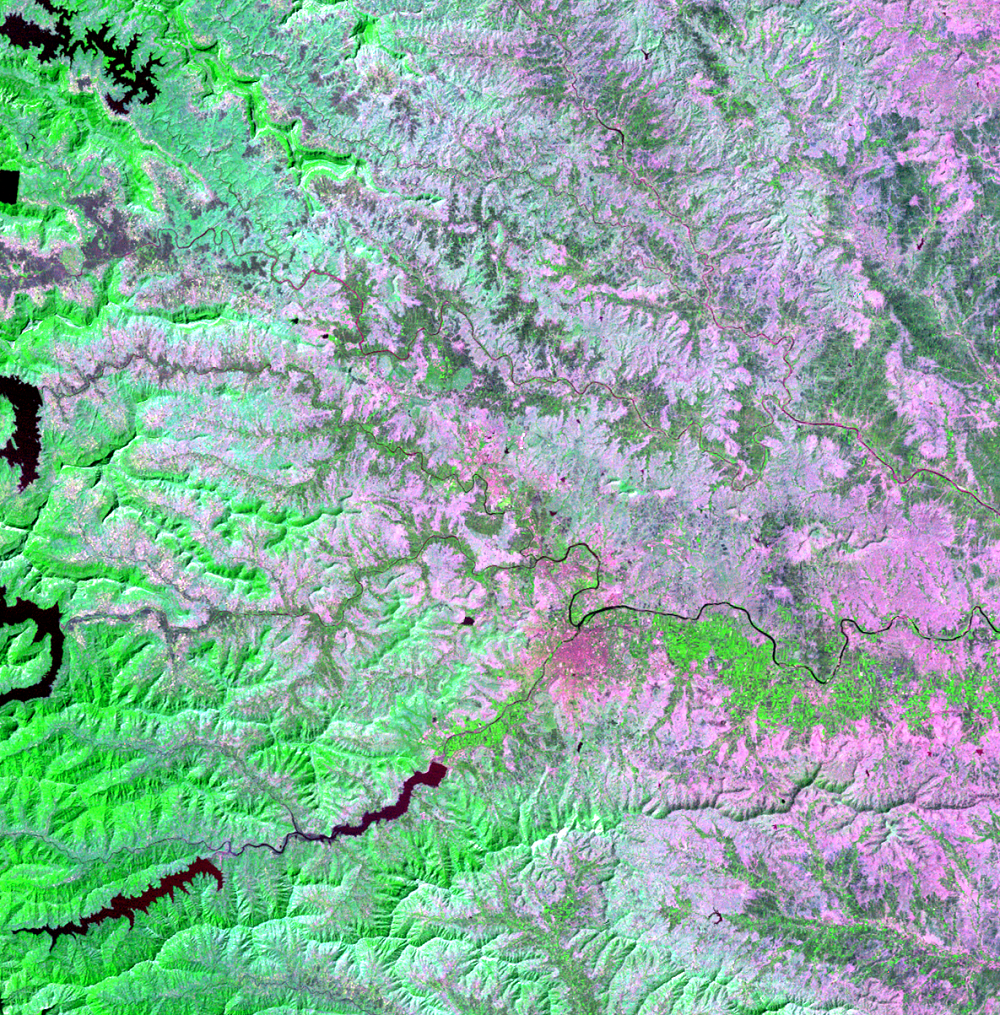
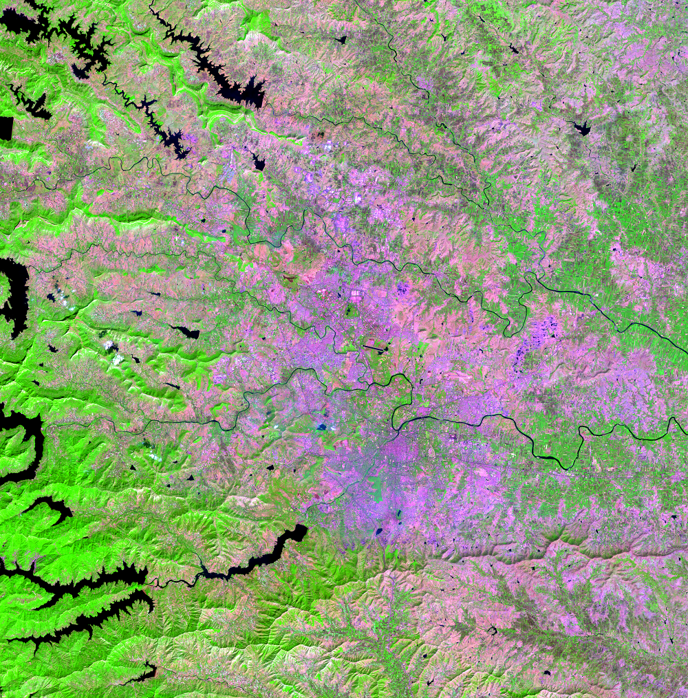
A fast-growing city in India is a study area for urban impervious surface and the urban heat island effect. Located in western India about 120 kilometers southeast of the coastal city Mumbai, Pune is known as an educational and industrial center. Its population has grown from 450,000 in 1950 to nearly 8 million in 2021. People from rural areas are migrating to the city for better employment opportunities. The education and industrial sectors are also attracting people to Pune from other countries.
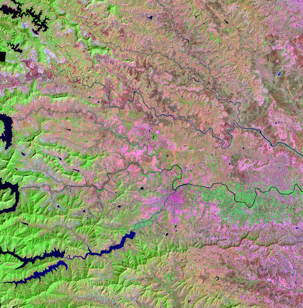
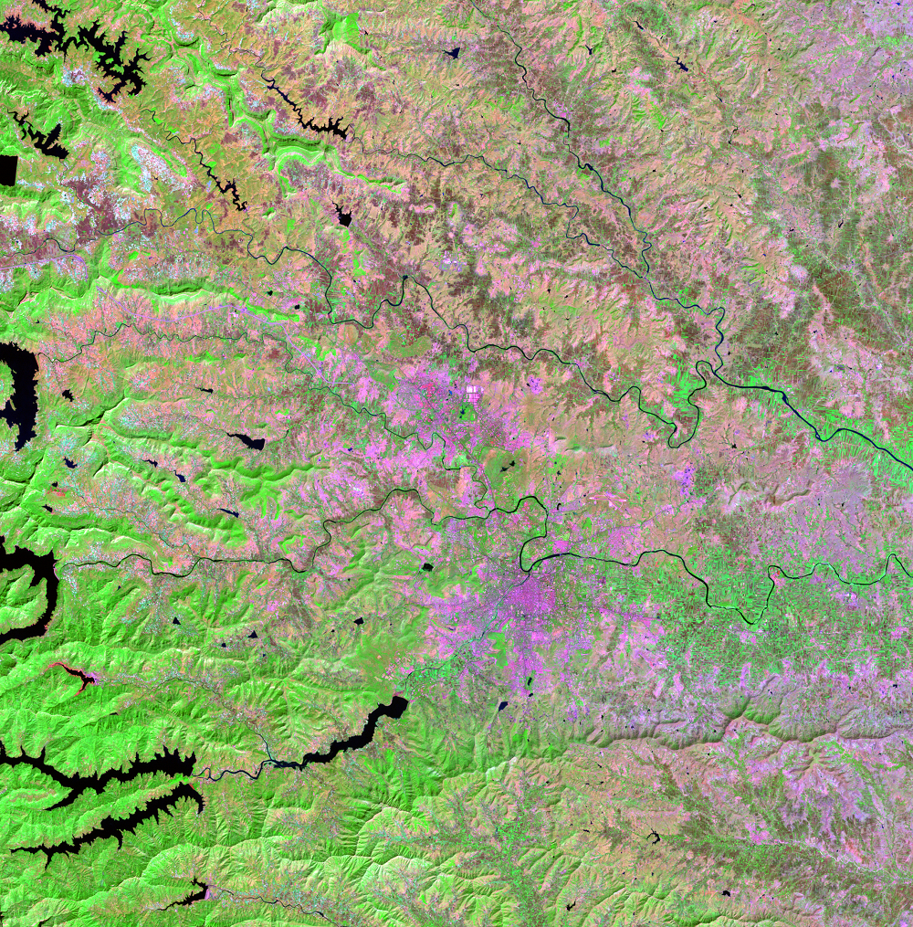
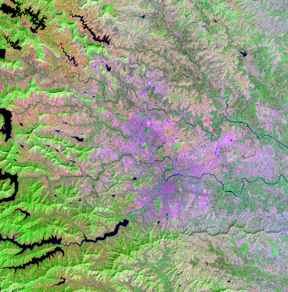
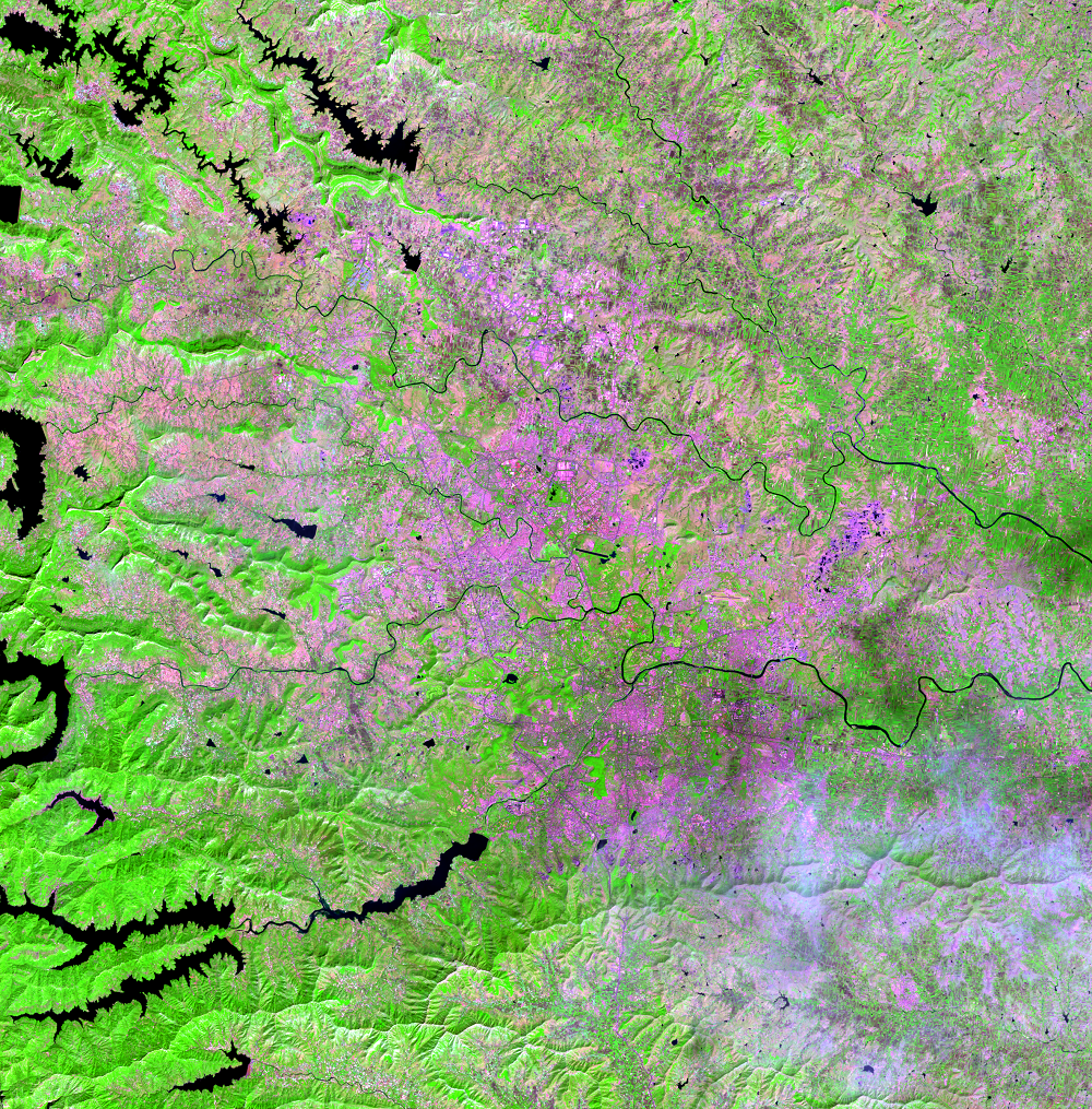
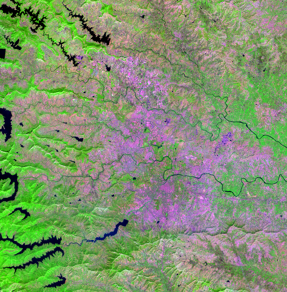
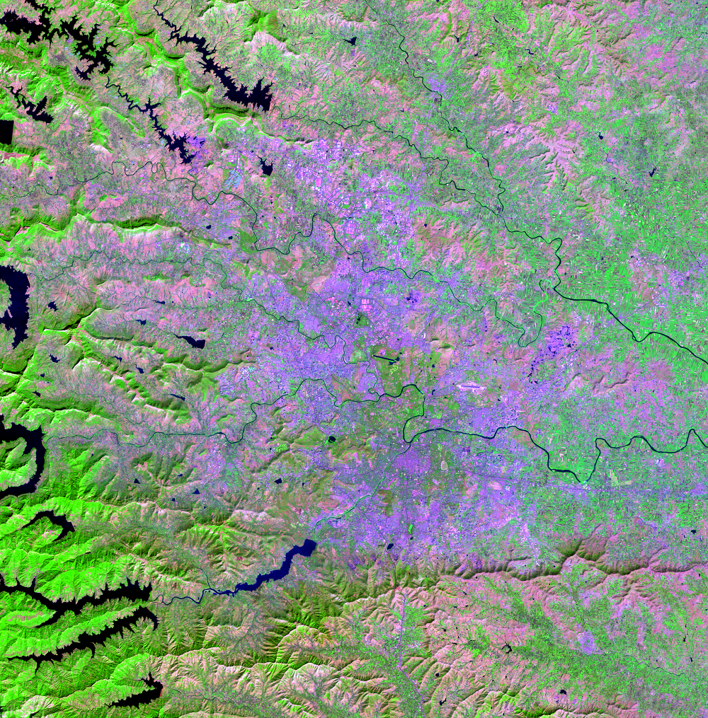
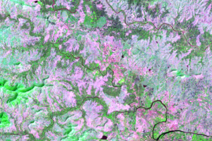
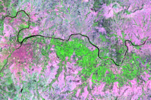
False-color Landsat images show the steady expansion of the Pune metropolitan area. Forests cover higher elevation land, shown in bright green mostly to the west. Dull colors are shrubland and grassland, which occupy the lower elevations. However, urban land—the lavender and purple hues—has been expanding over grasslands, barren, and agricultural land.
Pune’s proximity to Mumbai is also leading to its growth. The Mumbai–Pune expressway has reduced travel time between the two cities, so Pune has become a destination for those looking for housing away from Mumbai.
West of Pune is the Western Ghats mountain range, a relatively low range of forested mountains. One of the peaks west of Pune reaches just over 1,220 meters (4,000 feet) of elevation. Rivers flow out of the mountain range toward the east—reservoirs along the rivers store water for the populations downstream. The Mula River and the Mutha River meet in Pune to form the Mula-Mutha River as it flows toward the east.
In such a large city as Pune where the population is growing and those built-up surfaces are expanding so rapidly, the associated effects of streamflow changes and the urban heat island effect need to be measured and monitored.
Imagery
Every picture has a story to tell
Correlated
Additional story information
Downloads
Aithal, B. H., Shivamurthy, V., Rao, V., and Ramachandra, T.V., 2014, Prediction of Spatial Patterns of Urban Dynamics in Pune, India, in IEEE Indicon 2014, Proceedings: IEEE, at https://www.researchgate.net/publication/269686352_Prediction_of_Spatial_Patterns_of_Urban_Dynamics_in_Pune_India.
Demographia, 2021, Demographia World Urban Areas--Built-Up Urban Areas or World Agglomerations (17th ed.): 100 p., accessed March 17, 2022, at http://demographia.com/db-worldua.pdf.
ElevationMap.net, [n.d.], ElevationMap.net, accessed April 9, 2018, at https://elevationmap.net.
Gallo, K., and Xian, G., 2014, Application of spatially gridded temperature and land cover data sets for urban heat island analysis: Urban Climate, v. 8, p. 1–10, at https://doi.org/10.1016/j.uclim.2014.04.005.
Kantakumar, L.N., Kumar, S., and Schneider, K., 2016, Spatiotemporal urban expansion in Pune metropolis, India using remote sensing: Habitat International, v. 51, p. 11–22, at https://doi.org/10.1016/j.habitatint.2015.10.007.
Khape, A., 2017, Urban Heat Island Effect: More construction, less green cover making Pune hotter, says PMC report: The Indian Express, accessed March 15, 2018, at http://indianexpress.com/article/cities/pune/urban-heat-island-effect-more-construction-less-green-cover-making-pune-hotter-says-pmc-report-4772172/.
Kohli, D., Sliuzas, R., and Stein, A., 2016, Urban slum detection using texture and spatial metrics derived from satellite imagery: Journal of Spatial Science, v. 61, no. 2, p. 405–426, at https://doi.org/10.1080/14498596.2016.1138247.
Krishnamurthy, R., Mishra, R., and Desouza, K.C., 2016, City profile—Pune, India: Cities, v. 53, p. 98–109, at https://doi.org/10.1016/j.cities.2016.01.011.
Madaani, N., 2017, Newly developed areas in Pune experiencing ‘heat island’ effect: The Times of India, accessed March 15, 2018, at https://timesofindia.indiatimes.com/city/pune/newly-developed-areas-in-pune-experiencing-heat-island-effect/articleshow/58617760.cms.
Pune Riverfront, 2016, Riverfront Development: Pune Riverfront, accessed March 15, 2018, at http://puneriverfront.com/.
Shukla, S., Rathod, L.V., and Khire, M.V., 2016, Effects of Urbanization on Land Use/Land Cover and Stream Flow of a Sub-Tropical River Basin of India: International Journal of Urban and Civil Engineering: v. 10, no. 3, p. 378–386, at http://waset.org/publications/10004429.
U.S. Geological Survey, 2016, Urban planners and urban geographers turn to Landsat for answers: U.S. Geological Survey Fact Sheet 2016–3056, 2 p., http://dx.doi.org/10.3133/fs20163056.
Wagner, P.D., Bhallamudi, S.M., Narasimhan, B., Kantakumar, L.N., Sudheer, K.P., Kumar, S., Schneider, K., and Fiener, P., 2016, Dynamic integration of land use changes in a hydrologic assessment of a rapidly developing Indian catchment: Science of the Total Environment, v. 539, p. 153–164, at https://doi.org/10.1016/j.scitotenv.2015.08.148.
Yadav, P., and Deshpande, S.S., 2015, Spatio-temporal Assessment of Urban Growth Impact in Pune City using Remotely Sensed Data, in Asian Conference on Remote Sensing 36th, Proceedings: Manila, ACRS, at https://www.researchgate.net/publication/281457095_Spatio-
Other Stories
Related imagery and additional content
Impervious Surface
Scientists studying the effects of urban growth are concerned with sur...
Urban Heat Island
Those constructed surfaces have another measurable effect. Constructio...