

RBV's Beginnings
Earth Resources Observation and Science (EROS) Center - Earthshots
Landsat’s RBV had an inauspicious beginning. It rode into orbit on Landsat 1 on July 23, 1972. During orbit 196, just 14 days later, a relay in the Power Switching Module of the spacecraft got stuck in a permanently “on” state.
The problem could have been fixed with a difficult command sequence, but the other sensor on Landsat 1, the MSS, was already showing its excellent performance and became the favored sensor for its capability to acquire near-infrared data. So the RBV on Landsat 1 was not reactivated. In the short time it operated, it recorded 1,692 images.
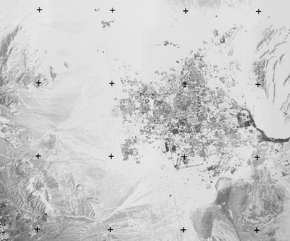
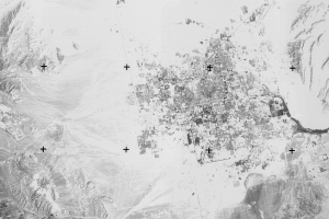
The RBV camera that flew on board Landsat 3 was redesigned and given a slightly different mission. This RBV had a spatial resolution higher than the MSS, 40 meters, to add a new dimension to the MSS’s multispectral coverage. The higher detail could be used for detailed ground mapping. The Landsat 3 RBV acquired many thousands more images than either one on board Landsats 1 and 2. The RBV imagery is scattered across the globe, and all of it resides in the EROS archive.
Imagery
Every picture has a story to tell
Correlated
Additional story information
Downloads
Other Stories
Related imagery and additional content
Alaska
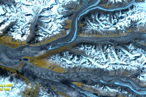
One of the factors that improves on Landsat sensors over the project’s...
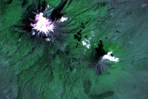
Mt. Ararat
Despite its problems, RBV data has been used in land change studies. R...
RBV Data
Roughly 138,000 images were taken by the RBV on Landsat 3. The data we...
RBV's Beginnings
Landsat’s RBV had an inauspicious beginning. It rode into orbit on Lan...
RBV's Problems
Because of RBV’s higher spatial resolution than MSS, glaciologists wer...