

Santiago, Chile
Earth Resources Observation and Science (EROS) Center - Earthshots
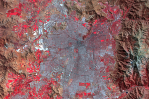
The rapid population growth of Santiago, Chile’s capital, has brought a series of problems for the city, all of which were complicated by Chile’s unusual geography.
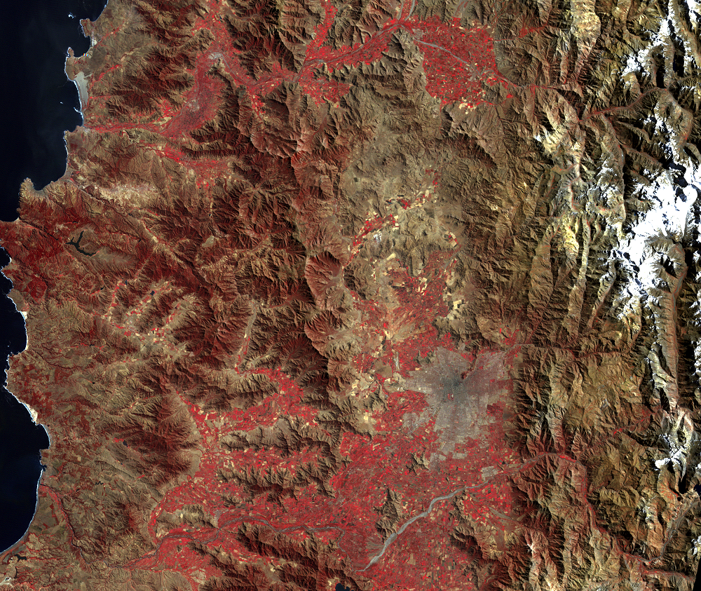
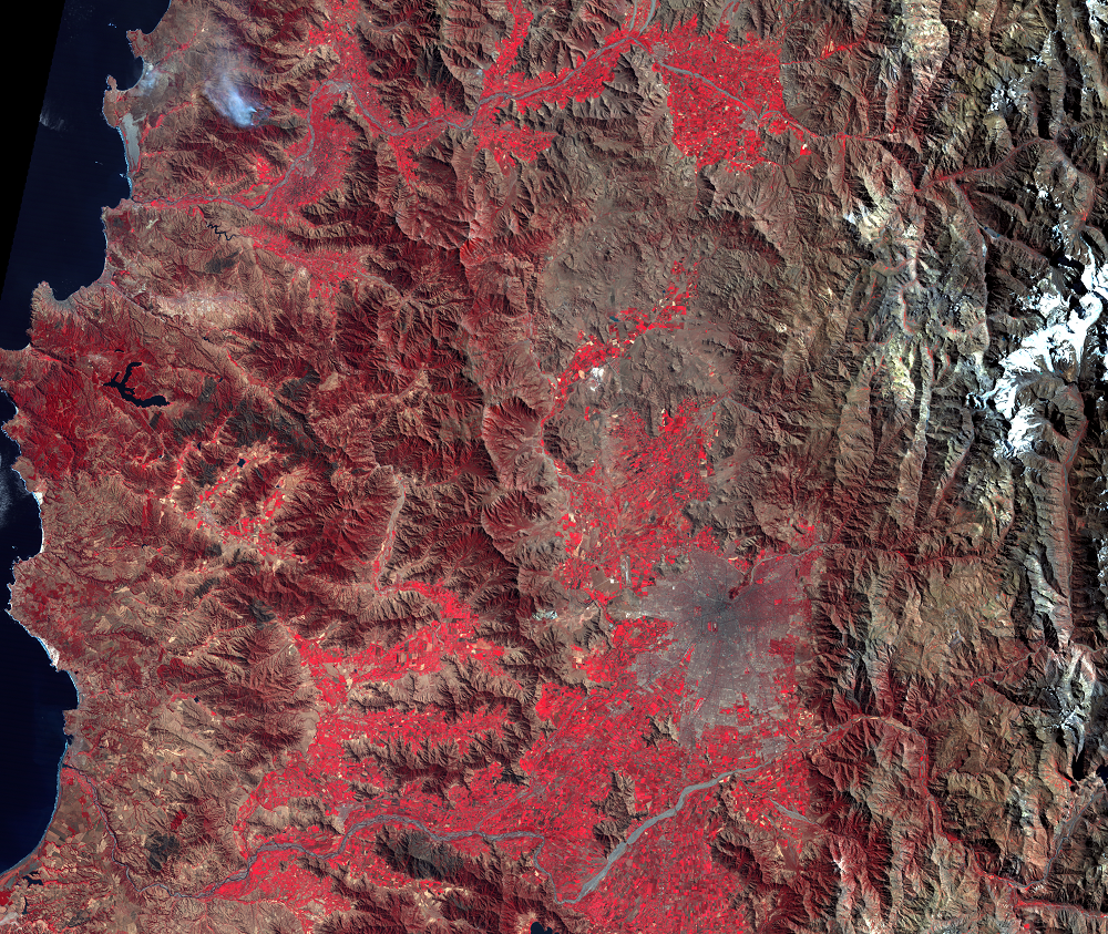
One Landsat image spans the breadth of this narrow country, from the Pacific Ocean to Argentina. These images were taken near the end of the warm, dry summer; the mountains show only a dull red vegetation signature, and a fire appears in the 1989 image. But there are still patches of snow visible in the Andes Mountains, over 6,000 meters above sea level.
In contrast, the Central Valley, between the Andes and the coastal range, shows a bright red signal from agriculture. Rivers feed into a network of canals irrigating vineyards, fruits, and vegetables. This Central Valley is the heartland of Chile and the home to 70–80% of its people.
With rapid industrialization after World War II, Chile’s population urbanized earlier than many other countries, already 68% urban by 1960, 81% by 1980, and 89% by 2010. Santiago itself contains more than a third of all Chileans, and its share of the country’s economic activity is even greater.
One result was some of the world’s worst air pollution. Santiago’s view of the mountains was often blocked by smog trapped in the valley by the mountains themselves. The government imposed carless Sunday mornings, regulation of the city’s 11,000 private buses, and other remedies. By the mid-1990s the air had improved.
Imagery

Downloads
Browder, J., Bohland, J., and Scarpaci, J., 1995, Patterns of Development on the Metropolitan Fringe—Urban Fringe Expansion in Bangkok, Jakarta, and Santiago: Journal of the American Planning Association, v. 61, no. 3, p. 310–327.
CIA, 2012, Chile: The World Factbook, available only online at https://www.cia.gov/library/publications/the-world-factbook/geos/ci.html. (Accessed April 20, 2012.)
Demographia, 2016, Demographia World Urban Areas—Built-Up Urban Areas or World Agglomerations (12th ed.): Belleville, Ill., Demographia, 110p., accessed on April 24, 2017, at http://demographia.com/db-worldua.pdf.
Hutchings, C., 1996, The streets of Santiago: The Geography Magazine, v. 68, no. 6, p. 36.
Larmer, B., 1992, The Greening of Santiago: Newsweek, August 10, 1992, p. 41.
Merrill, A.T., 1982, Chile, a country study: Washington D.C., American University, 314 p.
Scarpaci, J.L., Pio-Infante, R., and Gaete, A., 1988, Planning Residential Segregation—The Case of Santiago, Chile: Urban Geography, v. 9, no. 1, p. 19–36.
Scarpaci, J.L., 1992, Patterns of Development on the Metropolitan Fringe: A Peri-Urban Survey of Santiago, Chile: Center for Urban and Regional Studies, Virginia Polytechnic Institute and State University, Blacksburg, Va., Working Paper 92-1, 11 p.
Related Content
Growth and Housing
From 1975 to 2020, Santiago’s population increased from under 3.5 mill...