

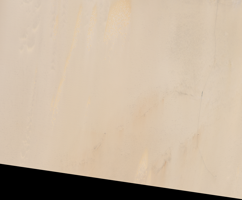
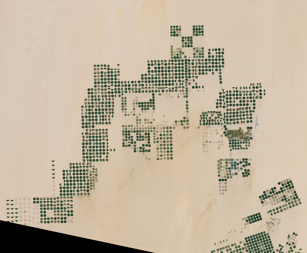
Sharq El Owainat, Egypt
Earth Resources Observation and Science (EROS) Center - Earthshots
The Landsat satellites were designed to detect landscape changes over time. However, sometimes what Landsat needs to see on the Earth’s surface is no change at all.
This is the story of a key Landsat calibration test site that is being retired as a test site because of the extensive land use change taking place in that area.
Imagery
Downloads
Abouelmagd, A., Sultan, M., Sturchio, N.C., Soliman, F., Rashed, M., Ahmed, M., Kehew, A.E., Milewski, A., and Chouinard, K., 2014, Paleoclimate Record in the Nubian Sandstone Aquifer, Sinai Peninsula, Egypt: Quaternary Research, v. 81, no. 1, p. 158–167, https://doi.org/10.1016/j.yqres.2013.10.017.
ESA, 2019, Earth from Space—Egyptian Crop Circles: ESA Images of the Earth, accessed June 25, 2020, at https://earth.esa.int/web/guest/images-of-the-earth/featured-image-archive/-/article/egyptian-crop-circles.
Helder, D.L., Senior Calibration Advisor, USGS Earth Resources Observation and Science (EROS) Center, 2020, personal communication.
Helder, D.L., Basnet, B., and Morstad, D.L., 2010, Optimized identification of worldwide radiometric pseudo-invariant calibration sites: Canadian Journal of Remote Sensing, v. 36, no. 5, p. 527–539, https://doi.org/10.5589/m10-085.
Hollier, A., 2017, Crop Circles in Sharq El Owainat: NASA Earth Observatory, accessed June 25, 2020, at https://earthobservatory.nasa.gov/images/90937/crop-circles-in-sharq-el-owainat.
Related Content
Earth As Art
The view of this region from Landsat is so fascinating, it’s the subje...
Landsat’s Accuracy
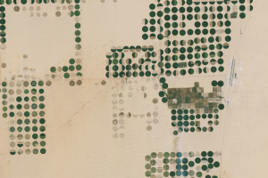
The Sharq El Owainat airport is visible on the right side of these ima...
Picking Calibration Sites
Engineers use test sites around the world to make sure Landsat imagery...
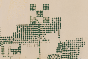
Watering the Sahara
One of the best test sites, named Egypt-2, was steadily reliable until...