

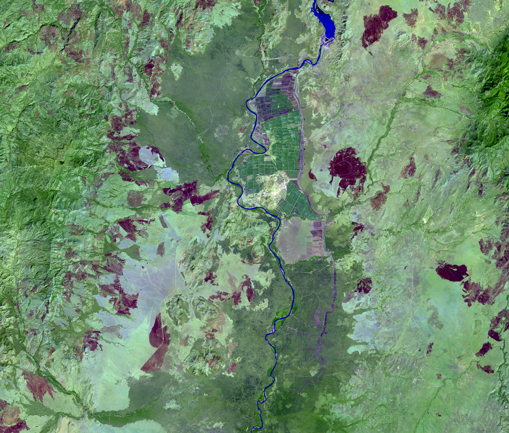
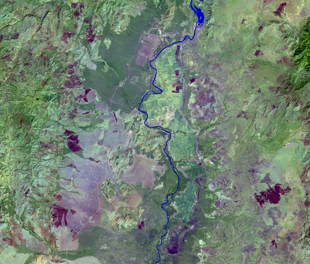
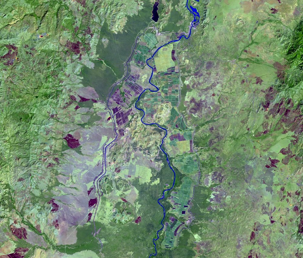
Sugar Plantations
Earth Resources Observation and Science (EROS) Center - Earthshots
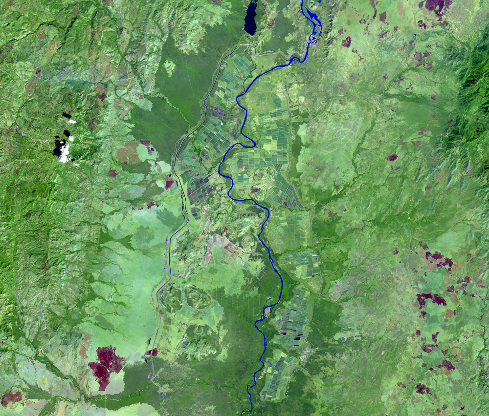
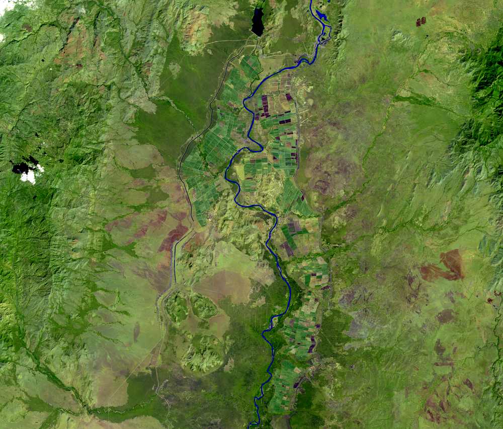
About 160 kilometers downstream from the dam are large irrigated sugar plantations. Made possible by the dam, land clearing for these plantations began in 2012.
In the imagery, the plantations are the blocky shapes near the Omo River. According to one source, 100,000 hectares of land are planned for sugar plantation development.
Sugarcane has a high water requirement. These plantations and associated agro-chemicals for this irrigation and the plans to build two more dams on the Omo River have many concerned about the long-term effects on Lake Turkana and the livelihoods of people who rely on the water supply to the lake provided by the Omo River.
Tribal communities in the lower Omo and Lake Turkana region rely on traditional farming, herding, and fishing, activities that depend on the water and nourishing floods from the Omo River.
Landsat helps communities track landscape change and the effects of large hydroelectric and irrigation projects, wherever they are in the world.
Imagery
Every picture has a story to tell
Correlated
Additional story information
Downloads
Other Stories
Related imagery and additional content
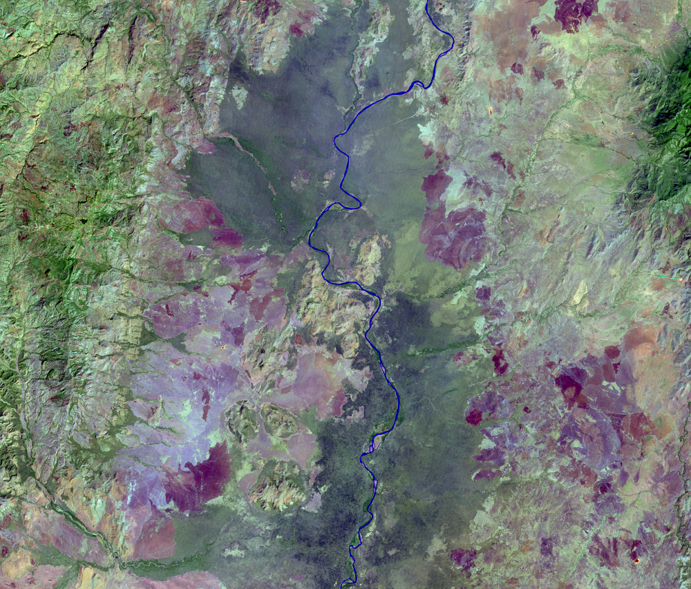
Gibe III Dam
At nearly 244 meters tall, Gibe III is Africa’s tallest dam and the co...
Sugar Plantations
About 160 kilometers downstream from the dam are large irrigated sugar...