

The Eruption
Earth Resources Observation and Science (EROS) Center - Earthshots
The volcanic blast on May 18, 1980, devastated more than 150 square miles of forest within a few minutes. In the following nine hours, volcanic ash rose more than 15 miles into the air, later to land in troublesome amounts as far away as Montana. Sixty people were dead or missing, including one USGS volcanologist, David Johnston, who was monitoring the mountain from nearby.
Before the eruption, Mount St. Helens towered about a mile above its base, but on May 18, 1980, its top slid away in an avalanche of rock and debris. When measured on July 1, 1980, the mountain's height had been reduced from 9,677 feet to 8,364 feet—a difference of about 1,300 feet.
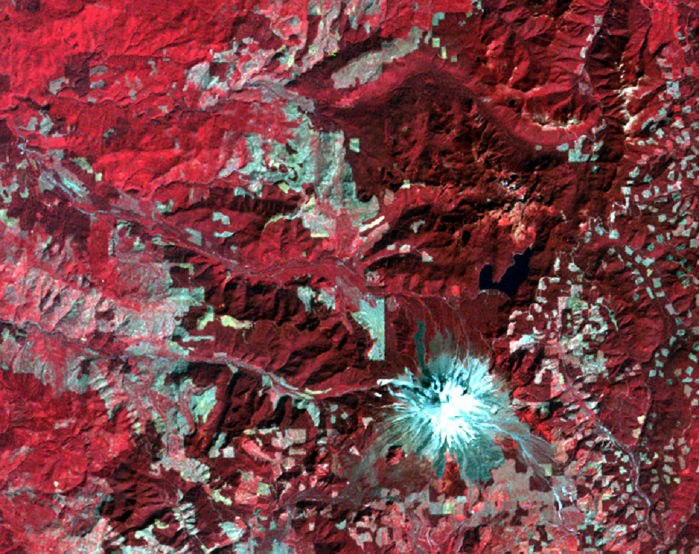
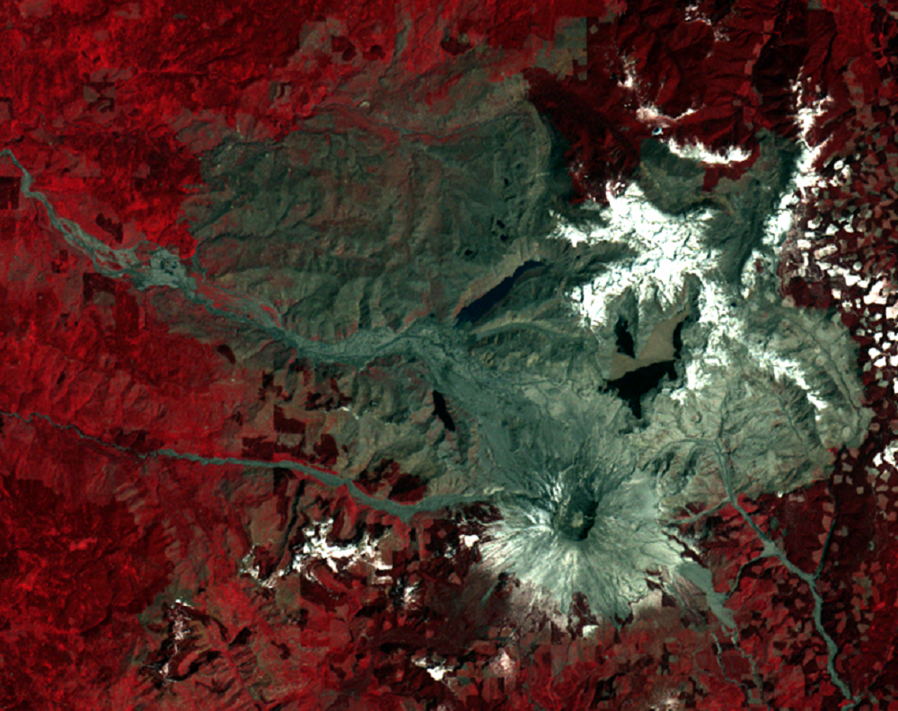
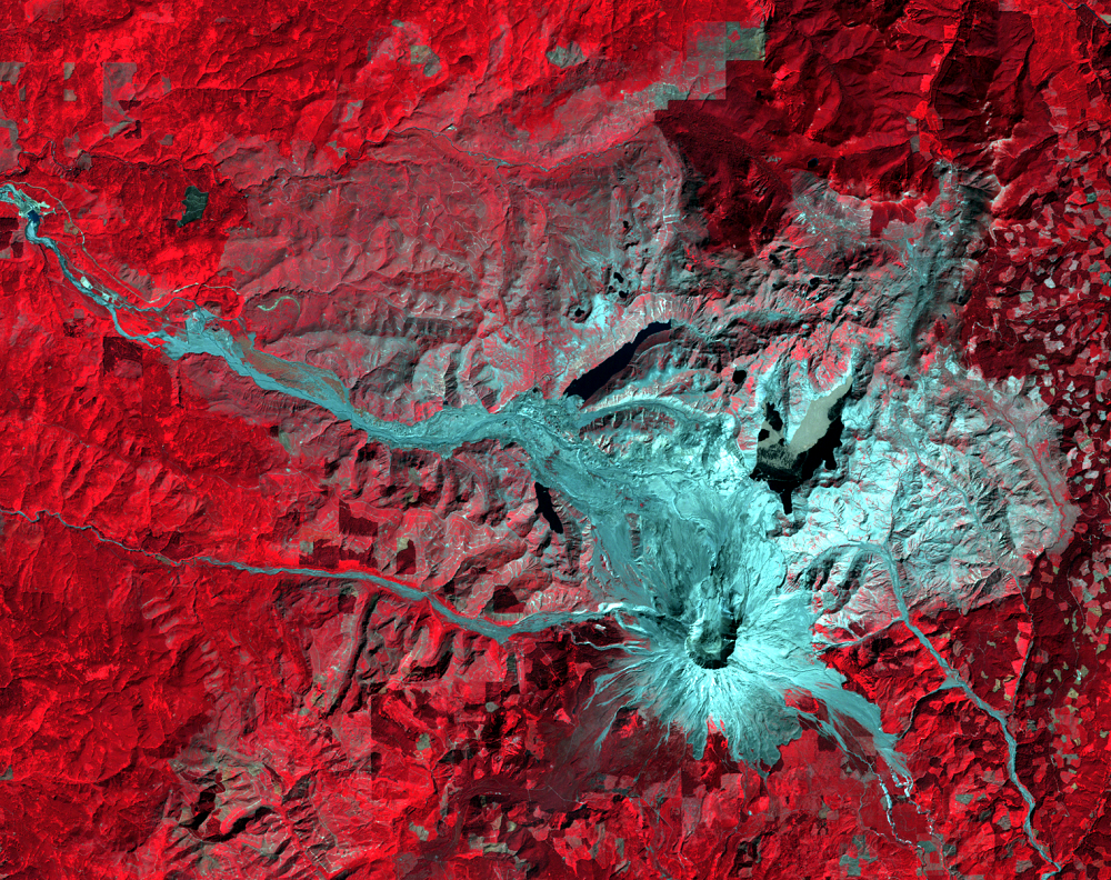
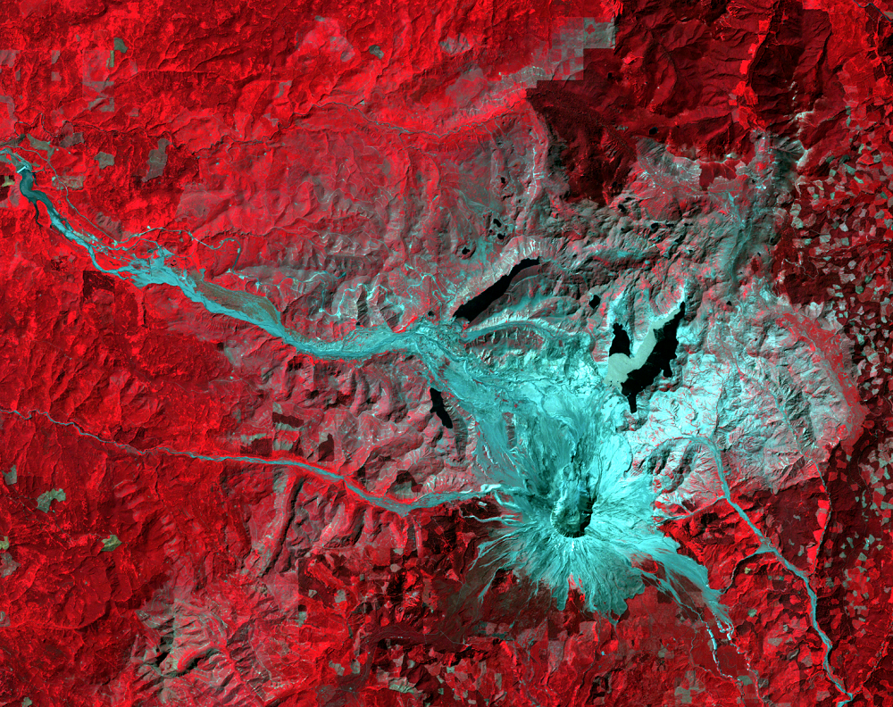
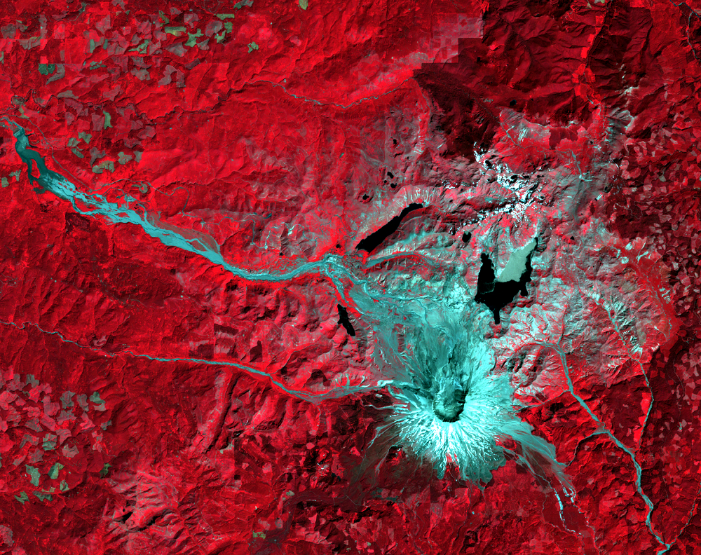
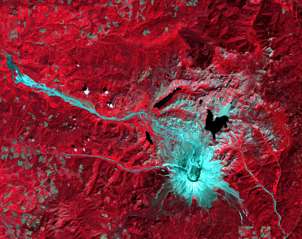
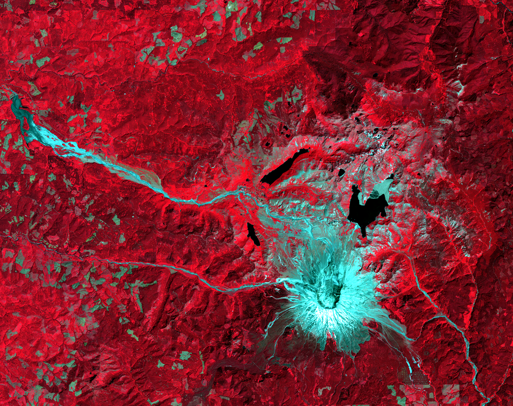
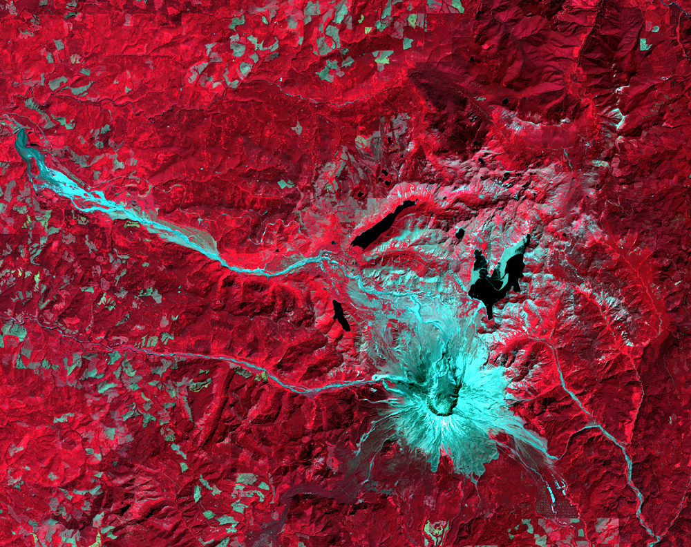
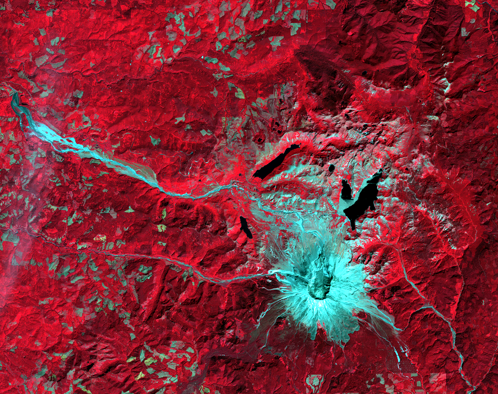
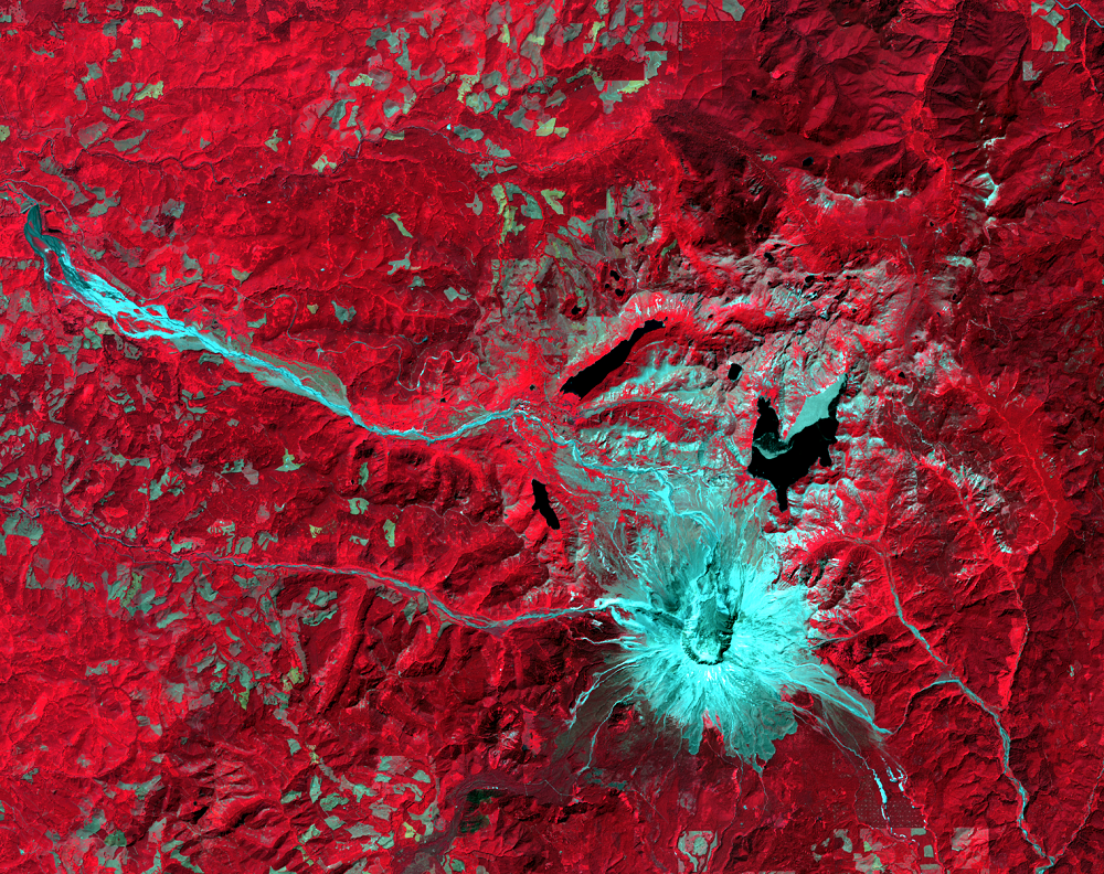
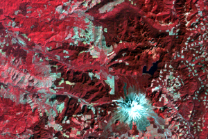
Look at the zoomed-in images. Forested areas appear red. Ash, mudslides, and mud-laden rivers are grayish blue. Water looks black. Ice and snow are white. Several changes can be seen in these images:
- The north-facing “amphitheater,” where the peak of the mountain slid away, is clearest in the 1988 image.
- The North and South Forks of the Toutle River are visible flowing to the west-northwest in the zoom-ins. The avalanche dumped rock and debris into the river valleys, in some places up to 170 m deep. Coldwater Creek and Castle Creek, which are tributaries of the Toutle, were blocked by this debris, forming Coldwater Lake and Castle Lake. These are visible in the post-eruption images.
- Spirit Lake, northeast of the peak, also flowed into the river. The avalanche raised its level 60 m. Its shape was also affected by debris that entered the lake and by the floating “raft” of logs that were swept into the lake.
- The image series shows gradual vegetation regrowth, as light red and pink, in the devastated area.
View an animation of a time series of Landsat images from the eruption and through gradual forest regrowth.
Imagery
Every picture has a story to tell
Correlated
Additional story information
Downloads
Other Stories
Related imagery and additional content
The Eruption
The volcanic blast on May 18, 1980, devastated more than 150 square mi...