

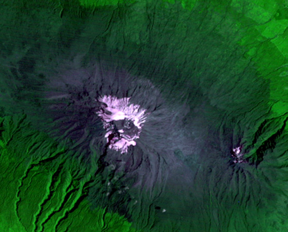
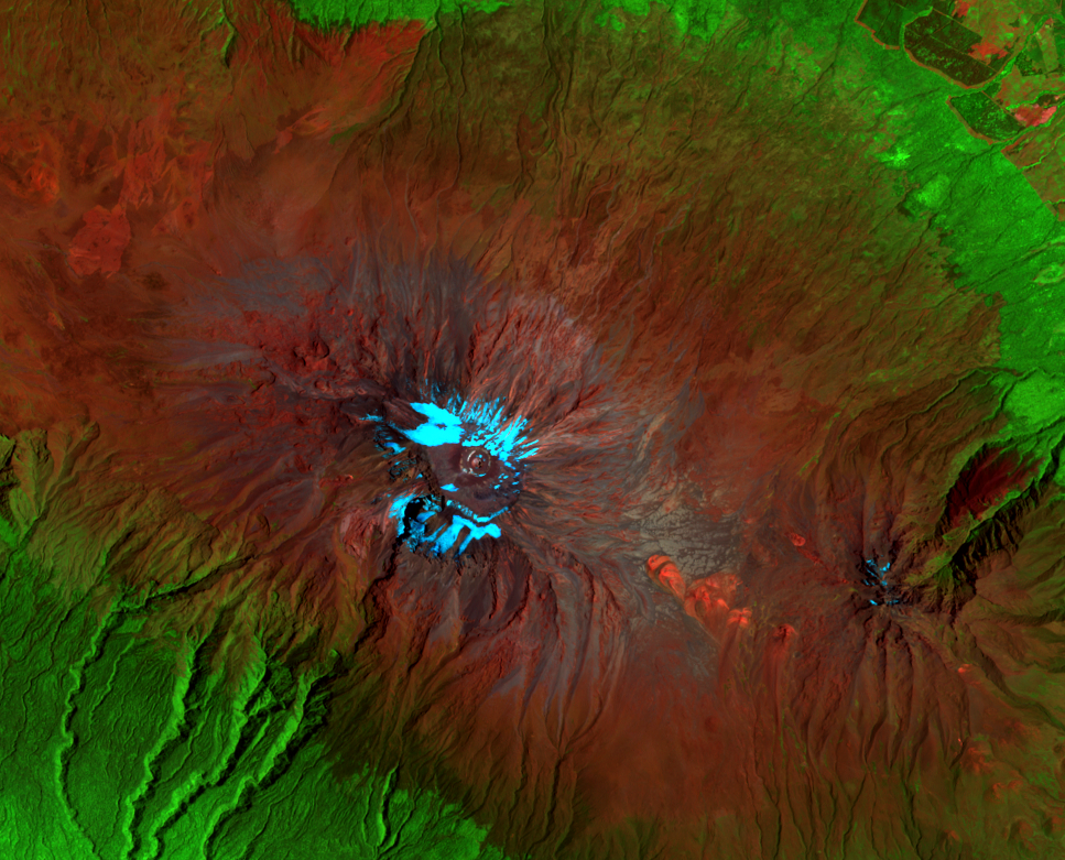
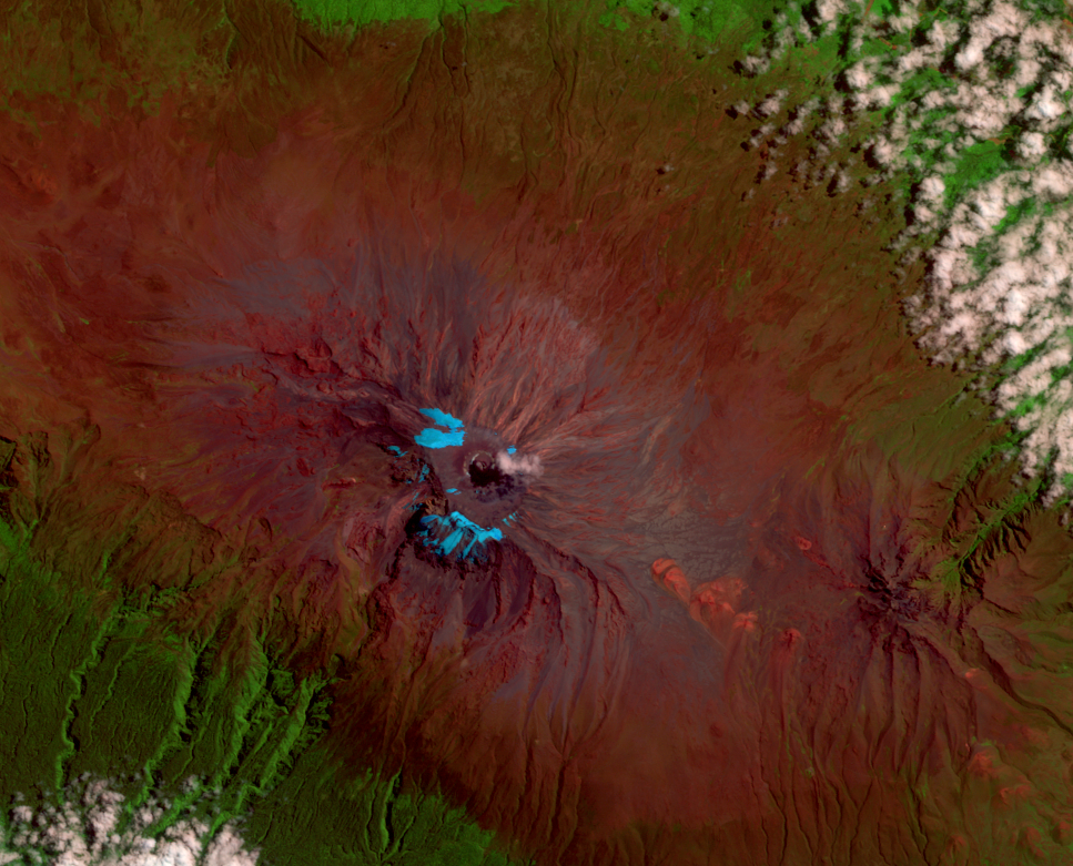
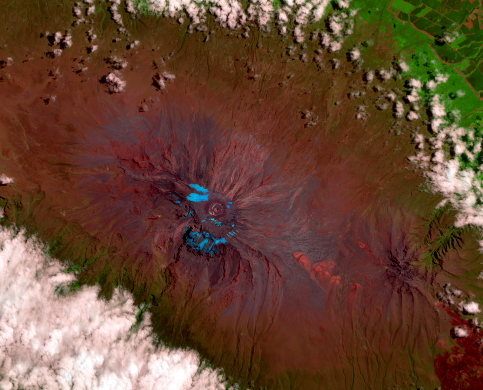
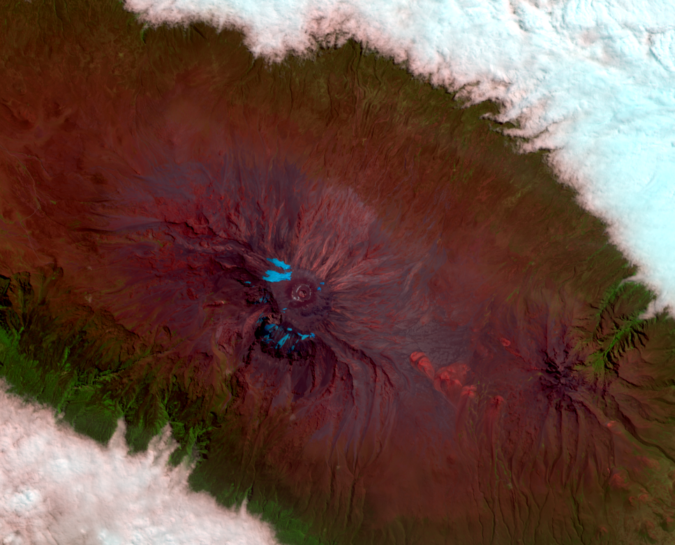
The Glaciers of Kilimanjaro
Earth Resources Observation and Science (EROS) Center - Earthshots
As the 2000 image was being taken, climatologist Lonnie Thompson was camped on the glacier ice, drilling out samples for analysis and preservation. When a year later he publicly stated that the glaciers might disappear between 2015 and 2020, he raised these glaciers to a new level of public and scientific debate. For better or worse, Kilimanjaro became a poster child for global warming.
Kilimanjaro’s glaciers have been shrinking since at least the 1880s. (Scientists measure the glaciers, not the fluctuating snow cover. Ground measurements are required in addition to aerial/satellite imagery, since the glaciers may be covered by snow or ash.) The ice has retreated both vertically and horizontally, but the loss of area has been more dramatic.
Vertically, the glaciers don’t appear to have lowered dramatically between 1880 and about 1960, but stereo aerial photographs indicate that from 1962 to 2000 they lowered almost 0.5 m per year. One member of Thompson’s 2000 party described the melting he observed: “By day, water streamed off the top of the glacier and down its steep sidewalls. . . In some places, the rivulets wandering along the surface had converged to form streams, which catapulted in waterfalls off the top” (Bowen, 2005).
Area of Kilimanjaro’s glaciers, 1880–2016
| Year | Area |
|---|---|
| 1880 | 20.0 km2 |
| 1912 | 12.1 km2 |
| 1953 | 6.7 km2 |
| 1976 | 4.2 km2 |
| 1989 | 3.3 km2 |
| 2000 | 2.6 km2 |
| 2003 | 2.5 km2 |
| 2007 | 1.85 km2 |
| 2011 | 1.76 km2 |
| 2016 | 1.7 km2 |
Imagery
Every picture has a story to tell
Correlated
Additional story information
Downloads
Other Stories
Related imagery and additional content
An Unusual Mountain
Many of the world’s highest peaks are the barely tallest points of hig...
Beyond the Ice
Tourism is now a major part of the local economy. Ten thousand visitor...

Snowfall, Sunshine, or Warm Air?
Why have these glaciers been shrinking? One factor is snowfall. We don...
The Glaciers of Kilimanjaro
As the 2000 image was being taken, climatologist Lonnie Thompson was c...