

Tree Islands
Earth Resources Observation and Science (EROS) Center - Earthshots
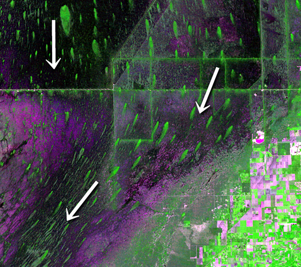
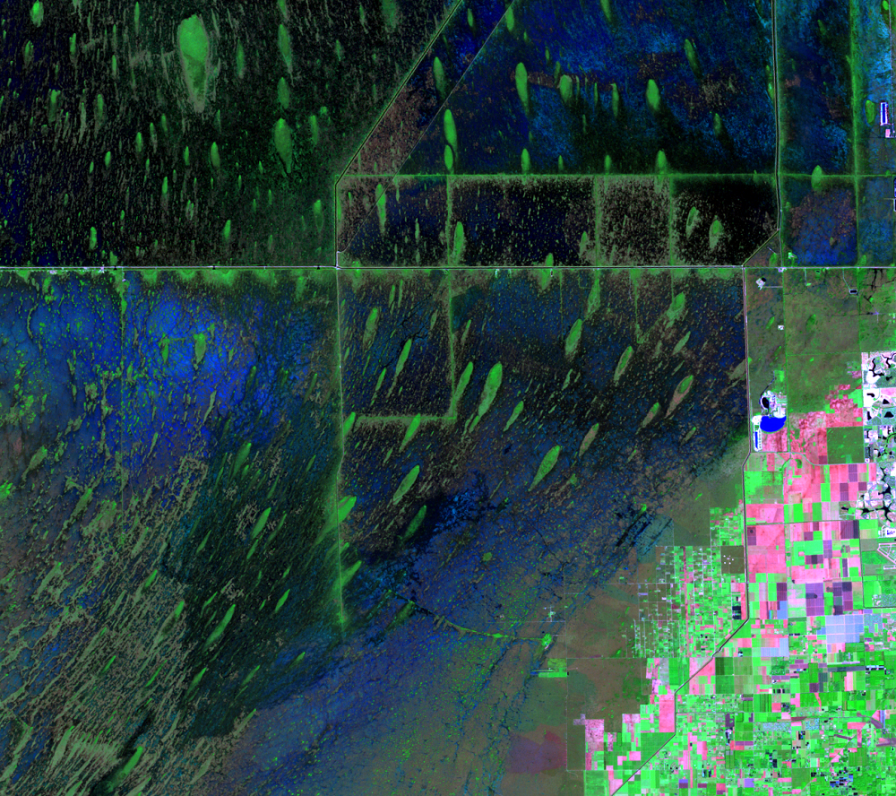
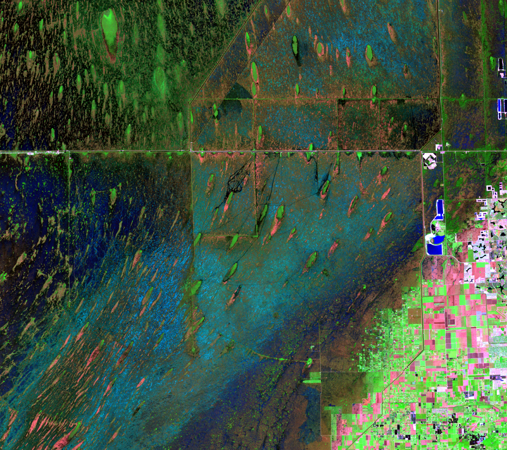
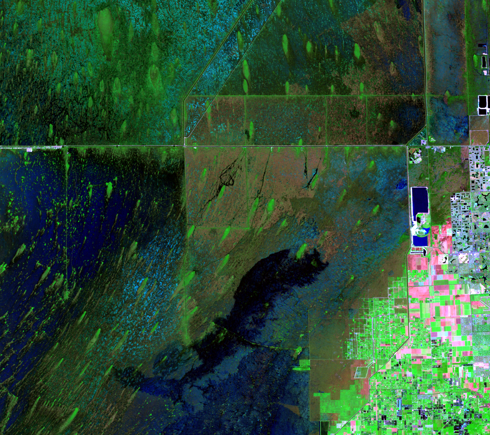
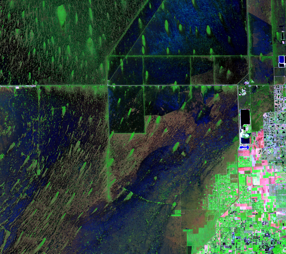
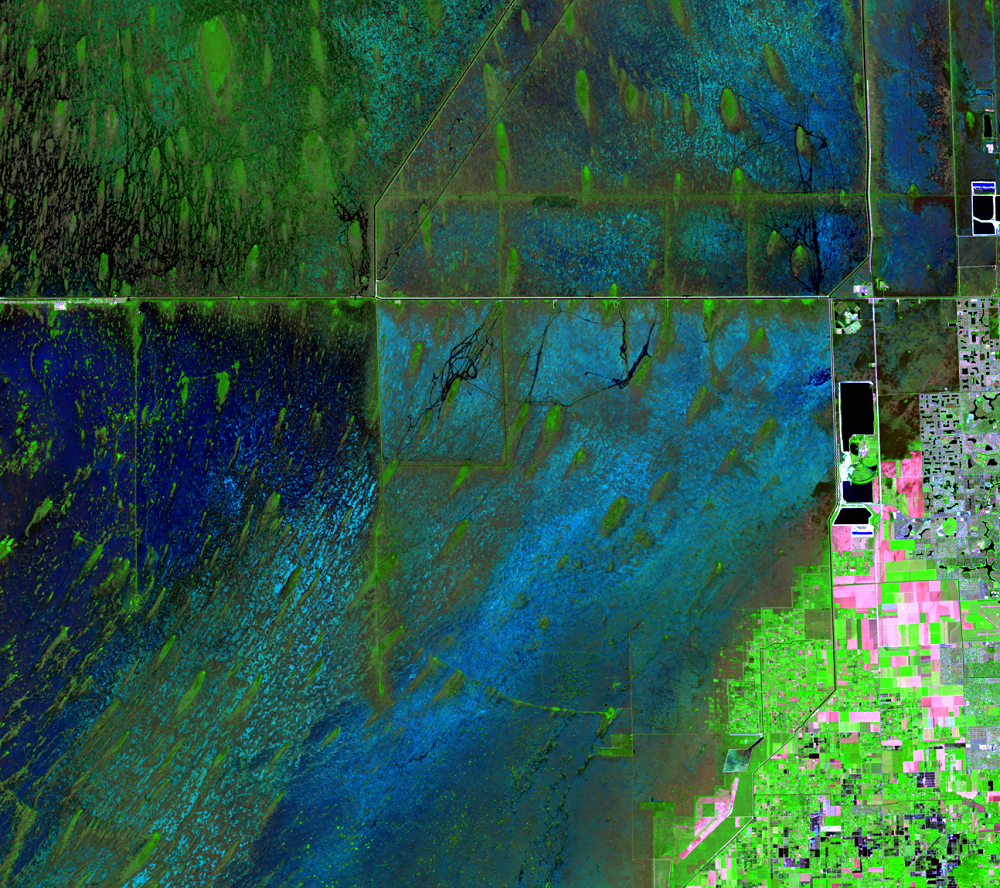
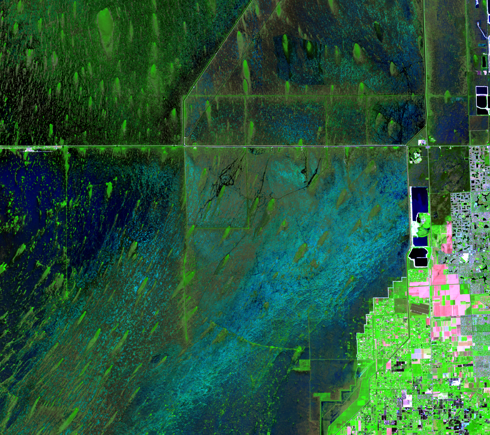
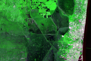
A unique feature of the Everglades is the dark green teardrop-shaped forms scattered throughout the region. Referred to as hummocks, or “tree islands,” these biodiversity hotspots provide food, cover, and critical nesting sites for numerous species.
The patches of woody vegetation range in size from 0.01 to 70 hectares, and they stand out from the sawgrass and marsh landscape 0.6–1.2 meters (2–4 feet) above the slough bottom. The teardrop shape generally points in the direction of the flow of water.
Tree islands can have as much as 10 times the nutrient phosphorus as the surrounding Everglades. They soak up both phosphorus and nitrogen, allowing these spots to flourish and provide habitats for plants, invertebrates, amphibians, reptiles, mammals, and resident and migratory birds, increasing overall biodiversity. As these islands store up phosphorus, they keep phosphorus low in the surrounding marsh. When the phosphorus concentrations in the rest of the marsh goes up, cattail invades, which affects fish and wading bird populations.
The number and areal extent of tree islands have been reduced over the past 75 years with the changes in hydrology caused by the levees and canals.
Imagery
Every picture has a story to tell
Correlated
Additional story information
Downloads
Other Stories
Related imagery and additional content
Agriculture
The fertile muck soils along the south shore of Lake Okeechobee in the...
Canals and Levees
Historically, water flowed slowly southward through the Everglades in ...
Limestone Mining
The Everglades sit on top of a bedrock of limestone. Limestone quarrie...
Residential Lakes
A lot of the urban area consists of large planned communities, often f...
Tree Islands
A unique feature of the Everglades is the dark green teardrop-shaped f...
Turkey Point
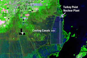
There is a notable shape southeast of Homestead on the coast of the Ba...
Urban Development
In 1900, southeastern Florida included a few small towns with a popula...