

Urban Development
Earth Resources Observation and Science (EROS) Center - Earthshots
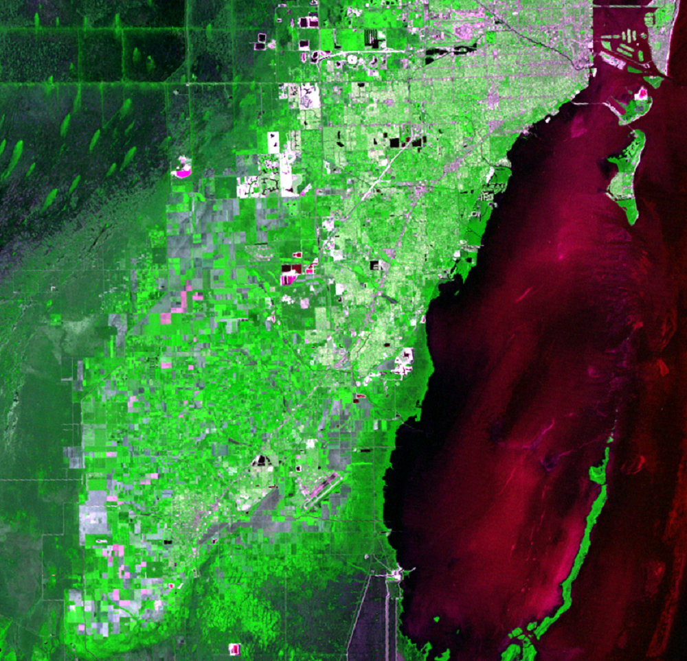
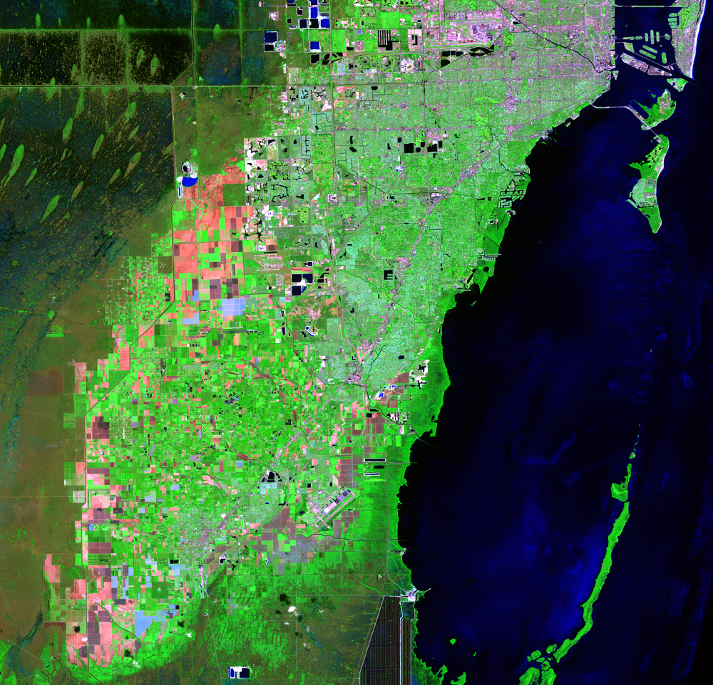
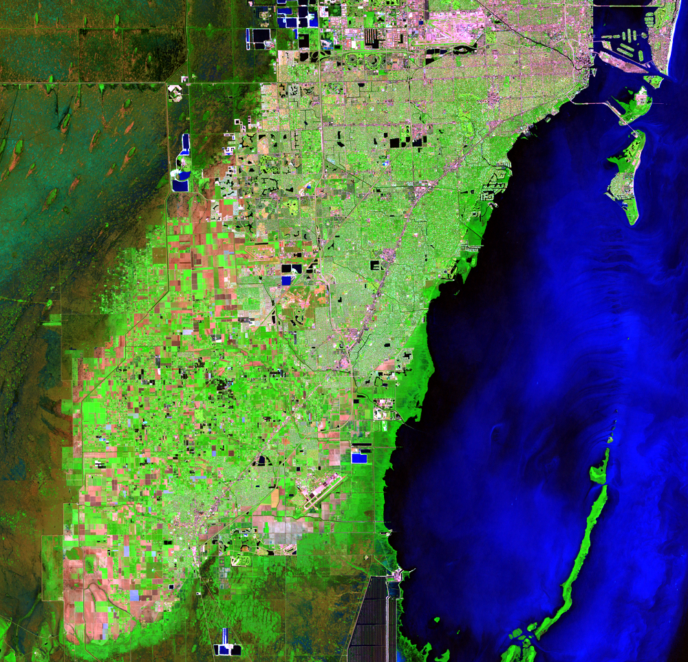
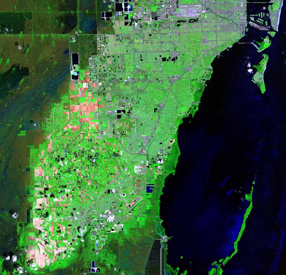
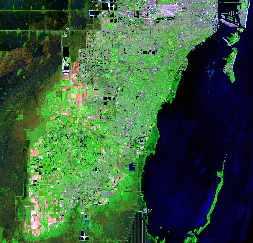
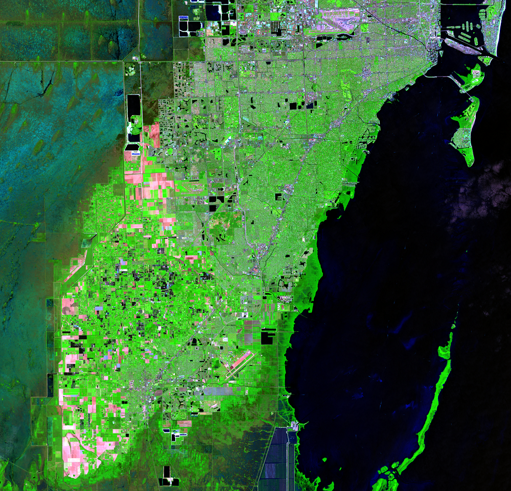
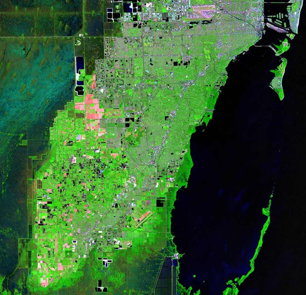
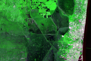
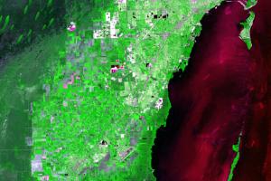
In 1900, southeastern Florida included a few small towns with a population of 3,592 people. Throughout the 20th century, Miami and other nearby towns steadily grew. According to the U.S. Census Bureau, the population of the Miami Metropolitan Statistical Area in 2016 was 6,066,387. In 1970, its population was listed as 1,267,792. In four and one-half decades, the population increased by over 378%.
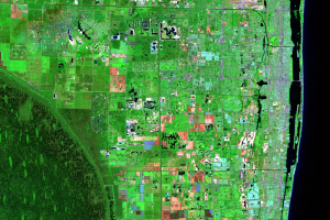
The urban area of Miami and surrounding suburbs stand out sharply against the dark green wetlands in the Landsat series. The urban areas lie on a slightly higher ridge, 2 to 7 meters above sea level, to form a “backbone” of the heavily urbanized coast.
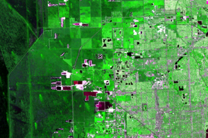
These images show urban development expanding on agricultural land north and west of Homestead. Homestead’s population grew from 13,674 in 1970 to 66,498 in 2015, an increase of 386%.
Imagery
Every picture has a story to tell

Correlated
Additional story information
Downloads
Other Stories
Related imagery and additional content
Agriculture
The fertile muck soils along the south shore of Lake Okeechobee in the...
Canals and Levees
Historically, water flowed slowly southward through the Everglades in ...
Limestone Mining
The Everglades sit on top of a bedrock of limestone. Limestone quarrie...
Residential Lakes
A lot of the urban area consists of large planned communities, often f...
Tree Islands
A unique feature of the Everglades is the dark green teardrop-shaped f...

Turkey Point
There is a notable shape southeast of Homestead on the coast of the Ba...
Urban Development
In 1900, southeastern Florida included a few small towns with a popula...