

Urban Growth
Earth Resources Observation and Science (EROS) Center - Earthshots
A population boom began in this region in the 1980s with increases in defense spending—military and aerospace industries became the area’s primary employers. A recession in the early 1990s slowed this growth along with defense spending cuts. The population recovered and grew once again but slowed with the 2008 recession. The population has again since rebounded.
Many residents of Antelope Valley now commute to the Los Angeles area. The cost of living is lower and many enjoy living in the smaller urban areas.
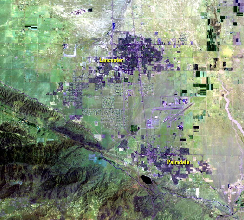
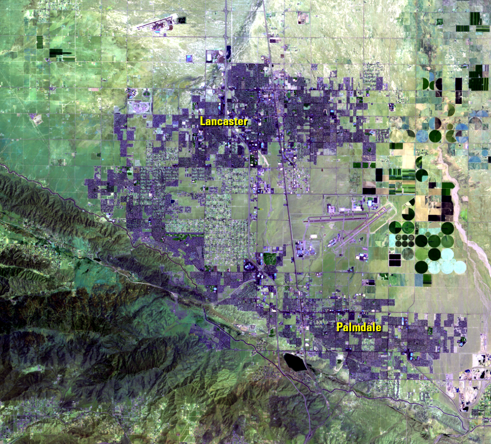
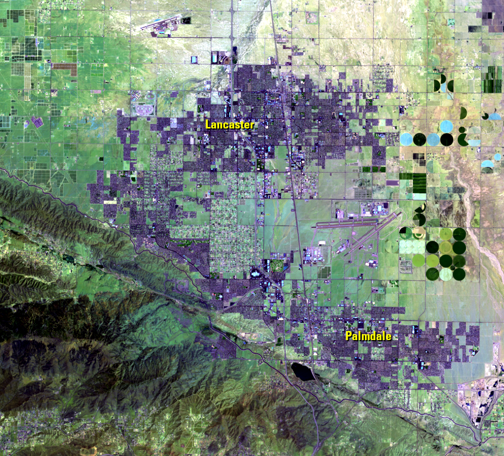
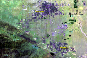
Despite drifting with the ups and downs of economic trade winds, these Landsat images display this urban growth. These images use near-infrared and shortwave infrared imaging to emphasize the expansion of streets and buildings. Urban and residential areas are in purple hues. Dark green circles and rectangles are farm fields, while the blocky shapes on the left side of the 2020 image are solar panels.
The two major cities visible in these images are Lancaster and Palmdale. Lancaster has seen a 252% increase in population since 1980. Palmdale has grown by a whopping 1,231% since 1980.
Lancaster
| Year | Population |
|---|---|
| 2022 | 169,185 |
| 2010 | 156,643 |
| 2000 | 118,718 |
| 1990 | 97,291 |
| 1980 | 48,027 |
Palmdale
| Year | Population |
|---|---|
| 2022 | 163,463 |
| 2010 | 152,755 |
| 2000 | 116,670 |
| 1990 | 68,842 |
| 1980 | 12,277 |
Imagery
Every picture has a story to tell
Correlated
Additional story information
Downloads
Other Stories
Related imagery and additional content
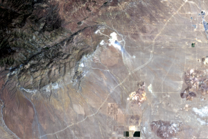
Solar
After 2010, solar farms began spreading out in various places across t...
Urban Growth
A population boom began in this region in the 1980s with increases in ...
Wind
The open spaces and high winds make the northern part of Antelope Vall...