

Water Level Changes
Earth Resources Observation and Science (EROS) Center - Earthshots
Even with water diverted from rivers into the Cheyenne Bottoms, little water makes it to the vast wetland during times of reduced streamflow. Expansion of center pivots in Kansas has led to a lower groundwater level and lower surface flows from streams.
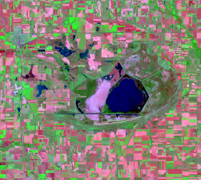
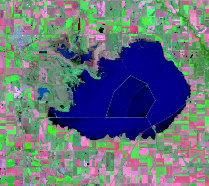
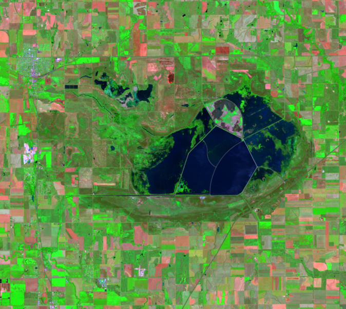
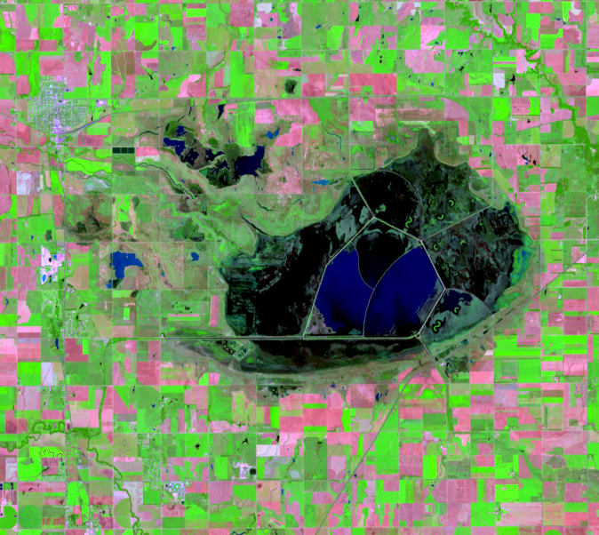
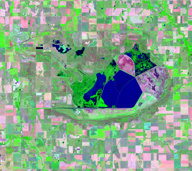
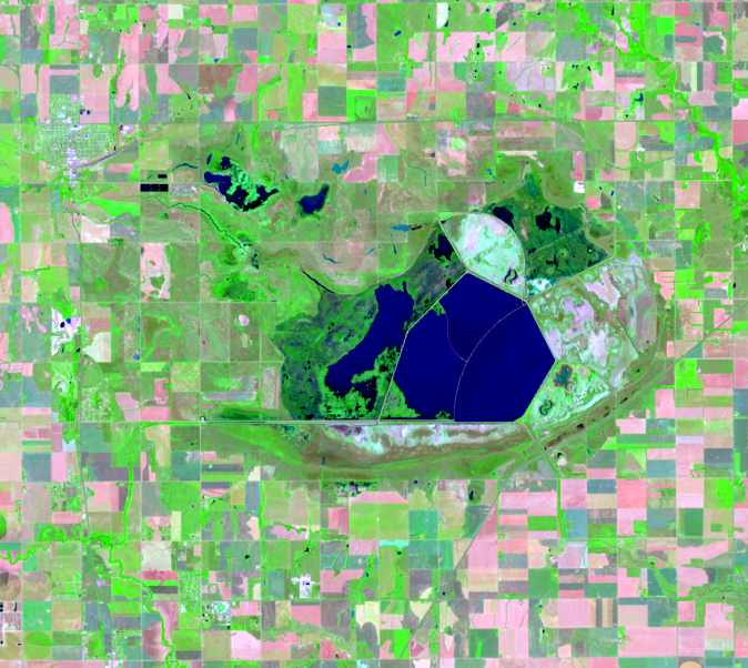
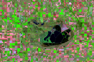
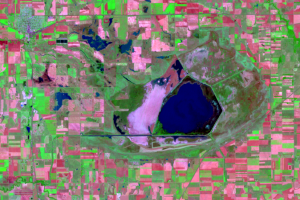
Decades of Landsat imagery demonstrate the water level changes over time. The Bottoms experienced flooding in 2007, then began to dry up in 2011.
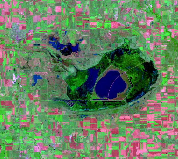
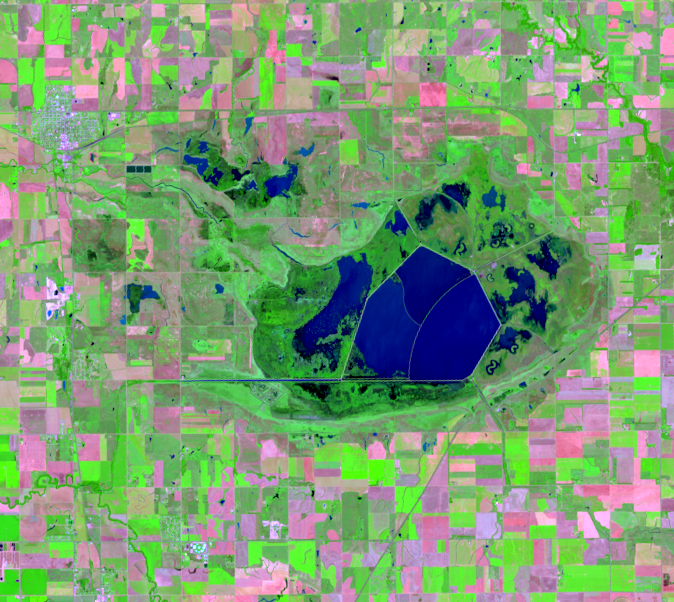
In 2013, the wetland dried up but filled again in late summer in time for the fall migration.
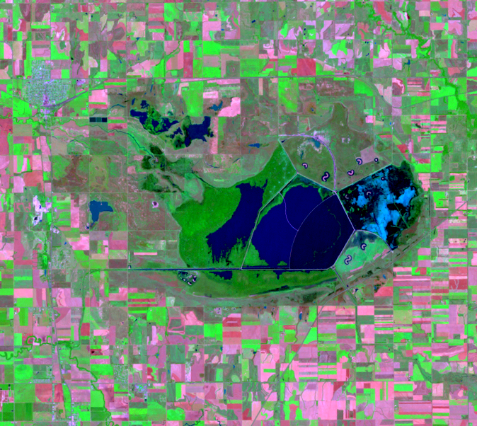
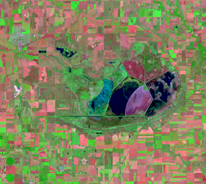
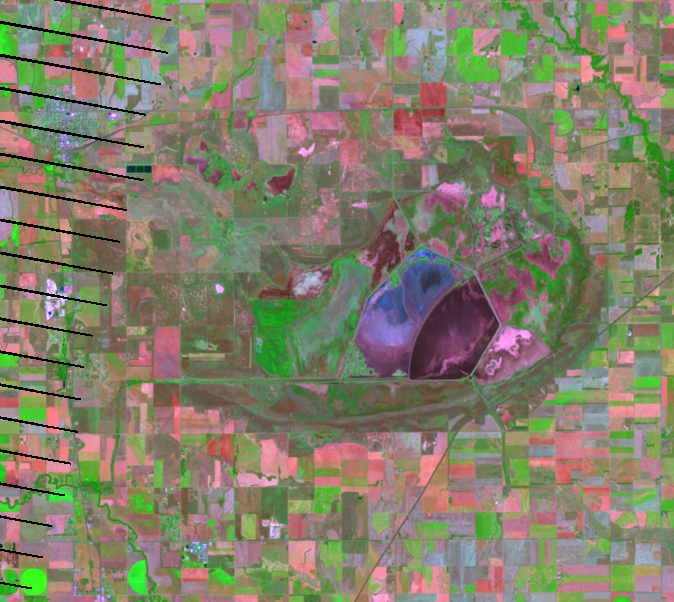
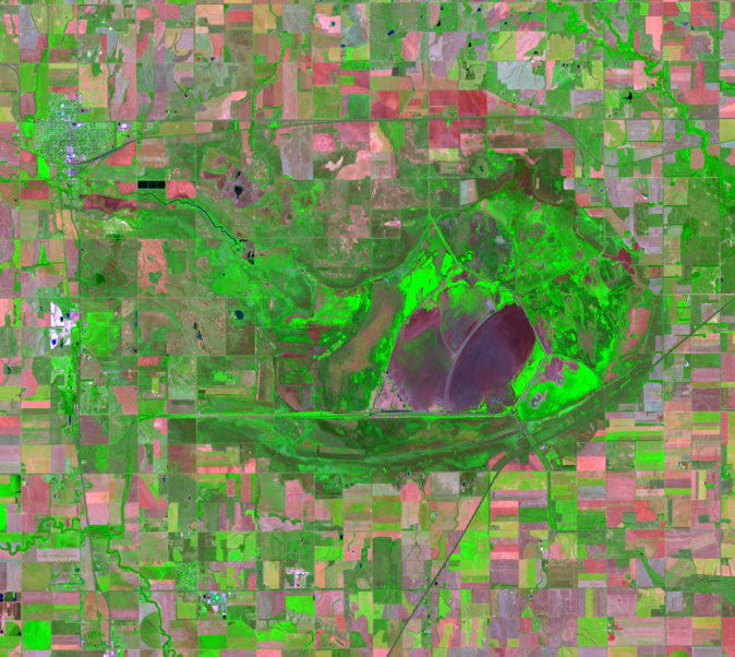
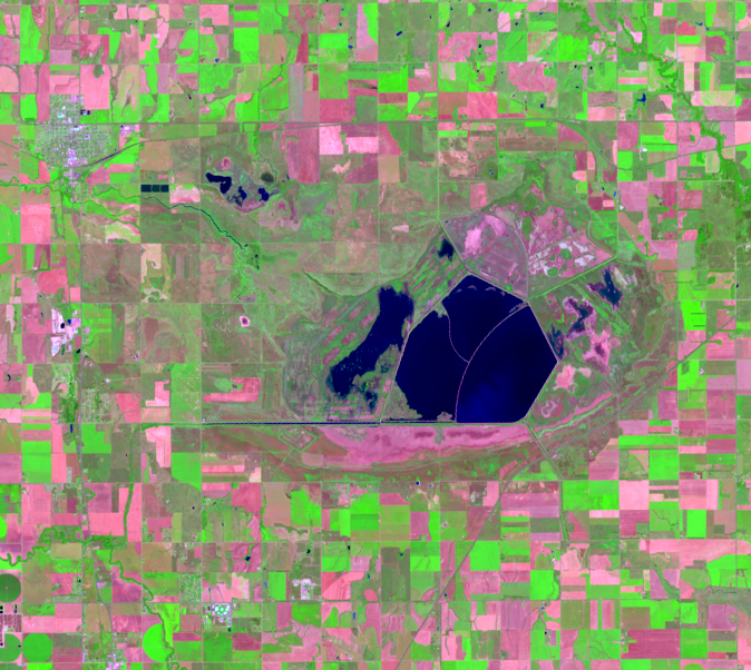
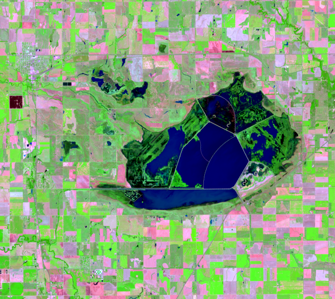
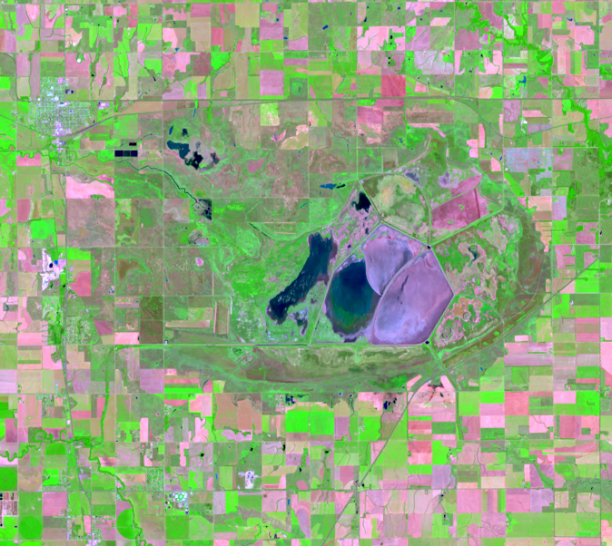
The wetlands were wet again in 2016–2017, went through a short drought in 2018, then had a very wet year in 2019. In 2020, the drought returned, and that spun into severe drought in 2022.
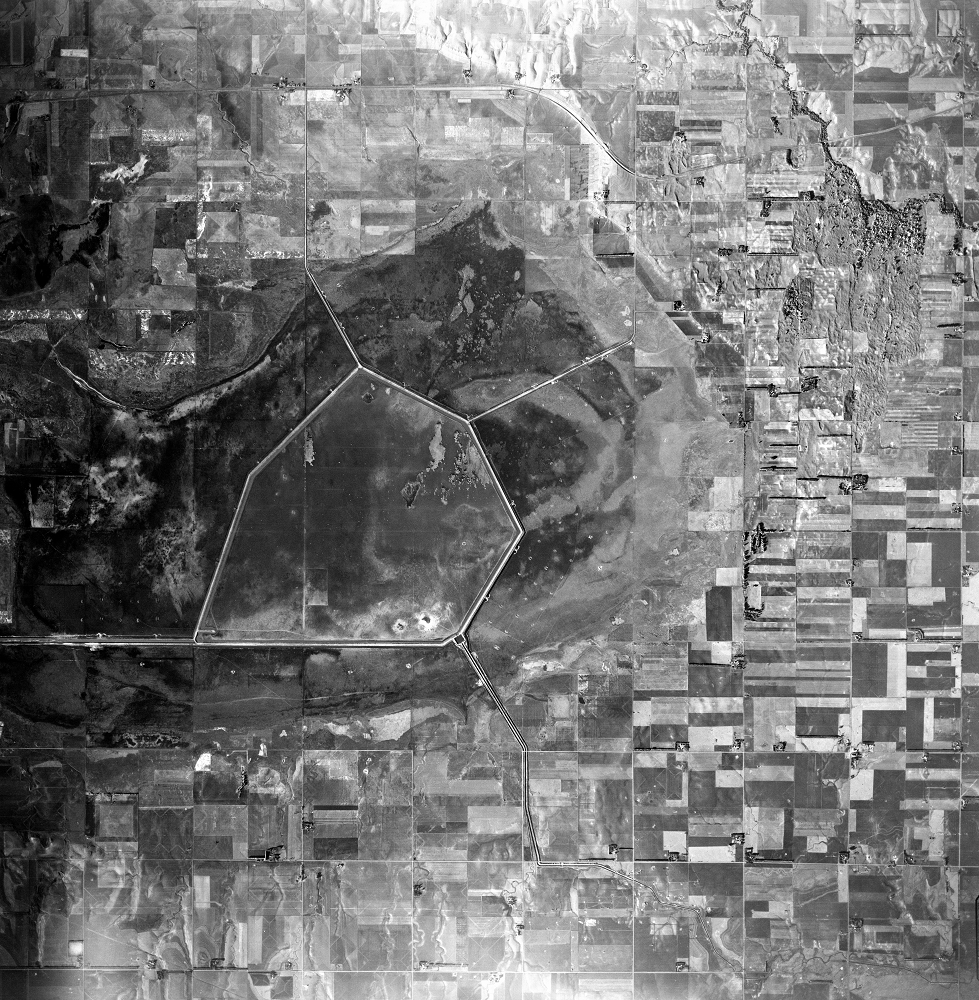
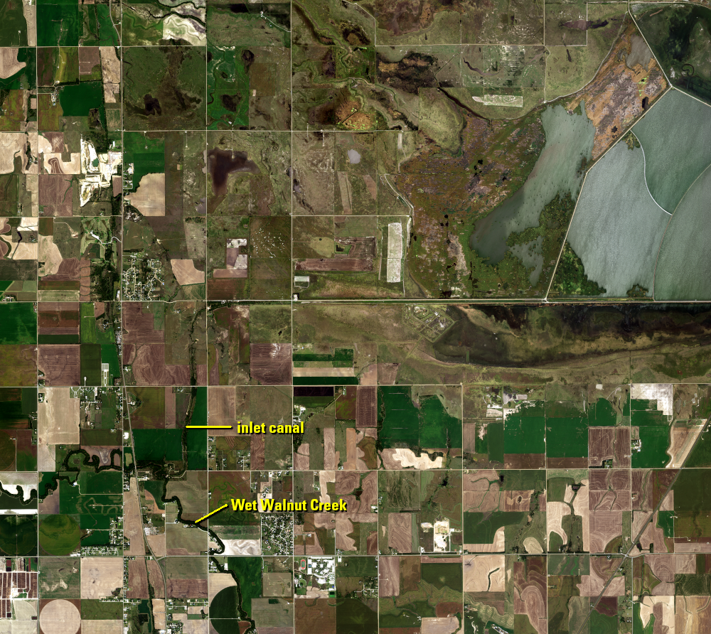
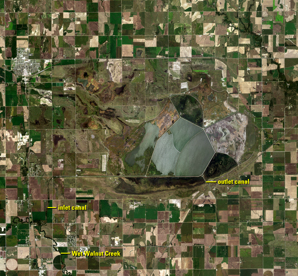
In addition to Landsat, the EROS archive contains aerial photos. A historical aerial photo from 1954 shows the wetland with the newly constructed dikes to divide it into five pools. The color aerial photo is from 2021 from the USDA NAIP program. A close up shows the location of the inlet canal from Wet Walnut Creek.
An outlet channel allows water to drain during heavy rains. It carries water east into Little Cheyenne Creek and eventually to the Arkansas River. Flooding, however, was not the problem in 2022.
Imagery
Every picture has a story to tell
Correlated
Additional story information
Downloads
Other Stories
Related imagery and additional content
A Key Rest Stop for Birds
The Cheyenne Bottoms are on the North American Central Flyway, kind of...
Water Level Changes
Even with water diverted from rivers into the Cheyenne Bottoms, little...