Earthshots
Earth Resources Observation and Science (EROS) Center - Earthshots
Welcome to Earthshots!
Satellite images reveal how people and nature change the Earth's landscape over time. We invite you to explore more than 100 unique locations around the world where satellites reveal the stories as the lands change. Click a location on the globe to learn more about the type of land change happening there. Or, scroll down and choose to learn more about key topic areas of land changes and visit some of the various locations around the world where they are occurring.
458 of 458
Petermann Glacier, Greenland
Petermann Glacier, Greenland
Petermann Glacier, Greenland
Kīlauea, Hawaii, USA
Maui, Hawaii, USA
Garden City, Kansas, USA
Saloum River, Senegal
Cheyenne Bottoms, Kansas, USA
Illinois/Indiana, USA
Selkirk Island, Chile
Brunt Ice Shelf, Antarctica
Chernobyl, Ukraine
Mesopotamian Marshes, Iraq
Mesopotamian Marshes, Iraq
The Everglades and Miami, Florida, USA
Nile River Delta, Egypt
Elburz Mountains, Iran
Riyadh, Saudi Arabia
Mount Kilimanjaro, Tanzania
Rondônia, Brazil
Powder River Basin, Wyoming, USA
Inland Delta of the Niger River, Mali
Antelope Valley, California, USA
Ayeyarwady Delta, Myanmar
Aral Sea, Kazakhstan and Uzbekistan
Aral Sea, Kazakhstan and Uzbekistan
Rondônia, Brazil
Orlando, Florida, USA
Atchafalaya Delta, Louisiana, USA
Athabasca Oil Sands, Alberta, Canada
Ayeyarwady Delta, Myanmar
Bahrain
Bakken Oil Boom, North Dakota, USA
Batagaika Crater, Russia
Lake Powell, Utah and Arizona, USA
Bear Glacier, Alaska, USA
Bear Glacier, Alaska, USA
Beijing, China
Beijing, China
Catfish Farms, Mississippi, USA
Mount Kilimanjaro, Tanzania
Three Gorges Dam, China
Athabasca Oil Sands, Alberta, Canada
Black Hills, SD, USA
Black Rock Playa, Nevada, USA
Powder River Basin, Wyoming, USA
Sydney, Australia
Breiðamerkurjökull Glacier, Iceland
Pearl River Delta, China
Sabah Al Ahmad Sea City, Kuwait
Brunt Ice Shelf, Antarctica
Riyadh, Saudi Arabia
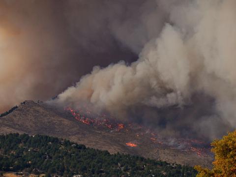
Cougar Creek Fire, Washington, USA
Black Rock Playa, Nevada, USA
Chuquicamata Mine, Chile
Elburz Mountains, Iran
Shiyan, China
The Everglades and Miami, Florida, USA
Cape Cod, Massachusetts, USA
Catfish Farms, Mississippi, USA
Catfish Farms, Mississippi, USA
Seno Plain, Mali
Lake Urmia, Iran
Isle de Jean Charles, Louisiana, USA
Las Vegas, Nevada, USA
Singapore
Brunt Ice Shelf, Antarctica
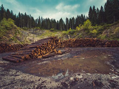
Logging in Oregon, USA
Chernobyl, Ukraine
Cheyenne Bottoms, Kansas, USA
Chuquicamata Mine, Chile
Nouakchott, Mauritania
Logging in Oregon, USA
Yucca Flat, Nevada, USA
Logging in Oregon, USA
Columbia Glacier, Alaska, USA
Chernobyl, Ukraine
Copenhagen, Denmark
Seno Plain, Mali
Cougar Creek Fire, Washington, USA
Seno Plain, Mali
Dallas, Texas, USA
Dallas, Texas, USA
Gypsy Moth Infestation, MA, CT, RI, USA
Shiyan, China
Dead Sea, Israel, Jordan, West Bank
Madagascar
Santa Cruz, Bolivia
Rondônia, Brazil
Ayeyarwady Delta, Myanmar
Monarch Butterflies, Mexico
Huang He Delta, China
Atchafalaya Delta, Louisiana, USA
Papua, Indonesia
Denver, Colorado, USA
Rosso, Mauritania
Sioux Falls, South Dakota, USA
Devils Lake, North Dakota, USA
Diamond Mines, Northwest Territories, Canada
Diamond Mines, Northwest Territories, Canada
Doha, Qatar
Pearl River Delta, China
Huang He Delta, China
Dubai, United Arab Emirates
Dubai, United Arab Emirates
Bahrain
Lake Hamoun, Iran and Afghanistan
Sharq El Owainat, Egypt
Sioux Falls, South Dakota, USA
Illinois/Indiana, USA
Diamond Mines, Northwest Territories, Canada
Elburz Mountains, Iran
Kīlauea, Hawaii, USA
Gulf of Fonseca, Honduras and Nicaragua
Shiyan, China
Mount Pinatubo, Philippines
Escondida Mine, Chile
San Joaquin Valley, California, USA
Beijing, China
Lake Thompson, South Dakota, USA
Filchner Ice Shelf, Antarctica
Athabasca Oil Sands, Alberta, Canada
Yellowstone National Park, USA
Wyperfeld National Park, Australia
Copenhagen, Denmark
Lake Naivasha, Kenya
Wadi As-Sirhan Basin, Saudi Arabia
Yellowstone National Park, USA
Phnom Penh, Cambodia
Garden City, Kansas, USA
Gibe III Dam, Ethiopia
Gibe III Dam, Ethiopia
Okomu Forest Reserve, Nigeria
Bear Glacier, Alaska, USA
Bear Glacier, Alaska, USA
Lake Powell, Utah and Arizona, USA
Monarch Butterflies, Mexico
Mesabi Range, Minnesota, USA
Grand Ethiopian Renaissance Dam, Ethiopia
Yanacocha Mine, Peru
Great Salt Lake, Utah, USA
Denver, Colorado, USA
Garden City, Kansas, USA
Santiago, Chile
Santa Cruz, Bolivia
Pearl River Delta, China
Gulf of Fonseca, Honduras and Nicaragua
Gypsy Moth Infestation, MA, CT, RI, USA
Hailstorm at EROS, Sioux Falls, SD, USA
Brunt Ice Shelf, Antarctica
Brunt Ice Shelf, Antarctica
Sydney, Australia
Ilısu Dam, Turkey
Isle de Jean Charles, Louisiana, USA
Gypsy Moth Infestation, MA, CT, RI, USA
Huang He Delta, China
Hubbard Glacier, Alaska, USA
Hurricane Katrina, New Orleans, Louisiana, USA
Lake Naivasha, Kenya
Mountaintop Mining, West Virginia, USA
Lake Thompson, South Dakota, USA
Mille Lacs Lake, Minnesota, USA
Mille Lacs Lake, Minnesota, USA
Diamond Mines, Northwest Territories, Canada
Brunt Ice Shelf, Antarctica
Iguazú, South America
Iguazú, South America
Iguazú, South America
IJsselmeer, Netherlands
Ilısu Dam, Turkey
Ilısu Dam, Turkey
Illinois/Indiana, USA
Imperial Valley, California, USA
Pune, India
Las Vegas, Nevada, USA
Athabasca Oil Sands, Alberta, Canada
Pearl River Delta, China
Dead Sea, Israel, Jordan, West Bank
Yellowstone National Park, USA
Inland Delta of the Niger River, Mali
Logging in Oregon, USA
Toshka Project, Egypt
Rosso, Mauritania
Isahaya Bay, Japan
Aral Sea, Kazakhstan and Uzbekistan
Isle de Jean Charles, Louisiana, USA
Svalbard, Norway
Iguazú, South America
Dallas, Texas, USA
Breiðamerkurjökull Glacier, Iceland
Singapore
Kīlauea, Hawaii, USA
Kalgoorlie, Western Australia
Kara-Bogaz-Gol, Turkmenistan
Lesotho
Aral Sea, Kazakhstan and Uzbekistan
Kara-Bogaz-Gol, Turkmenistan
Kīlauea, Hawaii, USA
Knife River Delta, Canada
Aral Sea, Kazakhstan and Uzbekistan
Lake Chad, West Africa
Lake Hamoun, Iran and Afghanistan
Lake Hamoun, Iran and Afghanistan
IJsselmeer, Netherlands
Las Vegas, Nevada, USA
Devils Lake, North Dakota, USA
Las Vegas, Nevada, USA
Lake Naivasha, Kenya
Phoenix, Arizona, USA
Lake Powell, Utah and Arizona, USA
Lake Thompson, South Dakota, USA
Lake Turkana, Kenya and Ethiopia
Lake Urmia, Iran
Bakken Oil Boom, North Dakota, USA
Las Vegas, Nevada, USA
Shiyan, China
Sharq El Owainat, Egypt
Landsat’s Return Beam Vidicon
Las Vegas, Nevada, USA
Illinois/Indiana, USA
Lesotho
The Everglades and Miami, Florida, USA
Dead Sea, Israel, Jordan, West Bank
Logging in Oregon, USA
Monarch Butterflies, Mexico
Madagascar
Madagascar
Mamoré River, Bolivia
Bahrain
Ayeyarwady Delta, Myanmar
Mount Pinatubo, Philippines
Maui, Hawaii, USA
Columbia Glacier, Alaska, USA
Mesabi Range, Minnesota, USA
Mesopotamian Marshes, Iraq
Mille Lacs Lake, Minnesota, USA
Escondida Mine, Chile
Chuquicamata Mine, Chile
Mountaintop Mining, West Virginia, USA
Athabasca Oil Sands, Alberta, Canada
Ayeyarwady Delta, Myanmar
Lesotho
Monarch Butterflies, Mexico
Monarch Butterflies, Mexico
Cape Cod, Massachusetts, USA
Inland Delta of the Niger River, Mali
Illinois/Indiana, USA
Beijing, China
Selkirk Island, Chile
Mount Kilimanjaro, Tanzania
Mount Pinatubo, Philippines
Black Hills, SD, USA
Mount St. Helens, Washington, USA
Mountaintop Mining, West Virginia, USA
Chuquicamata Mine, Chile
Landsat’s Return Beam Vidicon
Muskingum Mines, Ohio, USA
Shanghai, China
Orlando, Florida, USA
Monarch Butterflies, Mexico
Las Vegas, Nevada, USA
Nile River Delta, Egypt
Doha, Qatar
Nouakchott, Mauritania
Denver, Colorado, USA
Illinois/Indiana, USA
Sabah Al Ahmad Sea City, Kuwait
Maui, Hawaii, USA
Hurricane Katrina, New Orleans, Louisiana, USA
Chernobyl, Ukraine
Nile River Delta, Egypt
Copenhagen, Denmark
Powder River Basin, Wyoming, USA
Brunt Ice Shelf, Antarctica
Brunt Ice Shelf, Antarctica
Inland Delta of the Niger River, Mali
Nouakchott, Mauritania
Powder River Basin, Wyoming, USA
Okomu Forest Reserve, Nigeria
Okomu Forest Reserve, Nigeria
Yellowstone National Park, USA
Atchafalaya Delta, Louisiana, USA
Lake Turkana, Kenya and Ethiopia
Mille Lacs Lake, Minnesota, USA
Orlando, Florida, USA
Selkirk Island, Chile
Gypsy Moth Infestation, MA, CT, RI, USA
Mamoré River, Bolivia
Bakken Oil Boom, North Dakota, USA
Kīlauea, Hawaii, USA
Dubai, United Arab Emirates
Dubai, United Arab Emirates
Papua, Indonesia
Papua, Indonesia
Mount Pinatubo, Philippines
Pearl River Delta, China
Doha, Qatar
Monarch Butterflies, Mexico
Sydney, Australia
Petermann Glacier, Greenland
Phnom Penh, Cambodia
Phoenix, Arizona, USA
Orlando, Florida, USA
Sharq El Owainat, Egypt
Columbia Glacier, Alaska, USA
Mesabi Range, Minnesota, USA
Escondida Mine, Chile
Wyperfeld National Park, Australia
Mamoré River, Bolivia
Salar de Atacama, Chile
Phnom Penh, Cambodia
Lake Urmia, Iran
Powder River Basin, Wyoming, USA
Grand Ethiopian Renaissance Dam, Ethiopia
Salar de Atacama, Chile
Toshka Project, Egypt
Pune, India
Kīlauea, Hawaii, USA
Bear Glacier, Alaska, USA
San Antonio, Texas, USA
Dallas, Texas, USA
Selkirk Island, Chile
Dead Sea, Israel, Jordan, West Bank
Nouakchott, Mauritania
Chernobyl, Ukraine
Muskingum Mines, Ohio, USA
Mountaintop Mining, West Virginia, USA
Athabasca Oil Sands, Alberta, Canada
Selkirk Island, Chile
San Antonio, Texas, USA
The Everglades and Miami, Florida, USA
Verdi Ice Shelf, Antarctica
Phnom Penh, Cambodia
Riyadh, Saudi Arabia
Rondônia, Brazil
Rosso, Mauritania
Sabah Al Ahmad Sea City, Kuwait
Salar de Atacama, Chile
Saloum River, Senegal
Lake Urmia, Iran
San Antonio, Texas, USA
Gulf of Fonseca, Honduras and Nicaragua
San Joaquin Valley, California, USA
Lake Powell, Utah and Arizona, USA
Santa Cruz, Bolivia
Santa Cruz, Bolivia
Santiago, Chile
Petermann Glacier, Greenland
Inland Delta of the Niger River, Mali
Lake Chad, West Africa
Yucca Flat, Nevada, USA
Selkirk Island, Chile
Seno Plain, Mali
Shanghai, China
Sharq El Owainat, Egypt
Shiyan, China
Gulf of Fonseca, Honduras and Nicaragua
Singapore
Sioux Falls, South Dakota, USA
Sioux Falls, South Dakota, USA
Siren, Wisconsin, USA
Mount Kilimanjaro, Tanzania
Antelope Valley, California, USA
Dubai, United Arab Emirates
Phoenix, Arizona, USA
Inland Delta of the Niger River, Mali
Sioux Falls, South Dakota, USA
IJsselmeer, Netherlands
Las Vegas, Nevada, USA
Gypsy Moth Infestation, MA, CT, RI, USA
Hurricane Katrina, New Orleans, Louisiana, USA
Denver, Colorado, USA
Cape Cod, Massachusetts, USA
Devils Lake, North Dakota, USA
Toshka Project, Egypt
Gibe III Dam, Ethiopia
Kalgoorlie, Western Australia
Svalbard, Norway
Svalbard, Norway
Sydney, Australia
Mesabi Range, Minnesota, USA
Elburz Mountains, Iran
Wyperfeld National Park, Australia
Filchner Ice Shelf, Antarctica
Huang He Delta, China
Imperial Valley, California, USA
Black Hills, SD, USA
Great Salt Lake, Utah, USA
Batagaika Crater, Russia
Isahaya Bay, Japan
Mount St. Helens, Washington, USA
Great Salt Lake, Utah, USA
The Everglades and Miami, Florida, USA
Mount Kilimanjaro, Tanzania
Lake Hamoun, Iran and Afghanistan
Phnom Penh, Cambodia
Singapore
Singapore
Imperial Valley, California, USA
Toshka Project, Egypt
Toshka Project, Egypt
Petermann Glacier, Greenland
Yanacocha Mine, Peru
Powder River Basin, Wyoming, USA
Imperial Valley, California, USA
Siren, Wisconsin, USA
Hailstorm at EROS, Sioux Falls, SD, USA
Mesopotamian Marshes, Iraq
Dubai, United Arab Emirates
Three Gorges Dam, China
Bakken Oil Boom, North Dakota, USA
Toshka Project, Egypt
The Everglades and Miami, Florida, USA
Wadi As-Sirhan Basin, Saudi Arabia
San Joaquin Valley, California, USA
The Everglades and Miami, Florida, USA
Riyadh, Saudi Arabia
The Everglades and Miami, Florida, USA
Shanghai, China
Nile River Delta, Egypt
Doha, Qatar
Antelope Valley, California, USA
Pune, India
Aral Sea, Kazakhstan and Uzbekistan
Verdi Ice Shelf, Antarctica
Beijing, China
Wadi As-Sirhan Basin, Saudi Arabia
Mesopotamian Marshes, Iraq
Cheyenne Bottoms, Kansas, USA
Lake Chad, West Africa
Lake Powell, Utah and Arizona, USA
Sharq El Owainat, Egypt
Bakken Oil Boom, North Dakota, USA
Devils Lake, North Dakota, USA
Sydney, Australia
Phoenix, Arizona, USA
Las Vegas, Nevada, USA
San Antonio, Texas, USA
Black Rock Playa, Nevada, USA
Hubbard Glacier, Alaska, USA
Knife River Delta, Canada
Hubbard Glacier, Alaska, USA
Hubbard Glacier, Alaska, USA
Aral Sea, Kazakhstan and Uzbekistan
Lake Thompson, South Dakota, USA
Chernobyl, Ukraine
Denver, Colorado, USA
Bakken Oil Boom, North Dakota, USA
Antelope Valley, California, USA
Seno Plain, Mali
Wyperfeld National Park, Australia
Yanacocha Mine, Peru
Yellowstone National Park, USA
Yellowstone National Park, USA
Yucca Flat, Nevada, USA
Lake Hamoun, Iran and Afghanistan
Copenhagen, Denmark
Petermann Glacier, Greenland