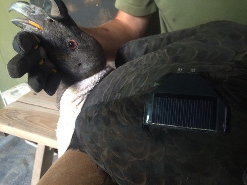
The USGS Fort Collins Science Center (FORT) worked with the U.S. Fish and Wildlife Service (FWS) to revise the California condor global positioning system (GPS) data acquisition, management, and archive workflow. FORT and the FWS implemented a Global System for Mobile Communication (GSM) GPS tracking system, a relatively economical cellular technology. The devices stream positional data to an online system that manages transmitter/bird deployment data and proofs incoming GPS data. A second online system pulls data from the first system and generates both a map of condor movements and a set of alerts for birds showing either no recent change in position or locations in a restricted area, such as an airport or construction zone. Finally, FORT scientists designed a way to harvest raw and proofed data into ScienceBase (a USGS data repository) for later distribution to other systems and ensure data preservation and archival. The improved data management system requires far less manual intervention than the existing system and provides more timely access to tracking data.
https://www.fort.usgs.gov/science-tasks/2465

California condor for GSM GPS wing mount (courtesy, Ventana Wildlife Society).

