
The USGS is leading a 3D Elevation Program (3DEP) effort to coordinate with other Federal agency partners and the State of Alaska to acquire new Alaska elevation data statewide using remote sensing techniques. Under its Geospatial Products and Services Contract (GPSC), the USGS is contracting with vendors to acquire 5-meter (m) resolution elevation data using Interferometric Synthetic Aperture Radar (InSAR) sensors flown on aircraft. Deliveries include a Digital Terrain Model (DTM) representing the bare earth, a Digital Surface Model (DSM) representing the tops of vegetation and structures, and an orthorectified radar intensity image (ORI). The new data are replacing decades-old 60-m resolution elevation data that have known vertical and horizontal errors. By the end of July 2017, 98% of statewide InSAR coverage was available or in progress. The 2018 acquisition includes the National Petroleum Reserve-Alaska (NPRA), the Yukon-Kuskokwim Delta, and the Alaska Peninsula. The USGS aims to complete Alaska InSAR collection by 2020. The remaining 2% of the State includes the western Aleutian Islands, the Kodiak Island archipelago, and St. Lawrence, St. Matthew, St. Paul, and St. George Islands.
InSAR data are being used in a wide variety of mapping, resource management, and human safety applications. The new elevation data serve as a foundational layer for updated and new USGS digital topographic maps that are being generated statewide for Alaska as the new elevation data become available. InSAR is also being used to update and refine the digital water-surface layer for Alaska that is critical to many applications. These Alaska mapping efforts are coordinated through the Alaska Mapping Executive Committee (AMEC), an executive body co-chaired by the Department of the Interior and the Department of Commerce. AMEC members represent multiple Federal agencies and the State. Alaska InSAR elevation data can be downloaded through the USGS The National Map data download service at https://viewer.nationalmap.gov/basic/.
https://www.usgs.gov/core-science-systems/ngp/user-engagement-office/al…
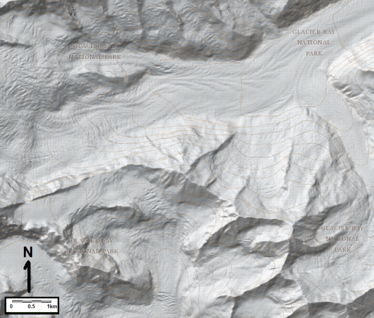
Shaded relief image from InSAR data for a portion of Glacier Bay National Park, Alaska.