

Residential Lakes
Earth Resources Observation and Science (EROS) Center - Earthshots
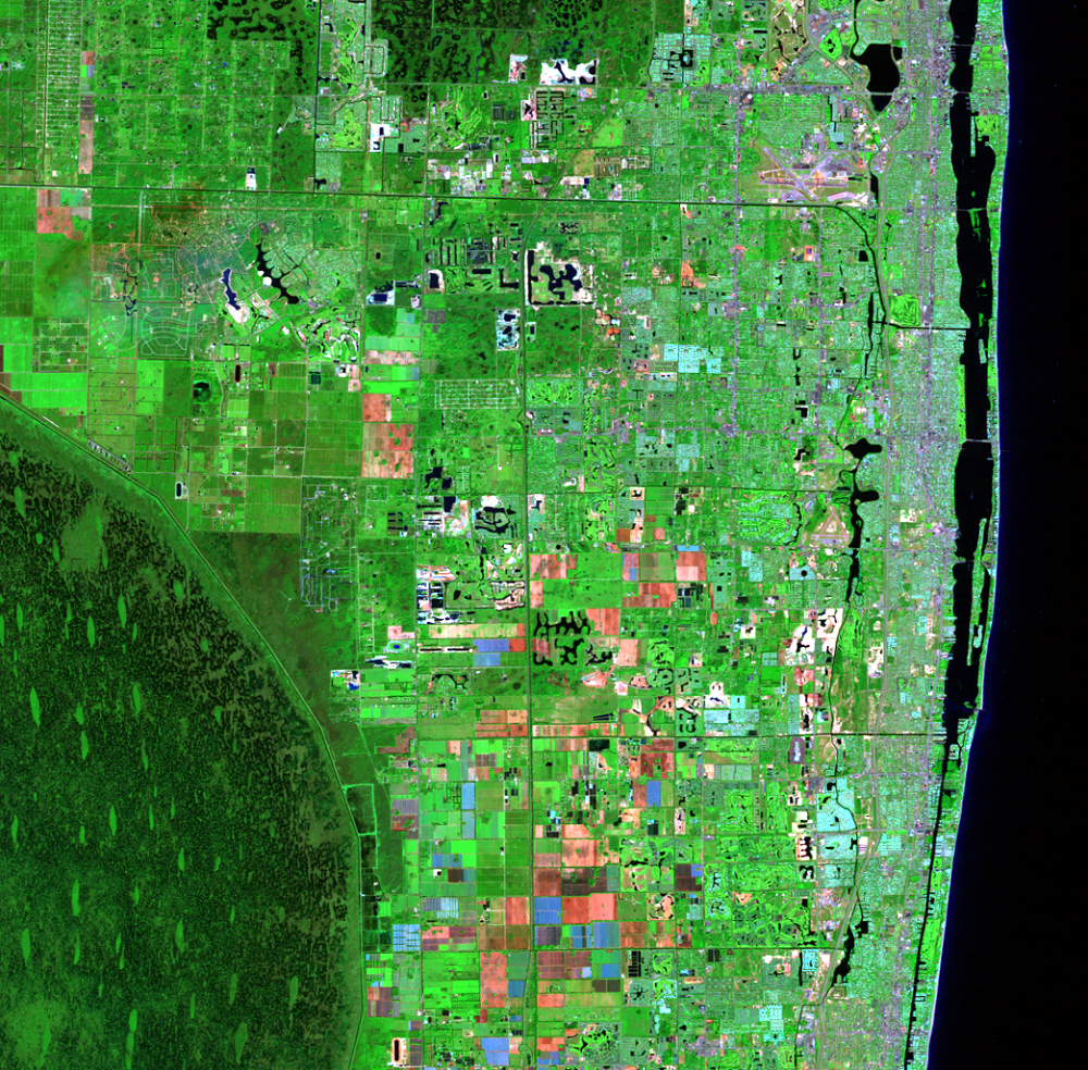
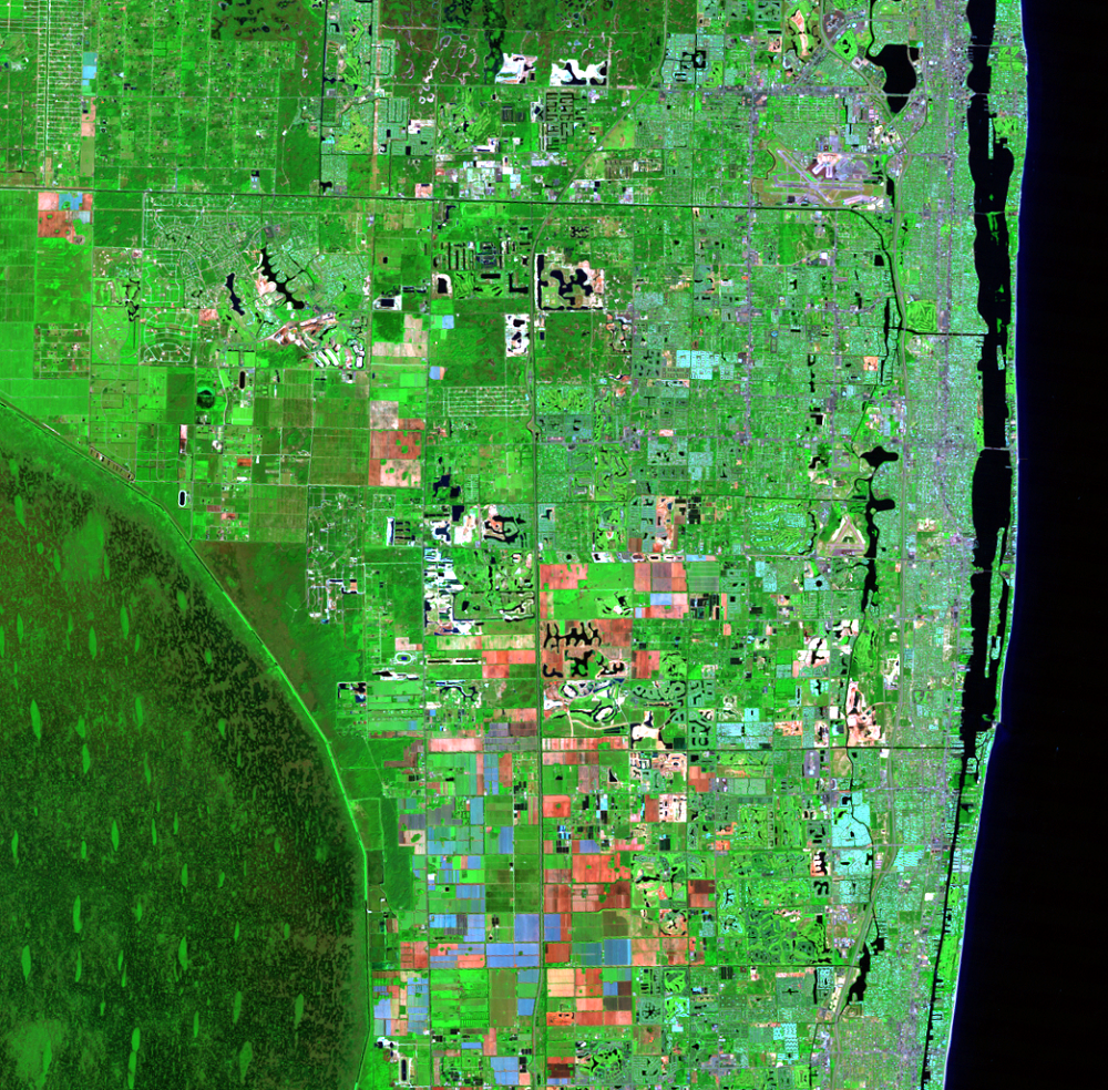
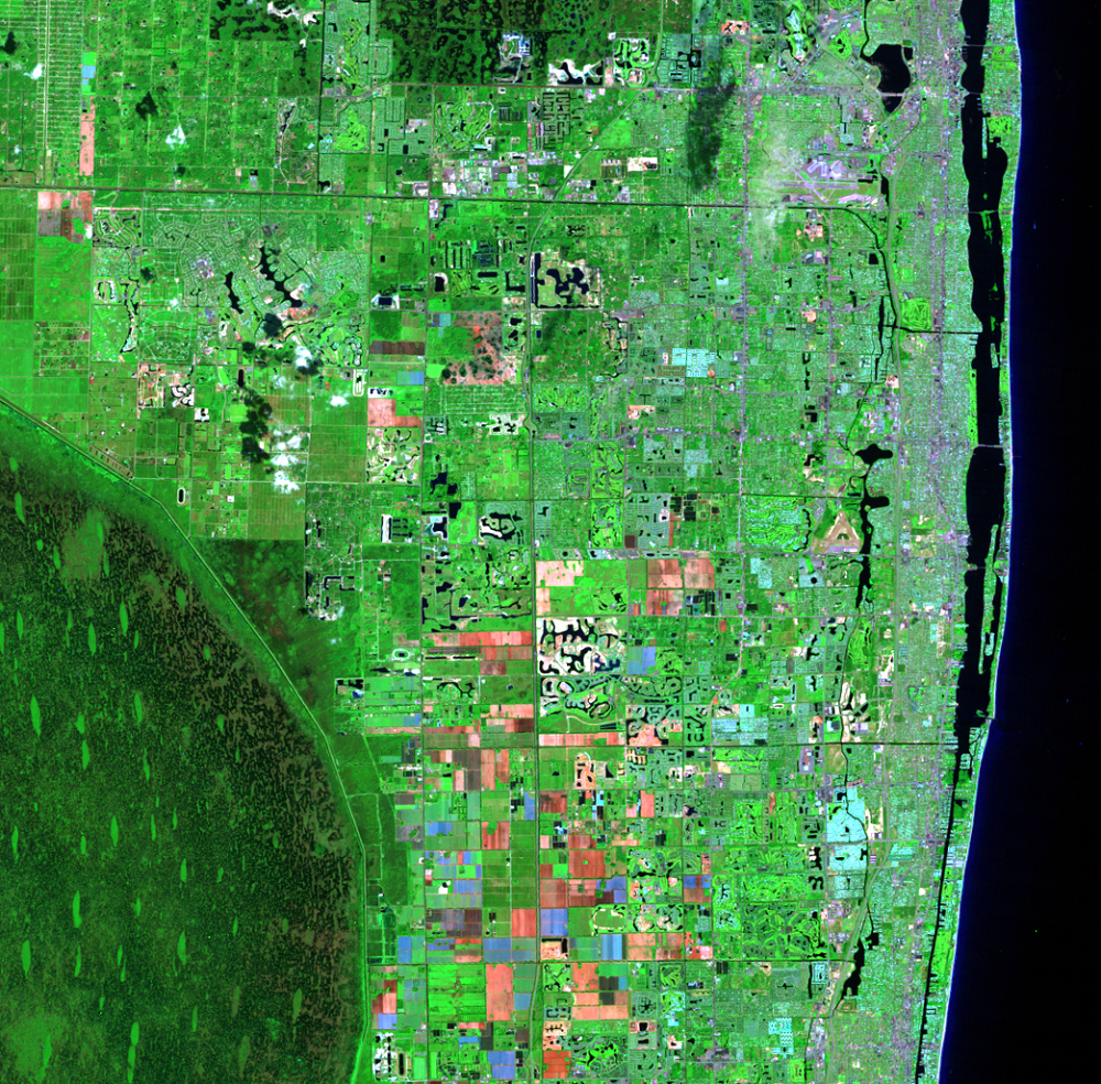
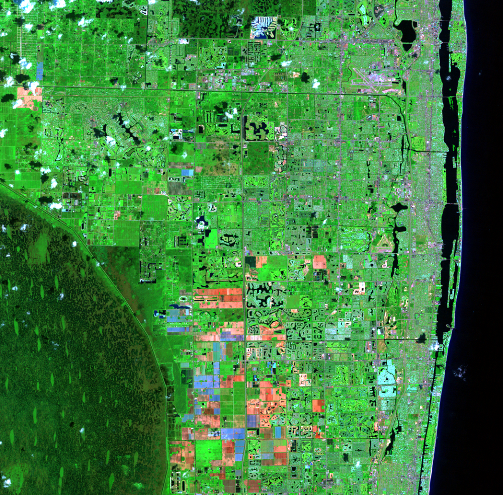
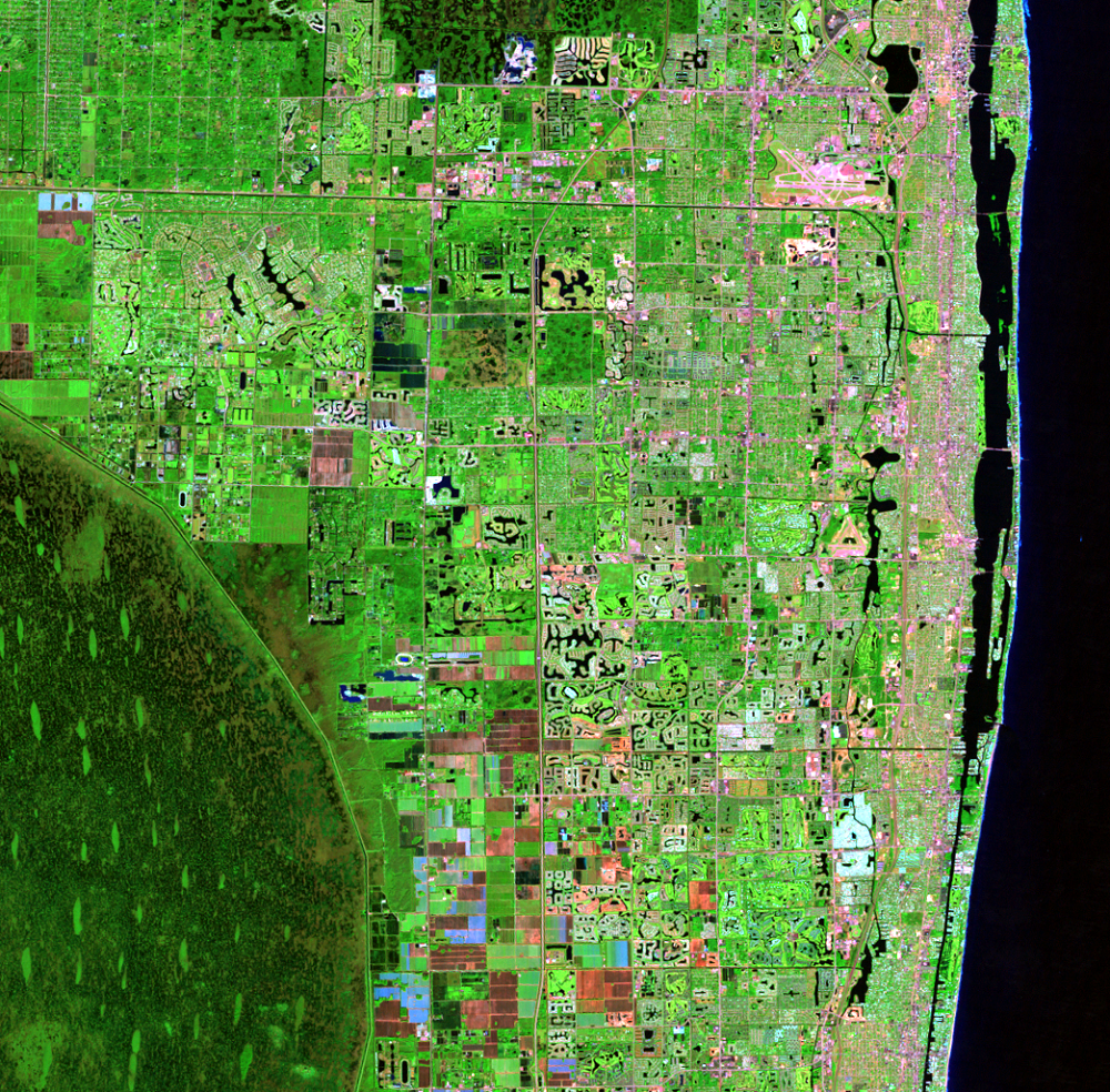
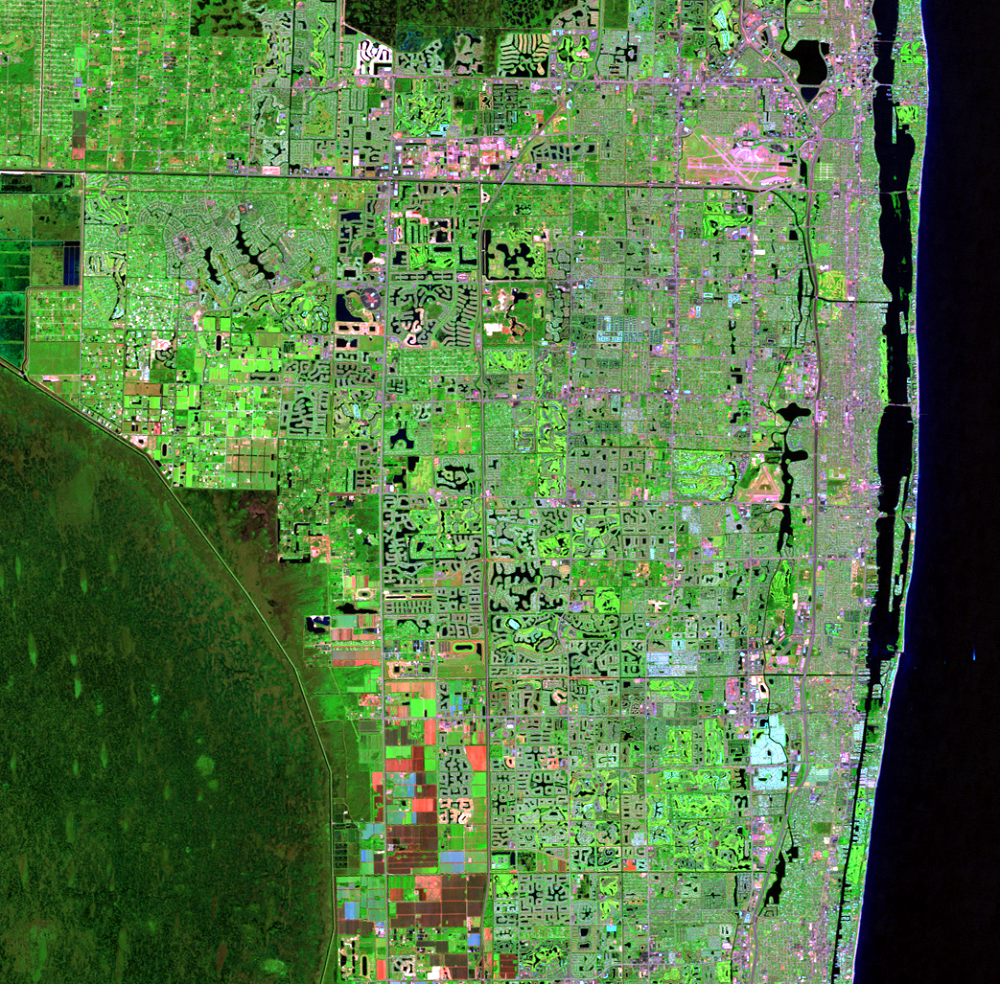
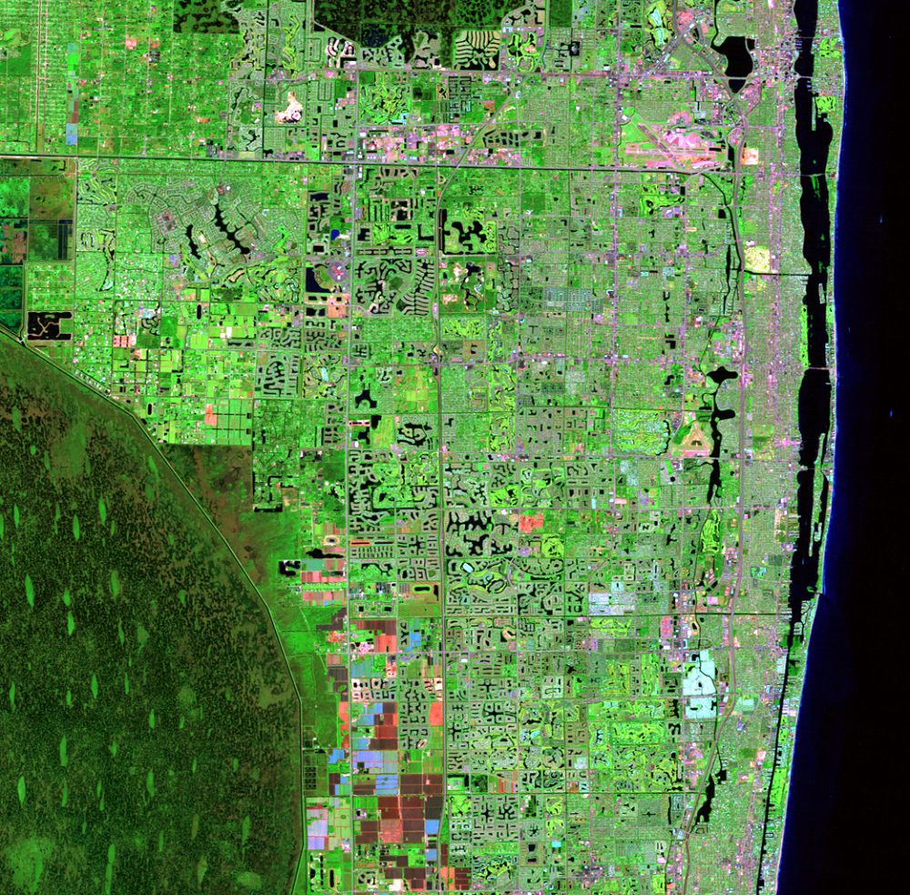
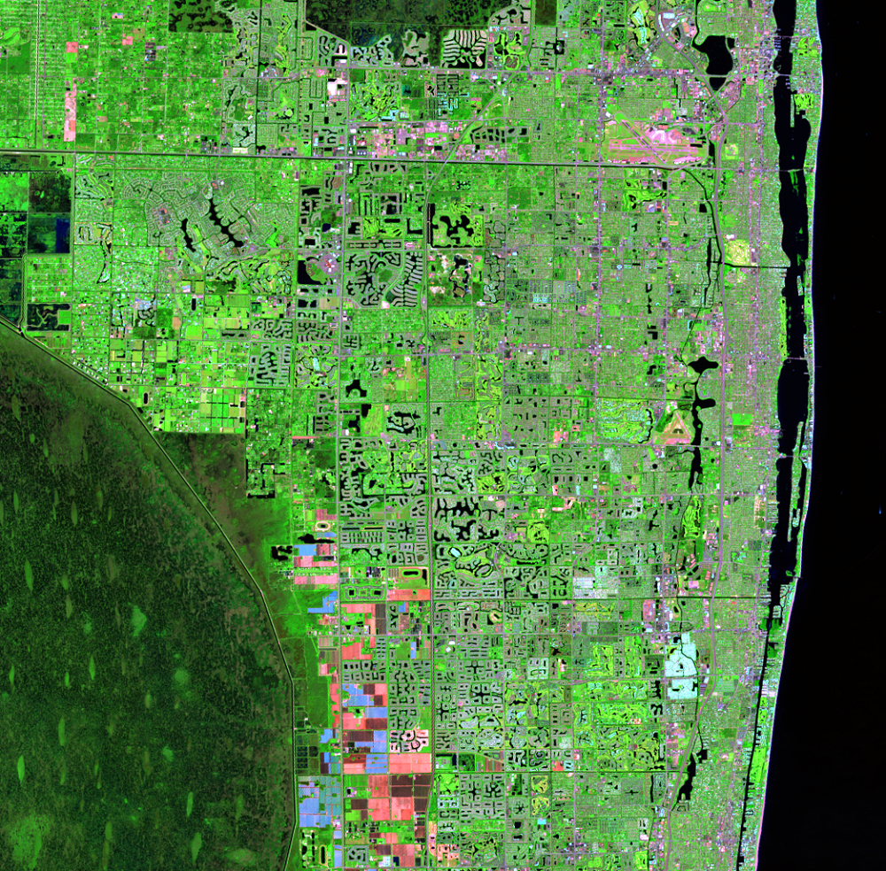
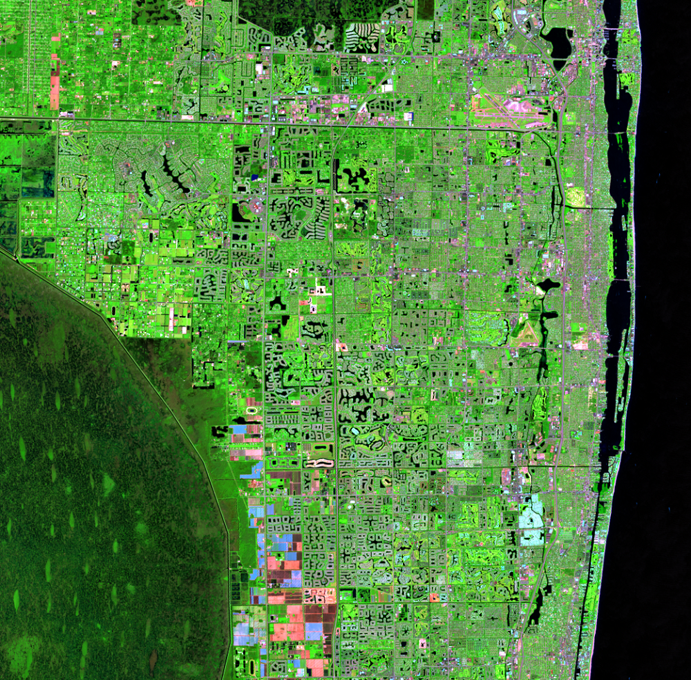
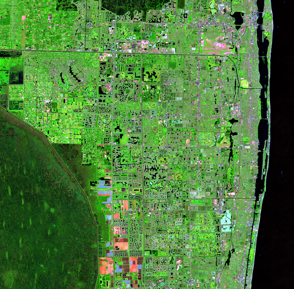
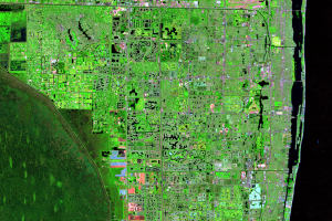
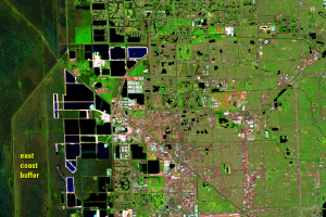
A lot of the urban area consists of large planned communities, often for retirees. Many of these communities incorporate artificial residential lakes. Digging out these lakes provided construction fill for roads and elevated low-lying land for development. The lakes also reduce the risk of urban flooding by capturing storm water runoff, and add aesthetic value.
Comparing the images in this time series, the number of small water bodies increases substantially. The small dark shapes are scattered throughout the green shades that indicate residential areas, along with golf courses, which appear brighter green. The dark green in the lower left is the Loxahatchee National Wildlife Refuge.
Imagery
Downloads
Related Content
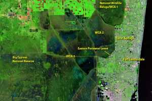
The Everglades and Miami, Florida, USA
Referred to as the “River of Grass,” the Florida Everglades is one of ...
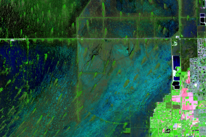
Canals and Levees
Historically, water flowed slowly southward through the Everglades in ...
Tree Islands
A unique feature of the Everglades is the dark green teardrop-shaped f...
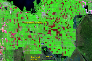
Agriculture
The fertile muck soils along the south shore of Lake Okeechobee in the...
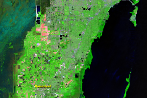
Urban Development
In 1900, southeastern Florida included a few small towns with a popula...
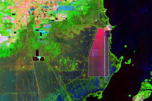
Turkey Point
There is a notable shape southeast of Homestead on the coast of the Ba...
Residential Lakes
A lot of the urban area consists of large planned communities, often f...
Limestone Mining
The Everglades sit on top of a bedrock of limestone. Limestone quarrie...