

Sioux Falls
Earth Resources Observation and Science (EROS) Center - Earthshots
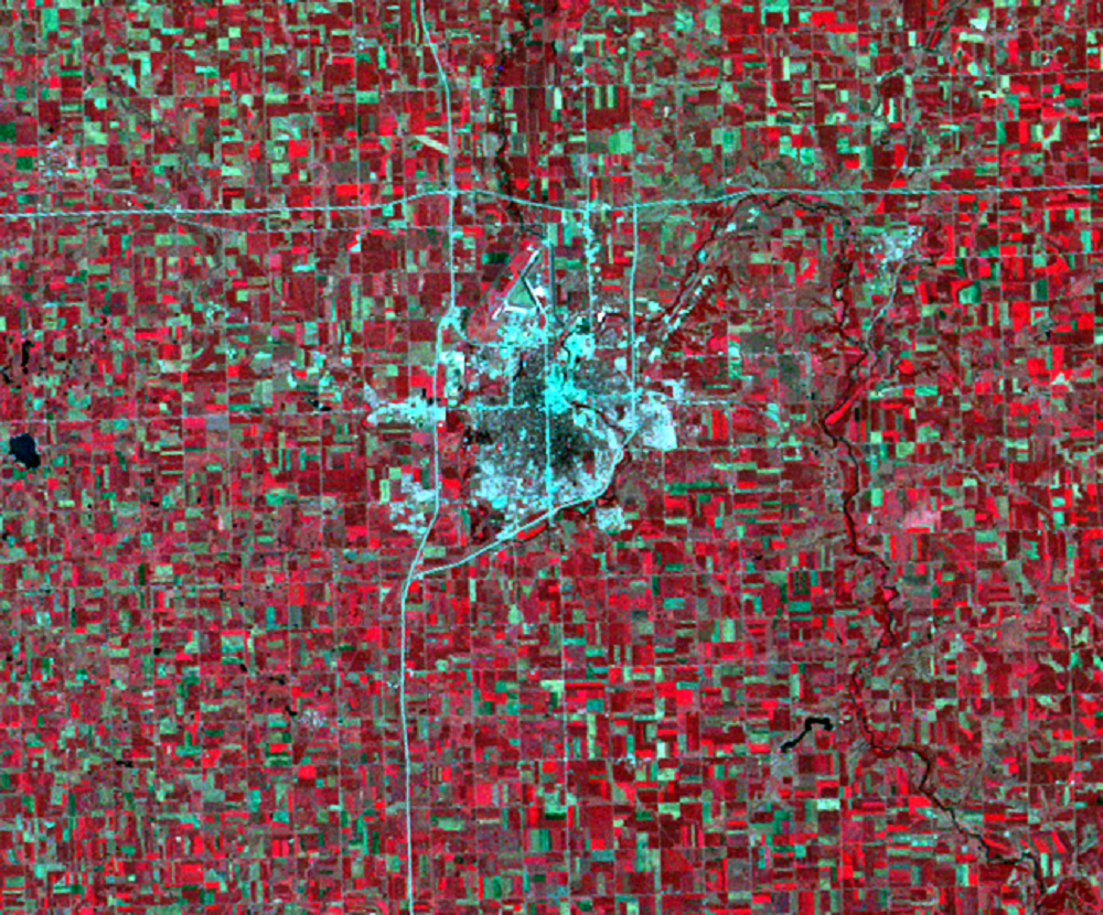
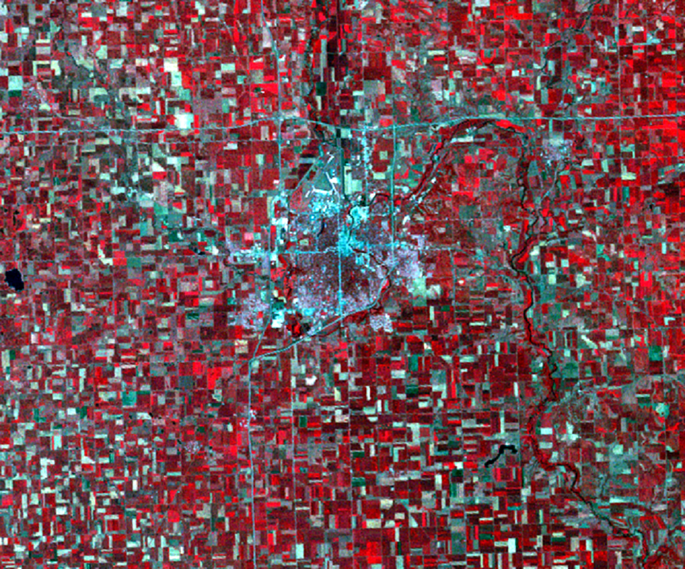
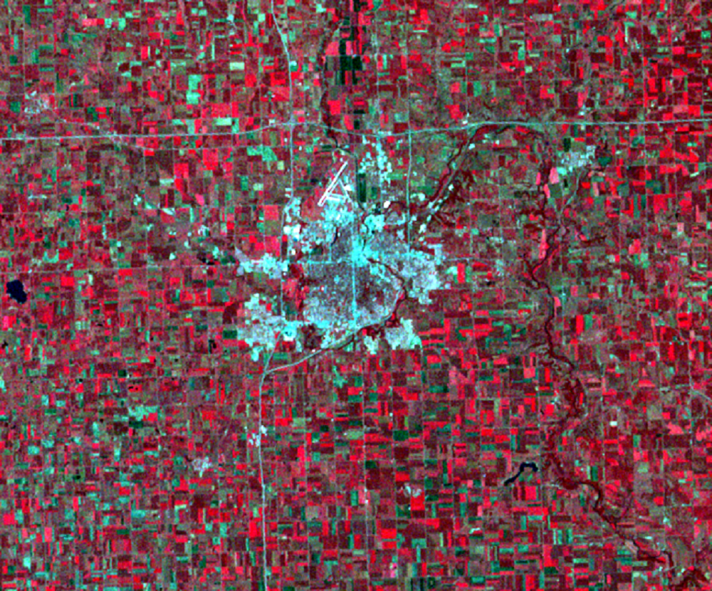
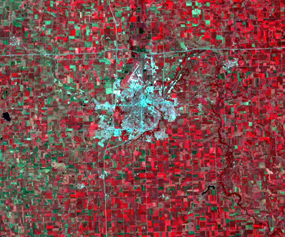
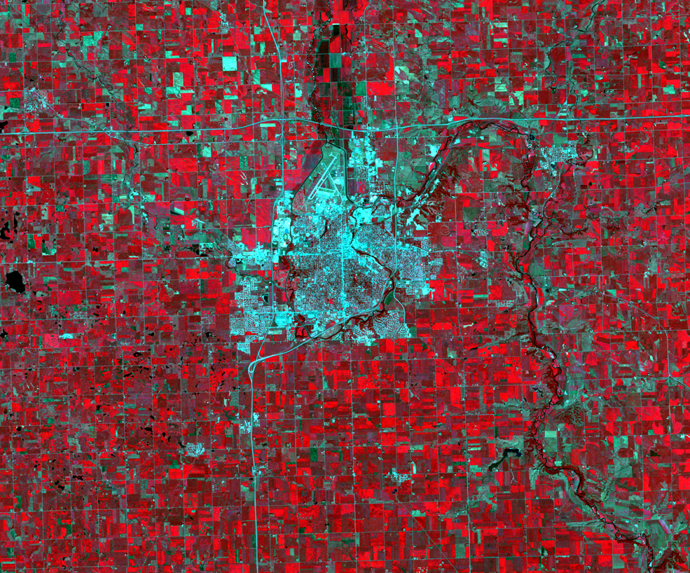
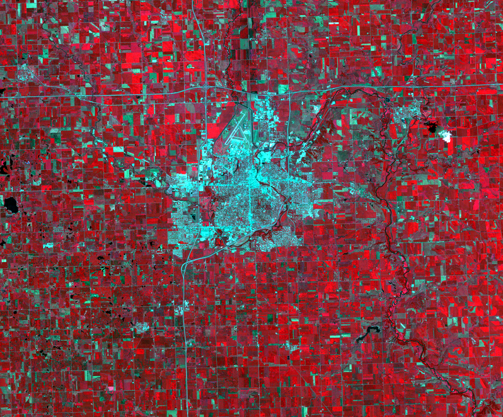
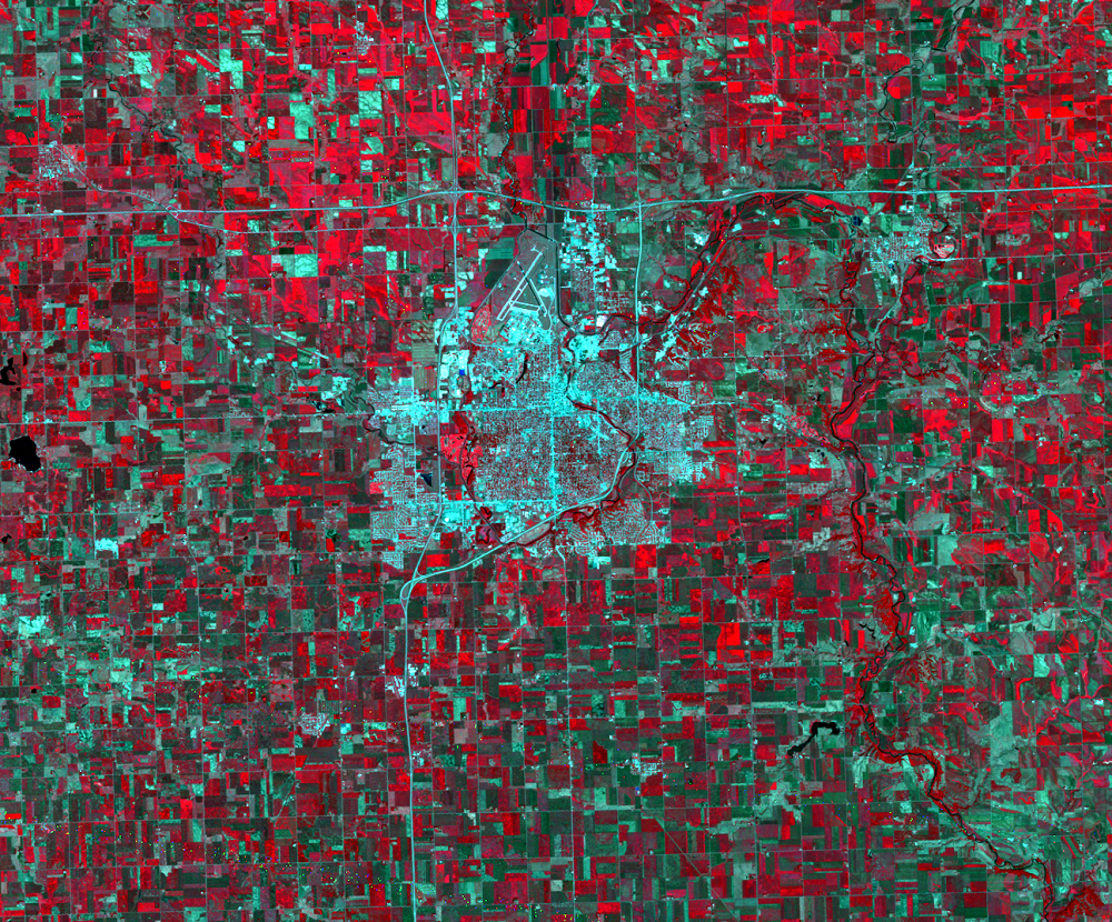
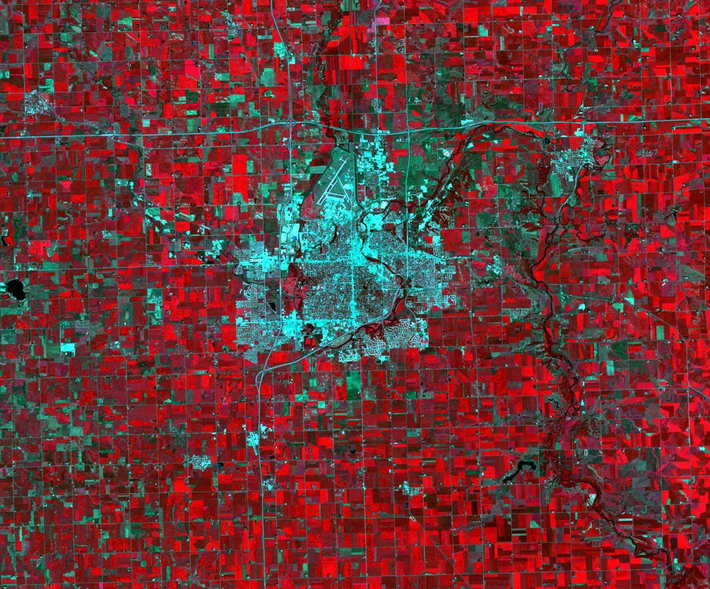
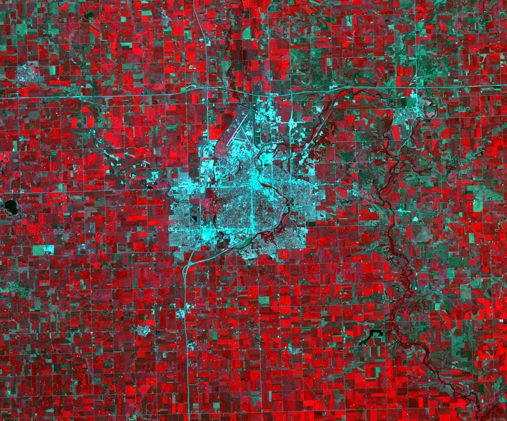
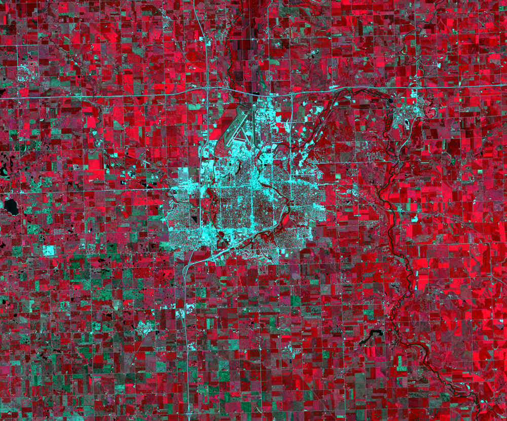
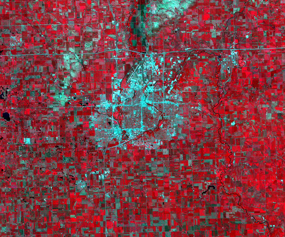
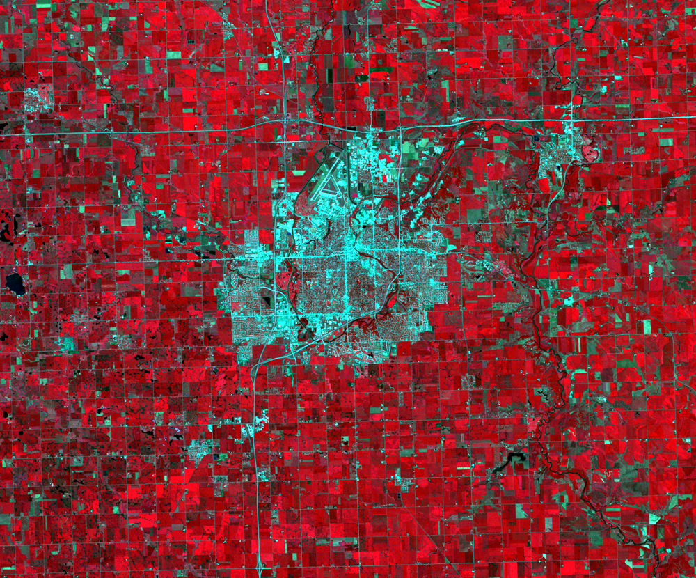
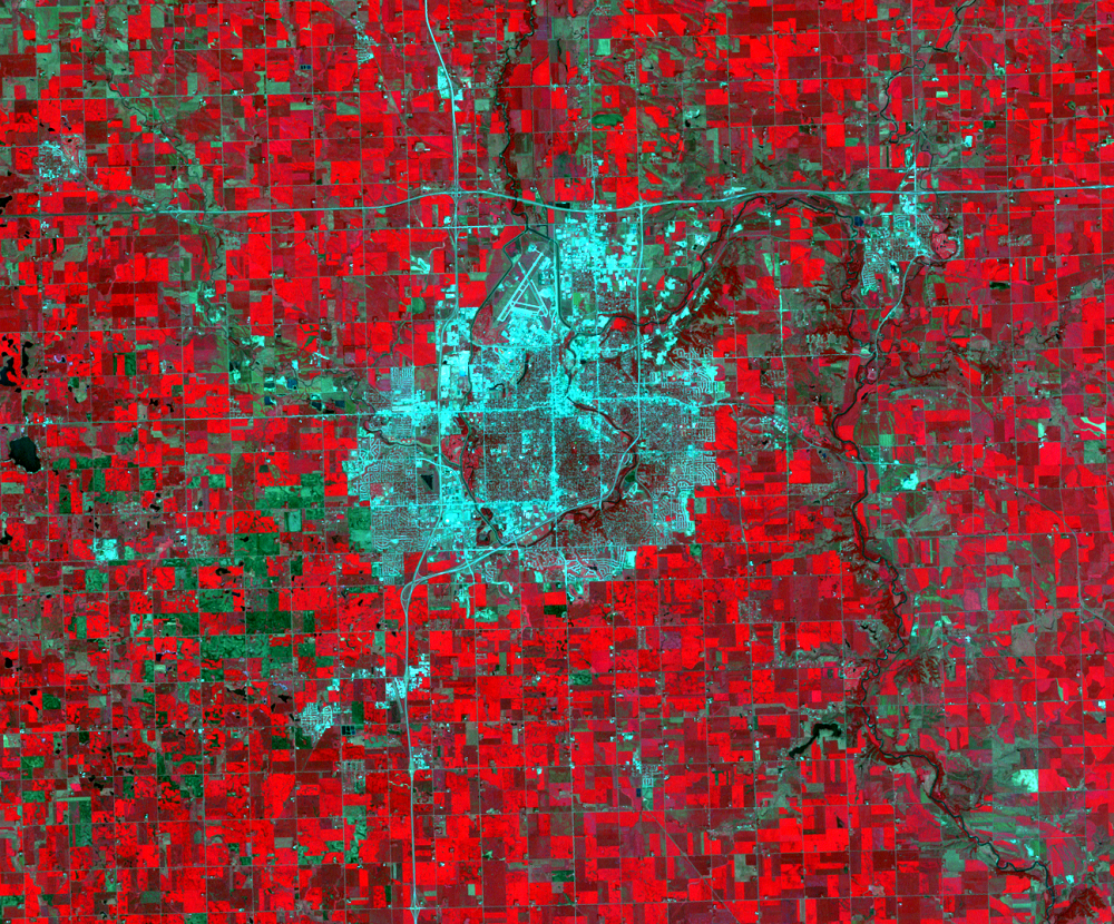
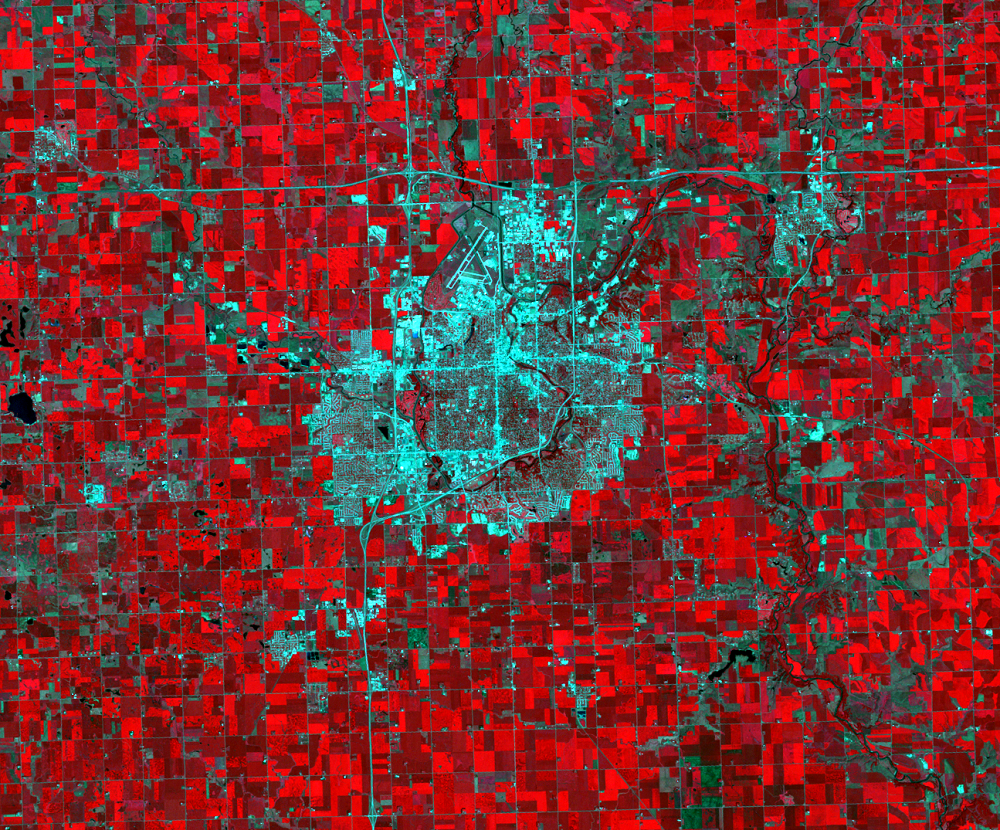
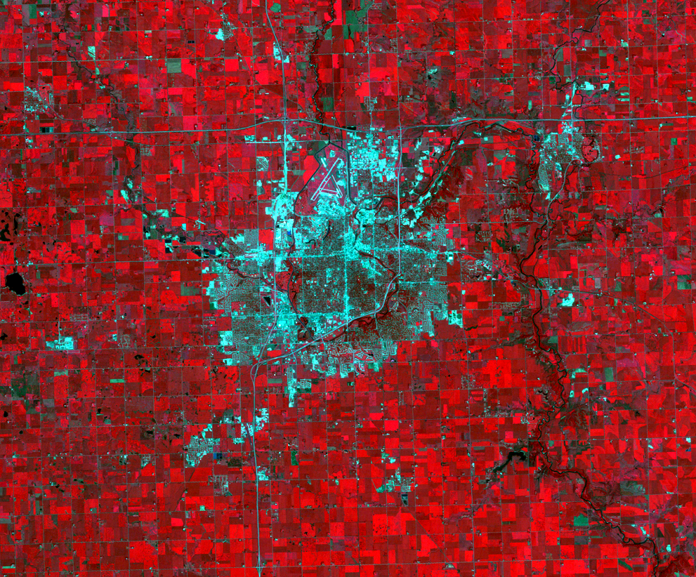
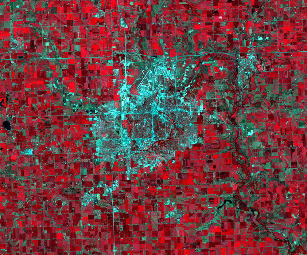
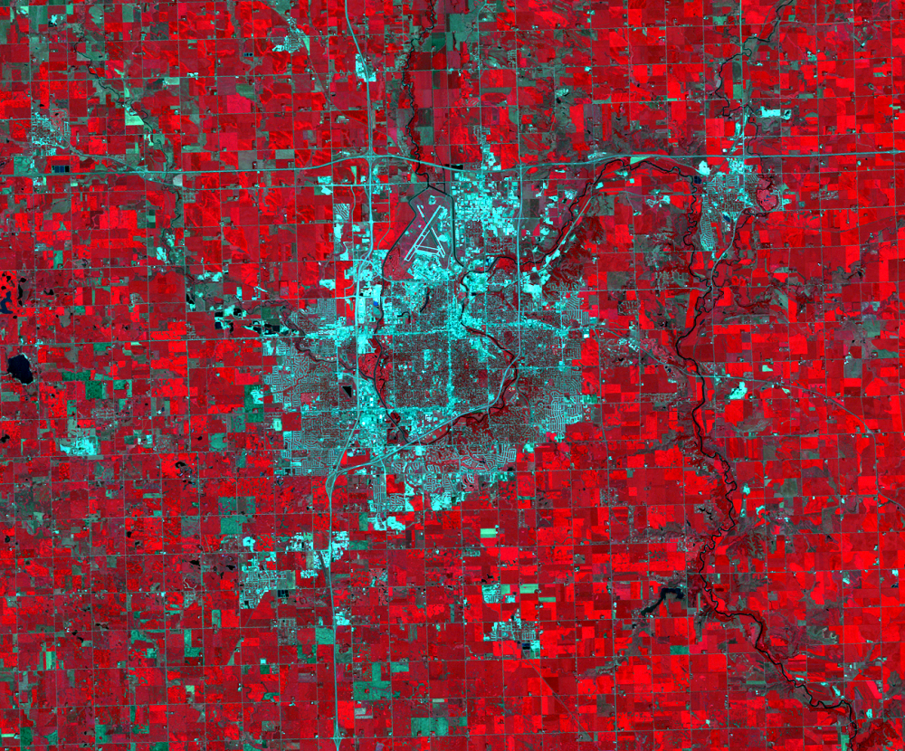
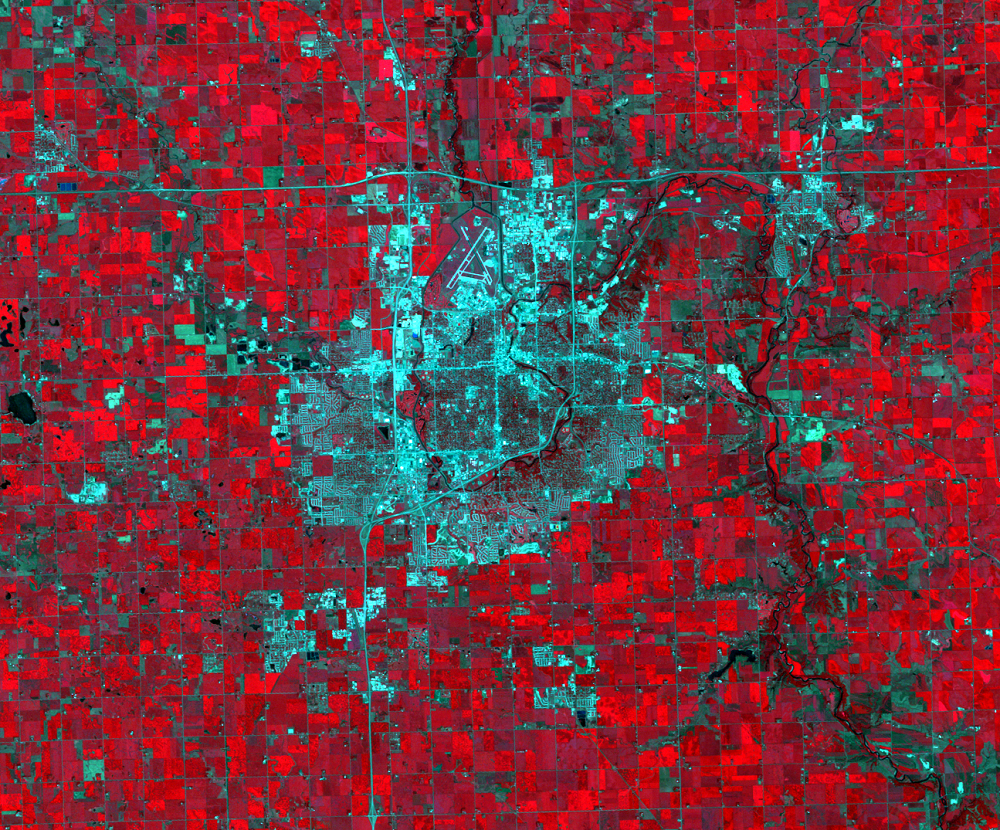
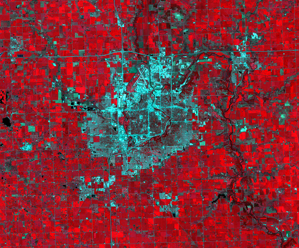
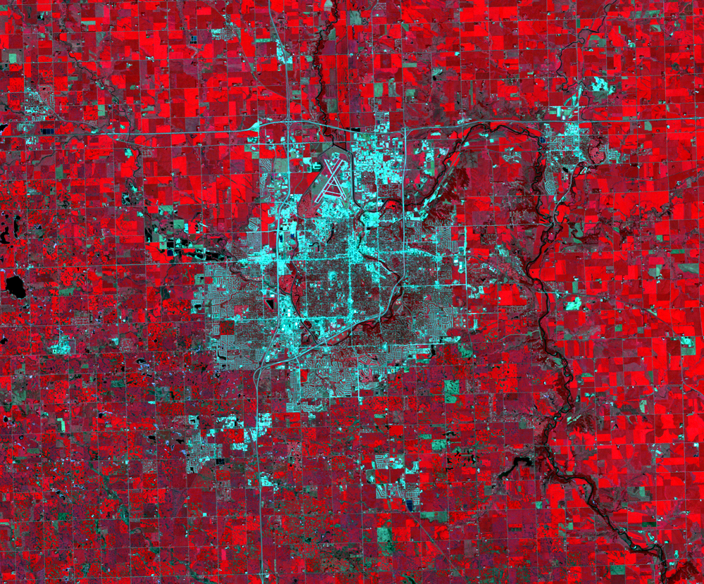
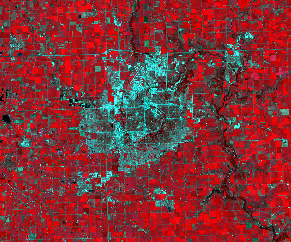
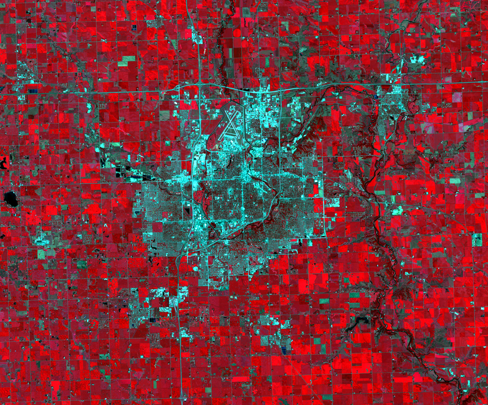
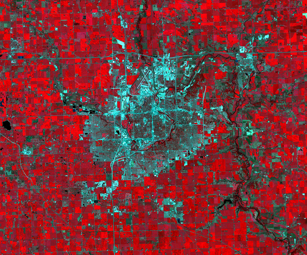
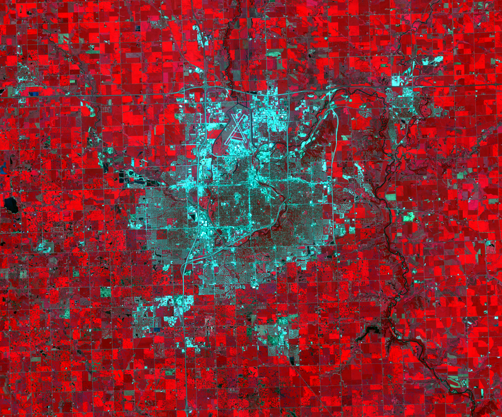
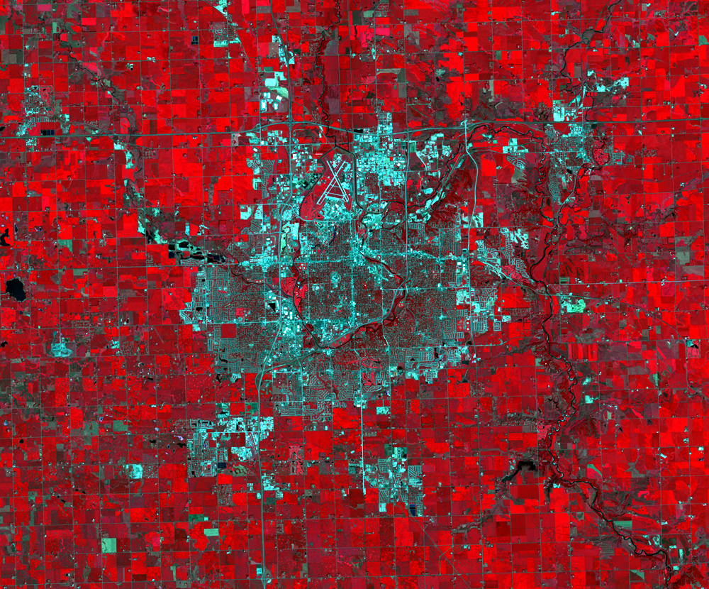
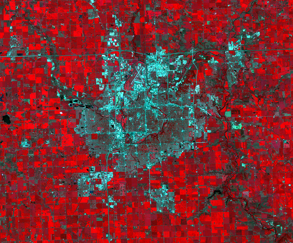
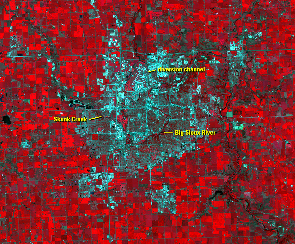
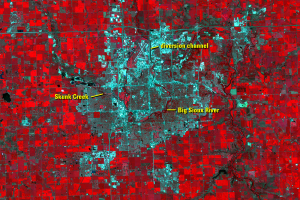
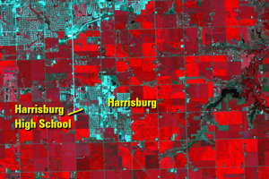
The Big Sioux River flows through Sioux Falls, with Skunk Creek joining on the west and a diversion channel for flood control on the north. New residential and retail areas expand most noticeably to the west, south, and east. After 2000, Sioux Falls urban growth expanded outward and developed suburbs. The Tea, Harrisburg, and Brandon communities grew rapidly in population during this time.
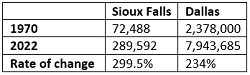
The U.S. Census Bureau estimates the 2022 population of the Sioux Falls metro area, which includes four counties, at 289,592. A quick comparison to the Dallas–Fort Worth, Texas, metro area, which is much larger, shows Sioux Falls’ population growing at a faster rate since 1970.
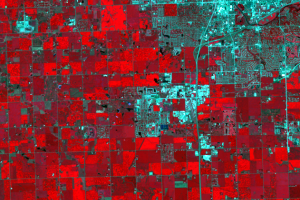
In these Landsat images, Landsat’s near-infrared imaging capability identifies growing vegetation in shades of red. Rural areas surrounding Sioux Falls are cropland, pastures, and small patches of forest by rivers and parks. Landsat’s near-infrared imaging makes the contrast between cropland and urban development more apparent.
What’s fueling the growth? In 1980, the State of South Dakota removed a cap on interest rates. That attracted credit card companies to Sioux Falls, the state’s largest city. During the 1980s, the city’s population expanded with the growth of the financial services industry. Later, the health care industry grew into a major pillar of the Sioux Falls economy.
Imagery
Downloads
Related Content
Sioux Falls, South Dakota, USA
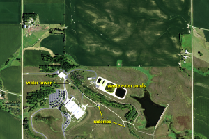
A half-section of land 10 miles north of Sioux Falls, South Dakota, su...
Sioux Falls
The Big Sioux River flows through Sioux Falls, with Skunk Creek joinin...
Development Patterns
The building of roads and streets is a visible sign of urban expansion...
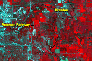
Eastward Expansion
On the east side of Sioux Falls, cropland continues to give way to dev...
Southern Expansion
Since we’re comparing rate of change in population growth since 1970, ...