

Bakken Oil Boom, North Dakota, USA
Earth Resources Observation and Science (EROS) Center - Earthshots
Even though oil is underground, Landsat images can reveal related land changes on the surface. The Bakken oil boom has made North Dakota the second leading oil producing state—behind only Texas. Evidence of this boom is apparent on the landscape.
The focus of this oil boom, which began around 2008, is on the Bakken formation of western North Dakota, northeastern Montana, and part of Canada. The Bakken formation constitutes one of the largest deposits of oil and natural gas in the United States. The Bakken is part of the larger Williston Basin, which, according to a 2013 USGS study, has 7.4 billion barrels of oil that is recoverable using today’s technology.
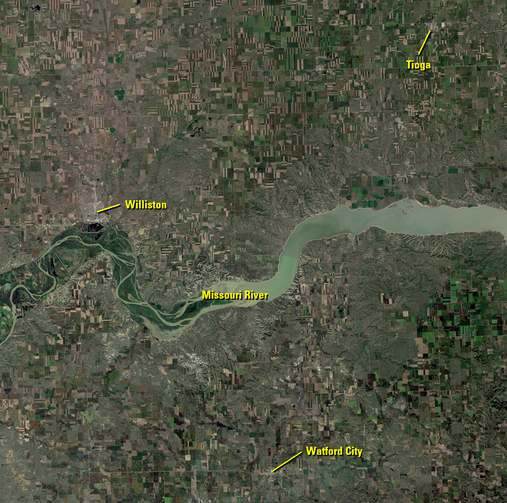
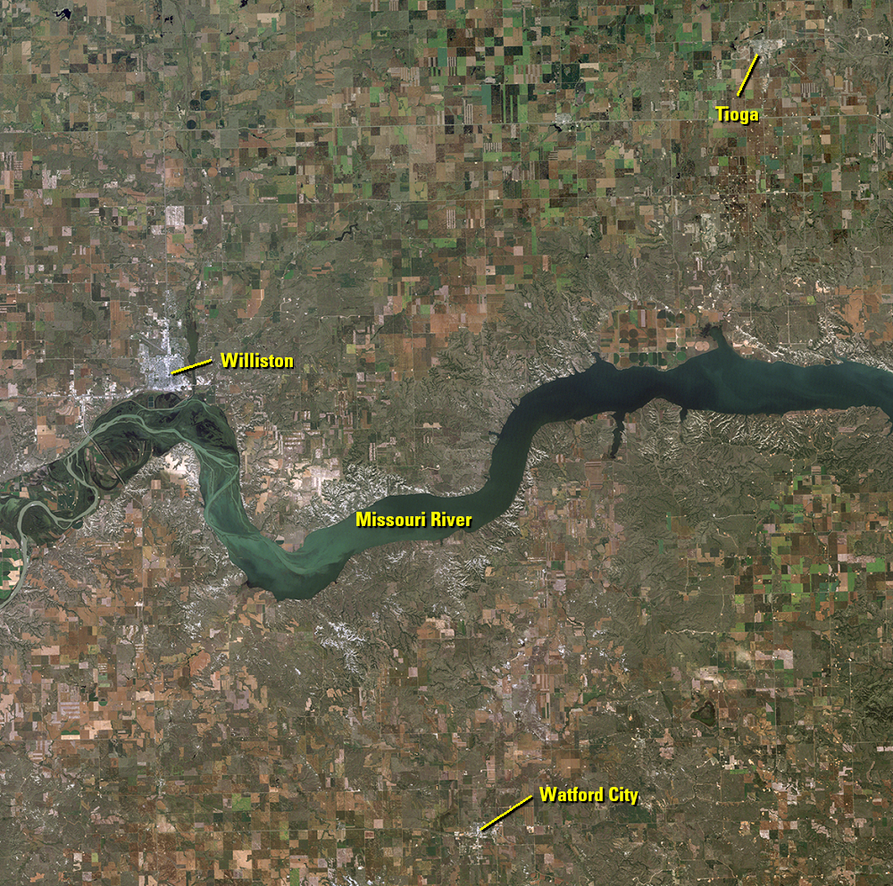
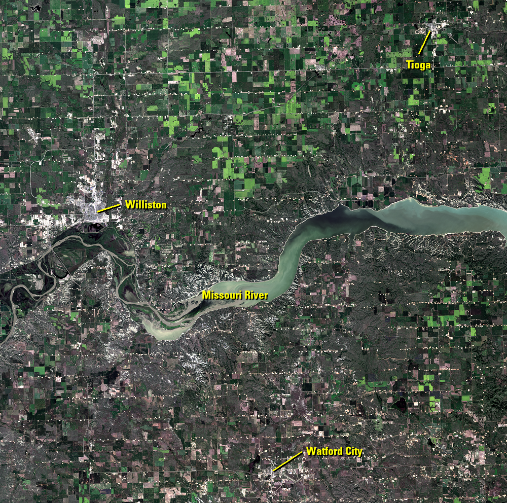
These Landsat images show the increasing number of oil platforms over just a few years, along with associated infrastructure changes. The overview images in this introductory section show the entire region that will be discussed in more detail in the following subsections.
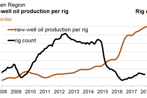
The North Dakota oil industry took off in the 1950s. When oil prices dropped in the 1980s, that boom ended. Oil prices recovered by 1990, but the current boom didn’t hit until the technology of hydraulic fracturing, or fracking, came along in the 2000s. By 2008, drilling in North Dakota surged like never before and oil production increased dramatically.
The oil and natural gas within the Bakken are locked in a rock formation. Fracking uses a mix of water, salt, chemicals, and sand to fracture the rock. The fractured rock allows the oil to flow to the well.
The price of oil crashed again in 2014, halting most of the drilling. But this was only after North Dakota’s oil industry reached the milestone of producing 1 million barrels per day. In mid-2017, oil prices recovered to around $50 a barrel, stabilizing the situation in North Dakota.
Imagery
Downloads
Allen, J. and Simmon, R., 2012, Gas Drilling, North Dakota: NASA Earth Observatory, accessed January 9, 2018, at https://earthobservatory.nasa.gov/NaturalHazards/view.php?id=79810.
Baumgarten, A., 2017, After the oil boom, how does North Dakota move on? WDAY, accessed January 9, 2018, at https://www.wday.com/news/government-and-politics/4331184-after-oil-boom-how-does-north-dakota-move.
City-data.com, 2018, Tioga, North Dakota: City-data.com, accessed August 10, 2022, at http://www.city-data.com/city/Tioga-North-Dakota.html.
City-data.com, 2018, Watford City, North Dakota: City-data.com, accessed August 10, 2022, at http://www.city-data.com/city/Watford-City-North-Dakota.html.
City-data.com, 2018, Williston, North Dakota: City-data.com, accessed August 10, 2022, at http://www.city-data.com/city/Williston-North-Dakota.html.
Dalrymple, A., 2012, Famous Bakken Formation Named For North Dakota Homesteaders: Oil Patch Dispatch, accessed January 9, 2018, at https://oilpatchdispatch.areavoices.com/2012/11/25/famous-bakken-formation-named-for-north-dakota-homesteaders/.
Gaswirth, S.B., Marra, K.R., Cook, T.A, Charpentier, R.R., Gautier, D.L., Higley, D.K., Klett, T.R., Lewan, M.D., Lillis, P.G., Schenk, C.J., Tennyson, M.E., and Whidden, K.J., 2013, Assessment of undiscovered oil resources in the Bakken and Three Forks Formations, Williston Basin Province, Montana, North Dakota, and South Dakota, 2013: U.S. Geological Survey Fact Sheet 2013–3013, 4 p., https://pubs.usgs.gov/fs/2013/3013/.
Geology.com, 2018, What is the Bakken Formation? Geology.com, accessed January 9, 2018, at http://geology.com/articles/bakken-formation.shtml.
Kennedy, M., 2016, New $50 million high school opens in Watford City, N.D.: American School & University, accessed January 9, 2018, at http://www.asumag.com/new-construction/new-50-million-high-school-opens-watford-city-nd.
North Dakota Studies, 2018, History of Oil Extraction: North Dakota Studies, State Historical Society of North Dakota, accessed January 9, 2018, at http://ndstudies.gov/gr8/content/unit-iv-modern-north-dakota-1921-present/lesson-1-changing-landscapes/topic-5-energy/section-3-oil.
Preston, T.M., and Kim, K., 2016, Land cover changes associated with recent energy development in the Williston Basin; Northern Great Plains, USA, Science of the Total Environment, v. 566–567, p. 1511–1518, https://doi.org/10.1016/j.scitotenv.2016.06.038.
Rapier, R., 2017, The Bakken Is Bustling Again: Forbes, accessed January 9, 2018, at https://www.forbes.com/sites/rrapier/2017/07/27/the-bakken-is-bustling-again/#7677a0af5d76.
Sisk, A., 2017, After OPEC Move, Oil Country Breathes A Sigh Of Relief: accessed January 9, 2018, at http://insideenergy.org/2017/05/29/after-opec-move-oil-country-breathes-a-sigh-of-relief/.
Sisk, A., 2017, The Bakken Gears Up For Its Second Decade: Inside Energy, accessed January 9, 2018, at http://insideenergy.org/2017/11/10/the-bakken-gears-up-for-its-second-decade/.
Sisk, A., 2017, Oil Patch Growth Creates A Funding Nightmare: accessed January 9, 2018, at http://insideenergy.org/2017/11/06/oil-patch-growth-creates-a-funding-nightmare/.
U.S. Census Bureau, [n.d.], U.S. Census Bureau website, accessed August 10, 2022, at https://www.census.gov.
U.S. Energy Information Administration, 2012, Pad drilling and rig mobility lead to more efficient drilling: Today in Energy, accessed January 9, 2018, at https://www.eia.gov/todayinenergy/detail.php?id=7910.
U.S. Energy Information Administration, 2018, Bakken Region—Drilling Productivity Report: U.S. Energy Information Administration, accessed January 19, 2018, at https://www.eia.gov/petroleum/drilling/pdf/bakken.pdf.
USGS, 2013, USGS Releases New Oil and Gas Assessment for Bakken and Three Forks Formations: USGS Science Features, accessed January 9, 2018, at https://www2.usgs.gov/blogs/features/usgs_top_story/usgs-releases-new-oil-and-gas-assessment-for-bakken-and-three-forks-formations/.
Williston Basin International Airport, 2017, Overview: accessed January 9, 2018, at http://www.xwaproject.com/overview/index.php.
Related Content
Land Change
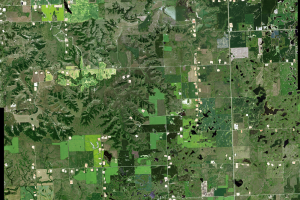
Thousands of well pads are scattered across northwestern North Dakota....
Pad Drilling
A new drilling technique called pad drilling reduces the overall footp...
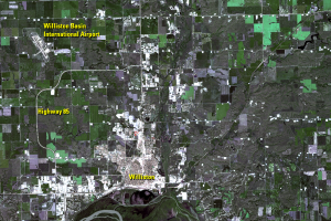
Williston
Located on the north side of a bend in the Missouri River, Williston i...
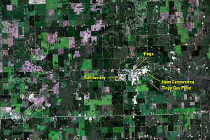
Tioga
Tioga is a small town in northwestern North Dakota that has also seen ...
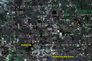
Watford City
Another growing community is Watford City, which built a new high scho...