

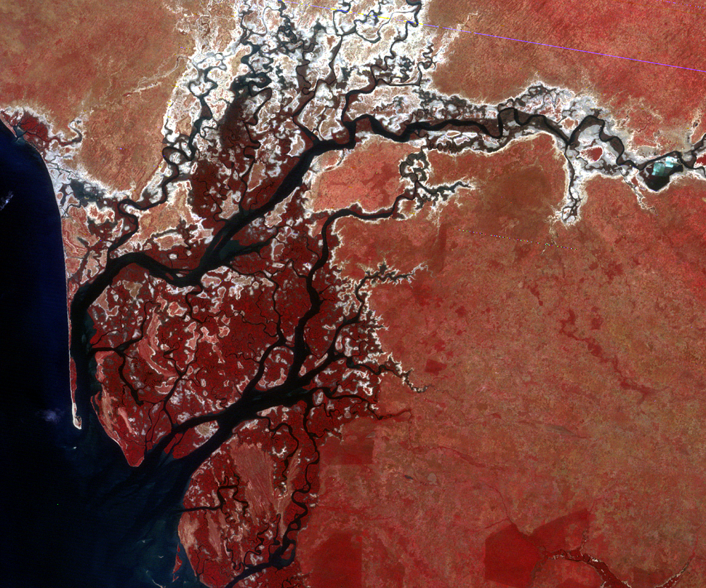
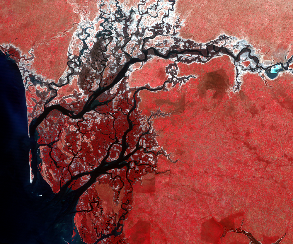
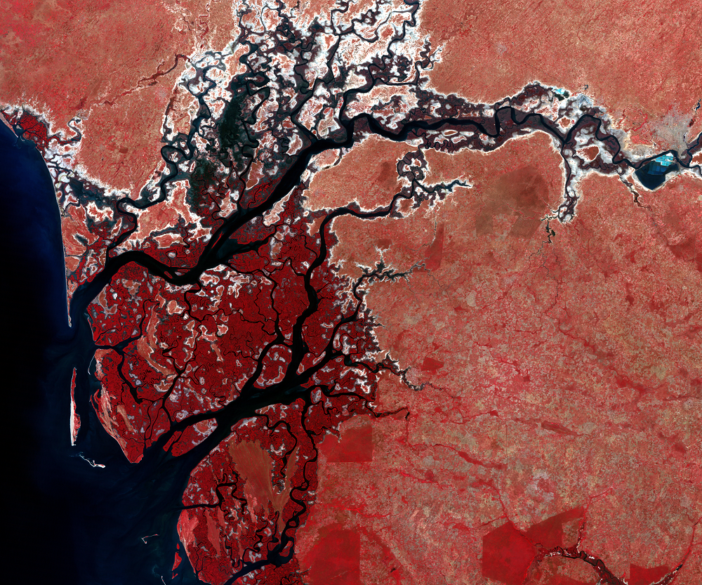
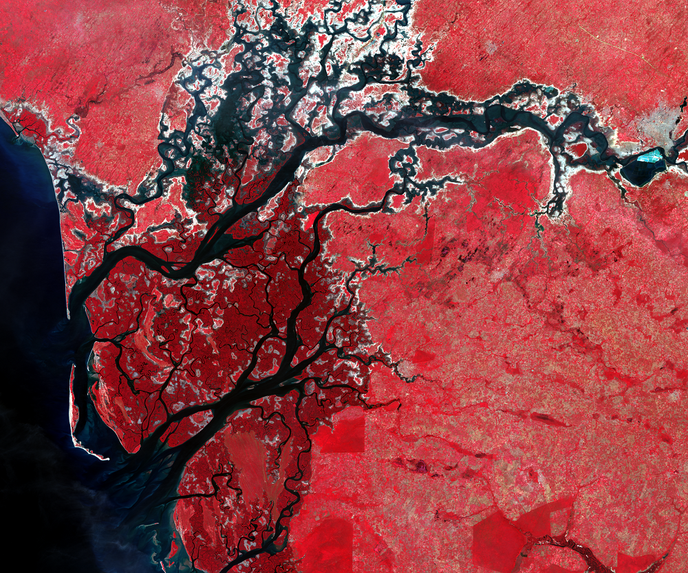
Saloum River, Senegal
Earth Resources Observation and Science (EROS) Center - Earthshots
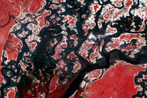
The estuaries of the Saloum River, near the coast in Senegal, are surrounded by mangrove forest. These images show the forests dying between, turning from dark red to gray. The likely cause is a persistent drought, which may have increased the estuary’s salinity beyond the mangroves’ tolerance. However, there are recent indications of mangrove gain in the region.
Imagery
Downloads
Andrieu, J., Lombard, F., Fall, A., Thior, M., Ba, B.D., and Dieme, B.E.A., 2020, Botanical field-study and remote sensing to describe mangrove resilience in the Saloum Delta (Senegal) after 30 years of degradation narrative: Forest Ecology and Management, https://doi.org/10.1016/j.foreco.2020.117963.
Remote Sensing Institute, 1986, Mapping and remote sensing of the resources of the Republic of Senegal—a study of the geology, hydrology, soils, vegetation and land use potential: Brookings, South Dakota, South Dakota State University, 655 p.
Thanks to Gray Tappan, USGS EROS, for photographs and written material.
Related Content
A Dying Forest
The coastal wetlands of Senegal are centered on the Saloum River and a...