

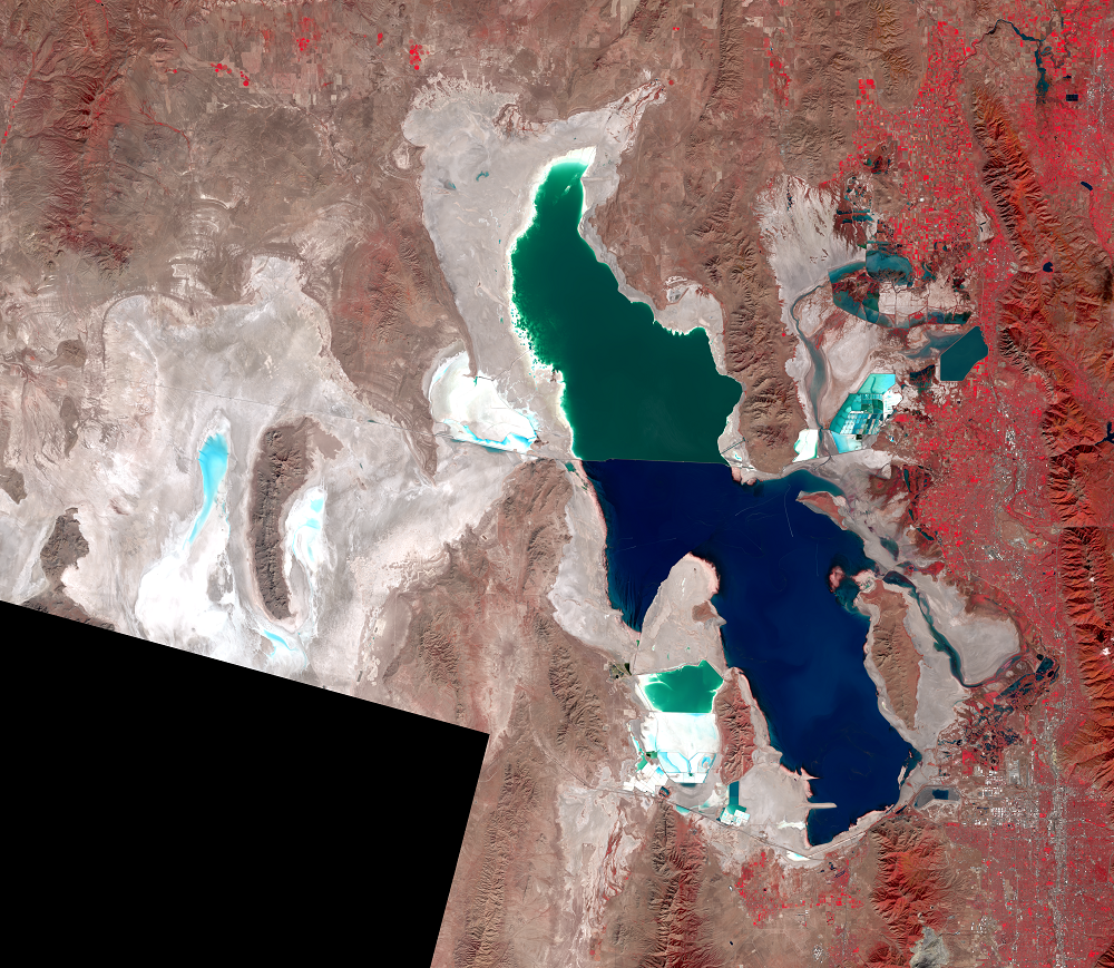
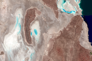
Great Salt Lake, Utah, USA
Earth Resources Observation and Science (EROS) Center - Earthshots
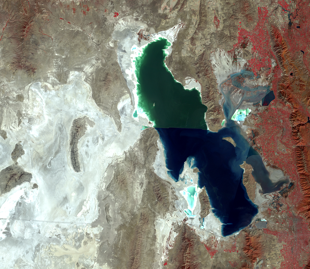
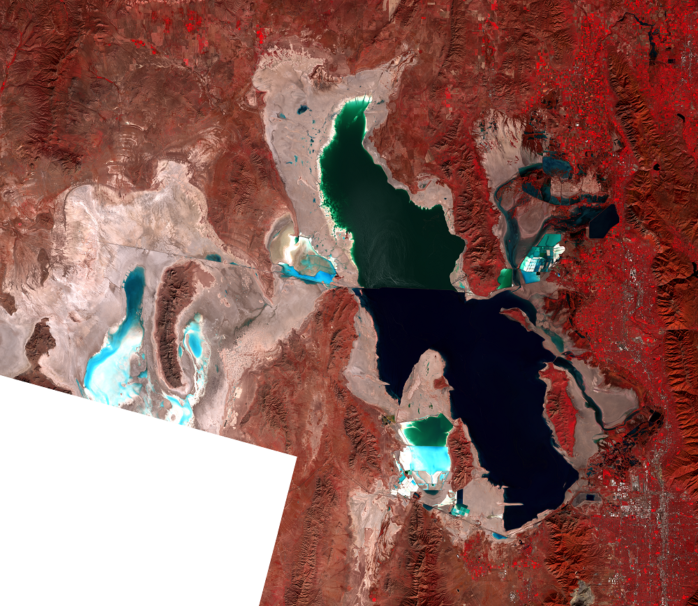
These images show the dramatic effects of the Great Salt Lake's high water levels in the 1980s. These effects included a great increase in the lake’s area, the opening of the causeway crossing the lake, and the creation of a new evaporation basin west of the lake.
The Great Salt Lake is a terminal lake, with no outlet rivers running to the ocean. Since water leaves the lake only through evaporation, it leaves behind its dissolved minerals, making the lake up to 8 times as salty as seawater.
The lack of outlets also means the lake responds dramatically to change in inflow. Rainy weather beginning in 1982 brought the highest levels in recorded history, peaking in June 1986 and March–April 1987. The lake is shallow for its size—about 70 miles long and 30 miles wide, but only about 40 feet deep. Because the lake basin is so shallowly sloped, extra inflow to the lake makes it rise only slowly, but any rise means a large increase in area. Highways, causeways, and parts of Salt Lake City were flooded or threatened in the 1980s, costing millions of dollars.
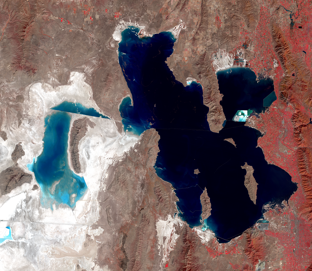
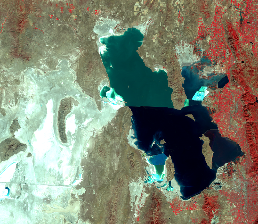
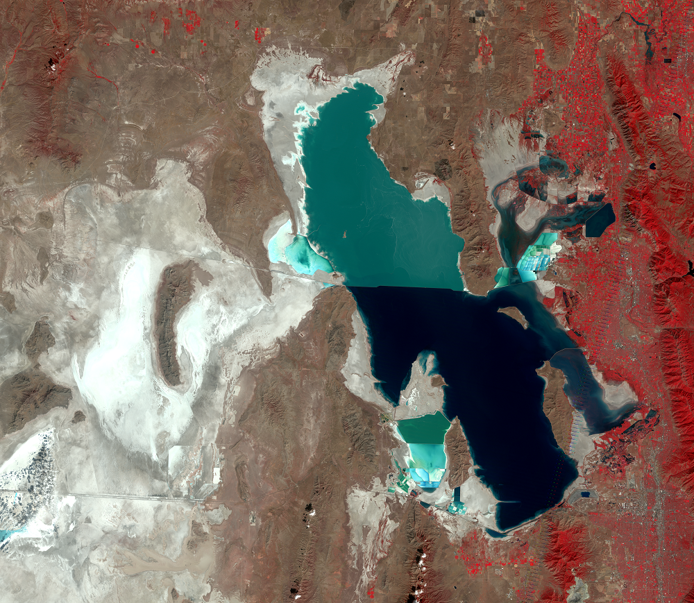
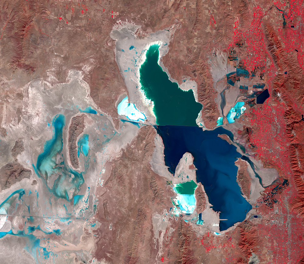
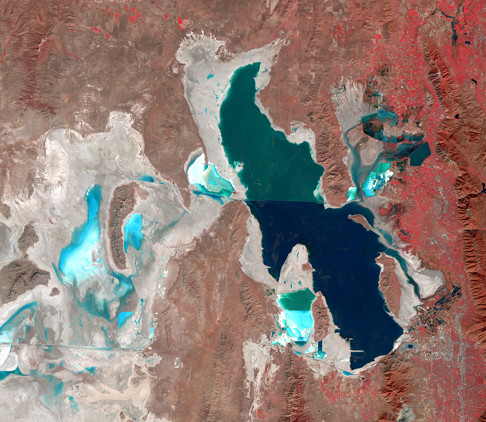
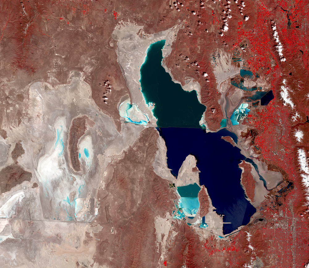
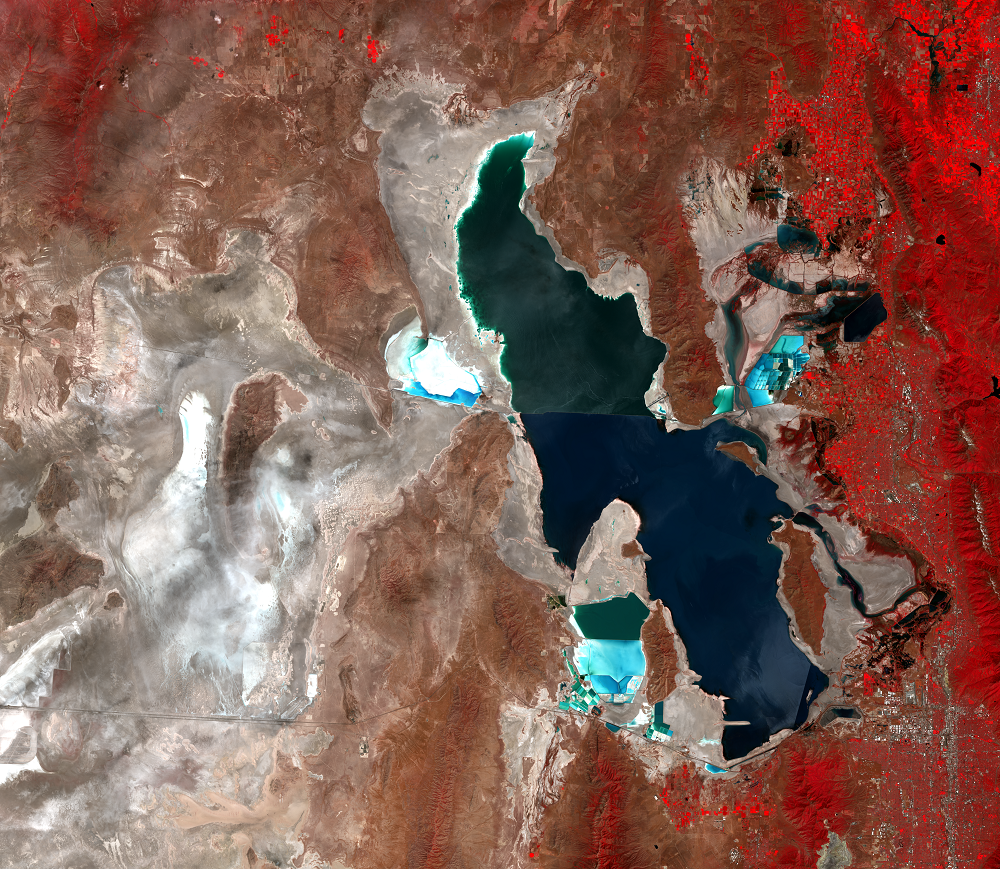
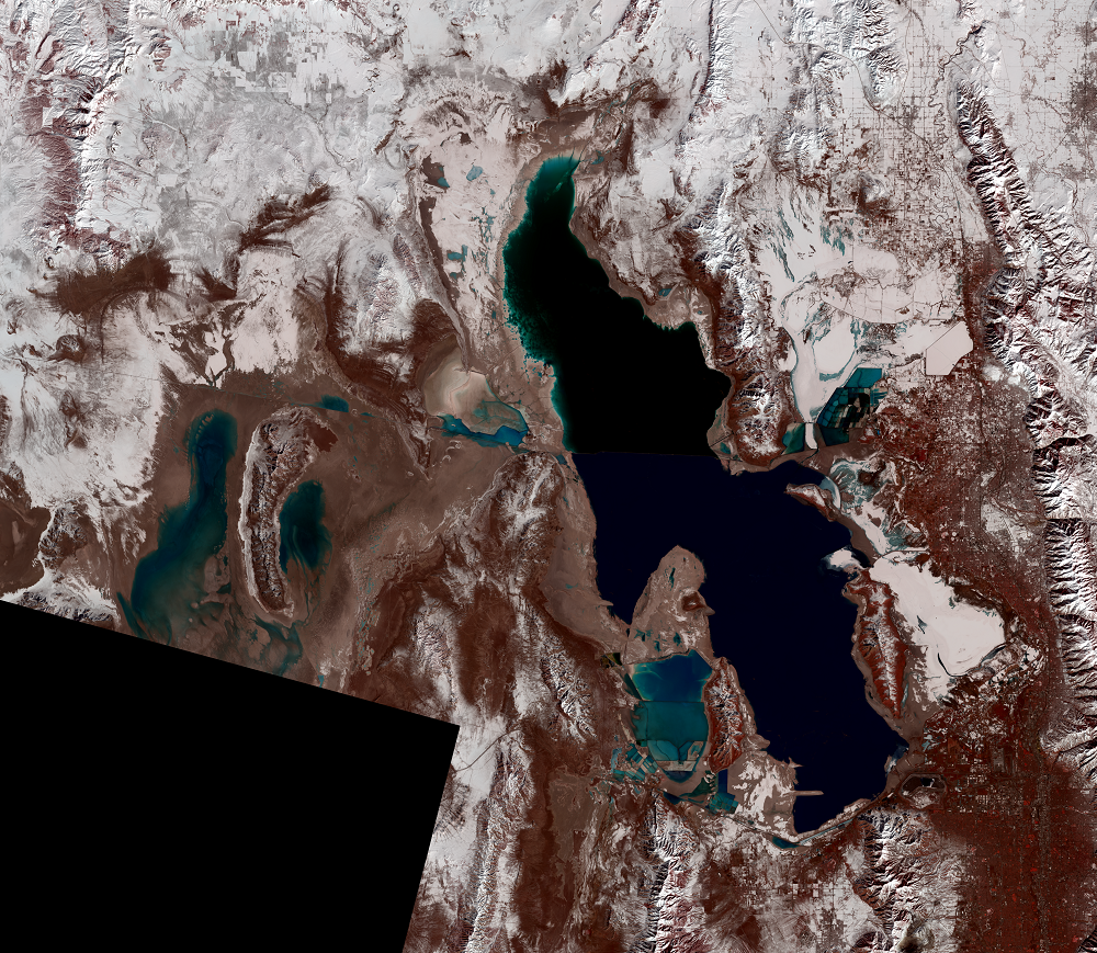
Long-term drought and water use led to Great Salt Lake reaching its lowest level on record in November 2022. This low level of the lake can increase dust pollution and reduce mineral extraction, shrimp production, waterfowl habitat, and recreational opportunities.
Landsat imagery shows the lake shrinking from June 2022 to October 2022, then slightly expanding in 2023.
Landsat has been monitoring the lake for over 50 years, and will keep tracking the water level changes.
Imagery
Downloads
Arnow, T., and Stephens, D., 1990, Hydrologic characteristics of the Great Salt Lake, Utah, 1847–1986: U.S. Geological Survey Water Supply Paper, 32 p.
Carlowicz, M., 2016, Salt Lake Water Woes: NASA Earth Observatory, accessed on November 3, 2016, at http://earthobservatory.nasa.gov/IOTD/view.php?id=88929.
Gore, R., and Richardson, J., 1985, No way to run a desert: National Geographic, v. 167, no. 6, p. 694–719.
Hassibe, W.R., and Keck, W.G., 1991, The Great Salt Lake: Washington, U.S. Geological Survey, 24 p.
NASA Earth Observatory, 2007, Algae in Great Salt Lake: NASA, available online at http://earthobservatory.nasa.gov/IOTD/view.php?id=7857. (Accessed May 14, 2012.)
Utah Water Science Center, 2010, Great Salt Lake, Utah: U.S. Geological Survey, available online at http://ut.water.usgs.gov/greatsaltlake/. (Accessed May 14, 2012.)
Wallace, J.W., 2011, A lake divided—A history of the Southern Pacific Railroad Causeway and its effects on Great Salt Lake, Utah: Utah Geological Society, available online at http://geology.utah.gov/utahgeo/gsl/lakedivided.htm. (Accessed May 14, 2012.)
Ware, L., 1984, The Great Salt Lake gets greater every day: Audubon, National Audubon Society, New York, v. 86, no. 5, p. 118–131.
Wold, S.R., and Waddell, K.M., 1994, Salt budget for West Pond, Utah, April 1987 to June 1989: U.S. Geological Survey Water Resources Investigations Report 93-4028, 20 p.
Wurtsbaugh, W., Miller, C., Null, S., Hahnenberger, M., and Howe, F., 2016, Impacts of Water Development on Great Salt Lake and the Wasatch Front: Utah State University, 9p. Available online at https://works.bepress.com/wayne_wurtsbaugh/171/.
Related Content
The Causeway
One of the first flood-control measures involved the railroad causeway...
The Evaporation Basin
In June 1986, the State of Utah began construction of a system to pump...