

Lake Levels Rise
Earth Resources Observation and Science (EROS) Center - Earthshots
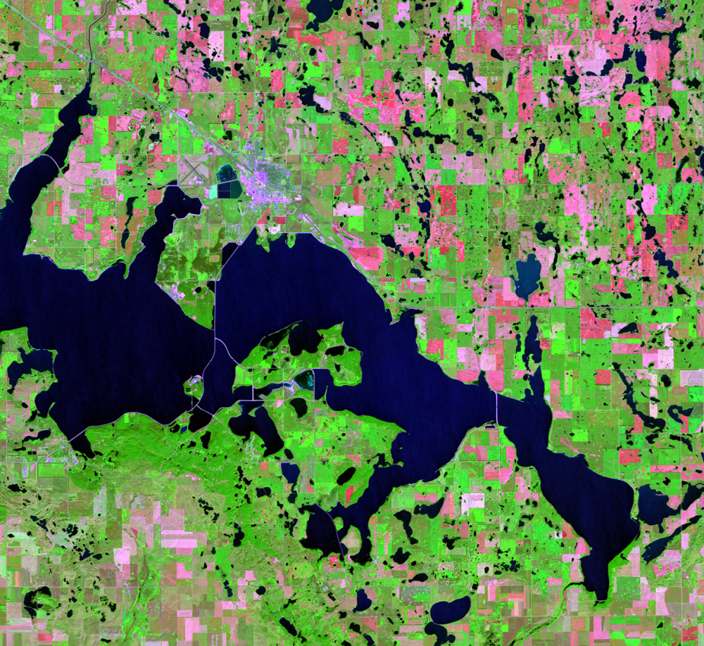
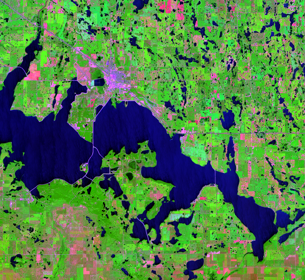
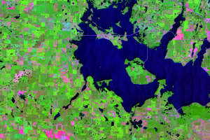
A general trend of above average precipitation in the region has caused Devils Lake to rise rapidly over the last few decades. If the lake reaches 1,458 feet (444.4 meters) above mean sea level, it will naturally overflow into the Sheyenne River, a tributary of the Red River. The North Dakota Geological Survey has determined that the lake has probably overflowed into the Sheyenne River only twice in the last 4,000 years.
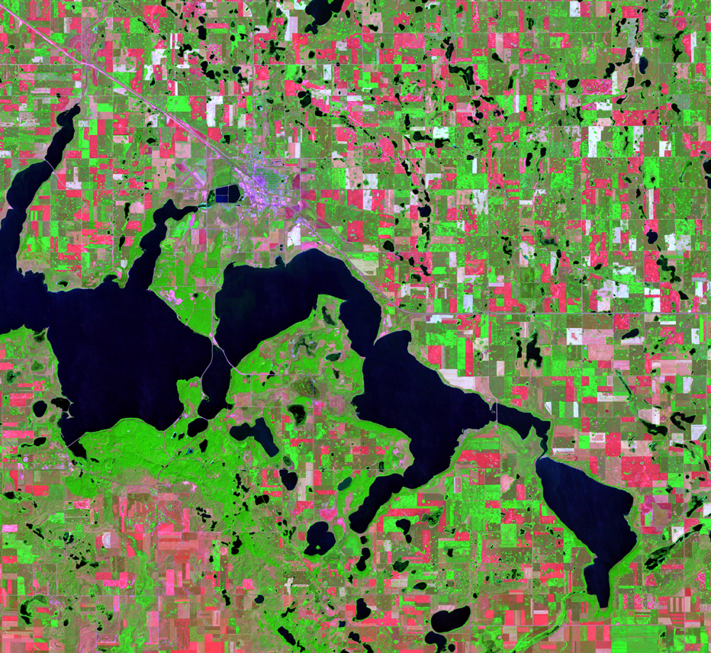
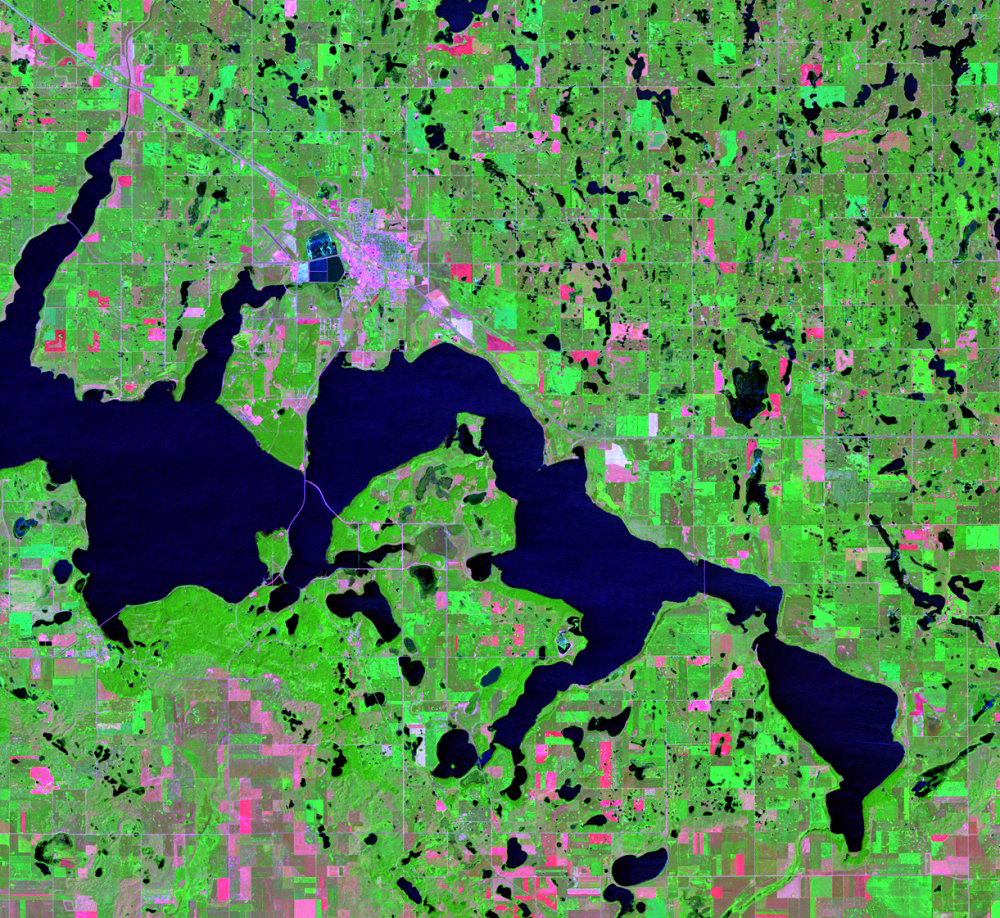
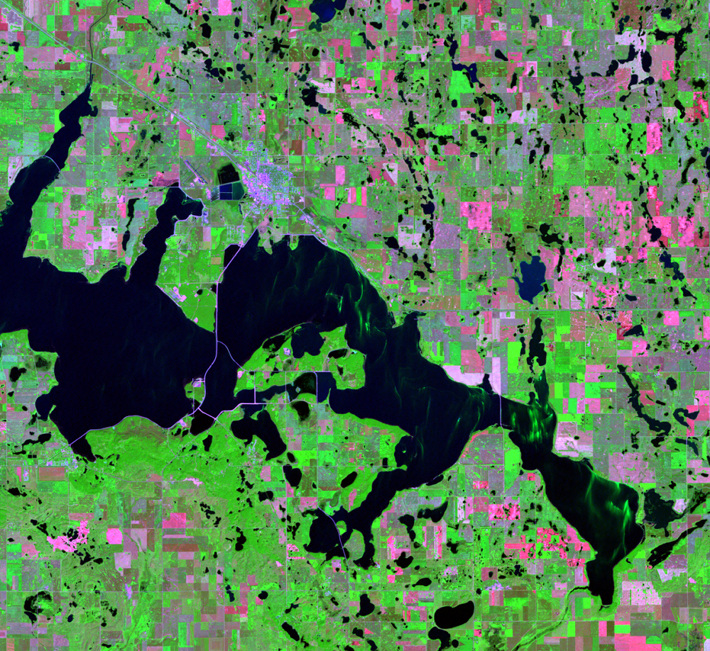
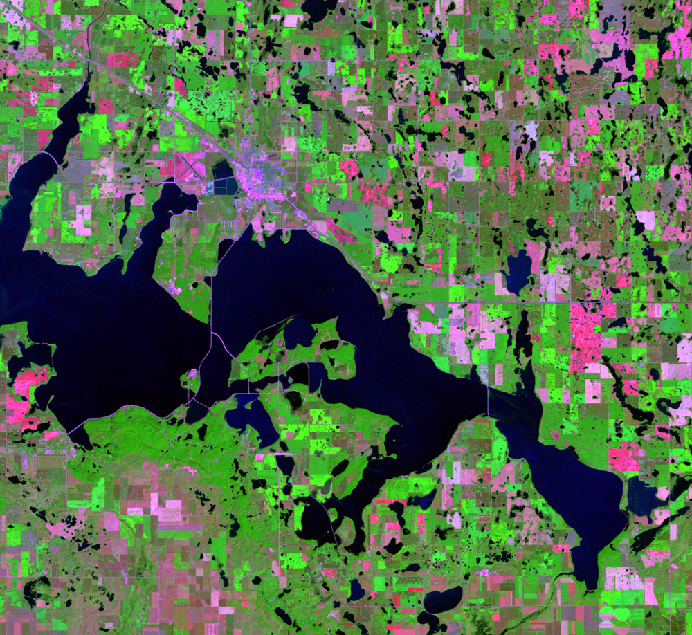
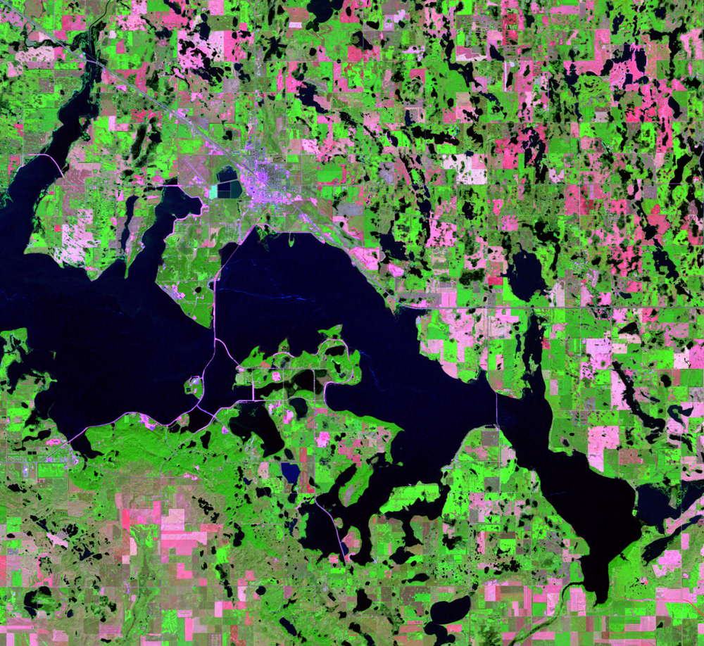
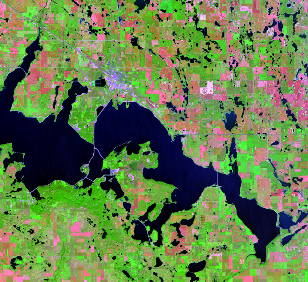
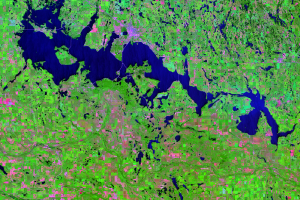
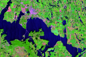
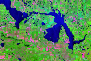
These Landsat images clearly show the lake’s dramatic change. In 1993, the lake water level was 1,422.6 feet (433.6 meters) above mean sea level. The lake reached an all-time high of 1,454.4 feet (443.3 meters) above mean sea level in June 2011. In 1993, the lake covered about 44,000 acres (17,800 hectares)—it has expanded to over 211,000 acres (85,400 hectares).
Even though it is still a few feet from its overflow level, the lake’s rapid rise is a great concern for residents of the region. If the lake does reach its overflow level, natural flooding could cause considerable damage downstream. The loss of farmland caused by the rising water has already been devastating to local farmers.
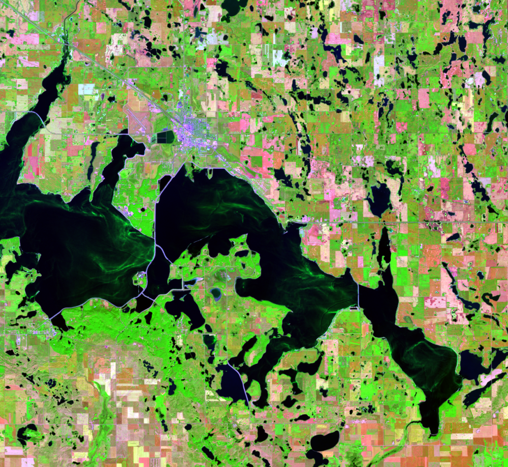
Another concern is algae blooms. The 2018 images show blue-green algae discoloring the water. In a severe algae bloom, the water can resemble spilled green paint or green pea soup.
Imagery
Downloads
Related Content
Devils Lake, North Dakota, USA
Devils Lake in northeastern North Dakota is a closed basin lake. Locat...
Lake Levels Rise
A general trend of above average precipitation in the region has cause...
Stump Lake
East of Devils Lake is Stump Lake. It becomes part of Devils Lake at a...
West Devils Lake
One flood mitigation plan might be to encourage excess water from Devi...