

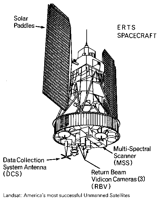
Landsat’s Return Beam Vidicon
Earth Resources Observation and Science (EROS) Center - Earthshots
A sensor on the early Landsats had a name worthy of some Star Trek gadget. Originally Landsat’s primary sensor, the Return Beam Vidicon (RBV) flew on the first three Landsats.
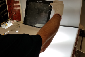
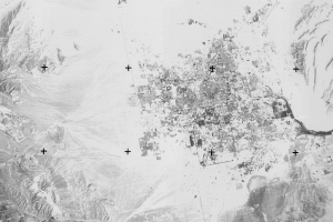
A sample RBV image shows the northwestern coast of Madagascar. The black-and-white image from 1981 has higher resolution than the Multispectral Scanner (MSS) on board the early Landsats. So what happened to these RBV images, and are they useful today?
What’s a Vidicon?
A vidicon is a television camera tube that formed an image by focusing light onto a photoconductive faceplate. An electron beam scanned the faceplate, detecting light intensity for each scan line. The beam then bounced back by an electrically charged area. The resulting picture was made up of about 5,000 separate scan lines (compared to 525 for a traditional television picture).
Imagery

Downloads
eoPortal, 2018, Landsat-1 to 3: eoPortal, accessed November 2, 2018, at https://directory.eoportal.org/web/eoportal/satellite-missions/l/landsat-1-3.
EROS Data Center, and Clark, B.P., 1981, Landsat 3 Return Beam Vidicon Response Artifacts—A Report on RBV Photographic Product Characteristics and Quality Coding System: USGS Open-File Report 82-803, accessed November 2, 2018, at https://pubs.er.usgs.gov/publication/ofr82803.
Ferrigno, J.G., Williams Jr., R.S., and Kent, T.M., 1983, Evaluation of Landsat 3 RBV Images for Earth Science Studies in Antarctica, in Oliver, R.L., James, P.R., and Jago, J.B. (Eds.), Antarctic Earth Science: Cambridge, Cambridge University Press, p. 446–449.
Freden, S.C., and Gordon Jr., F., 1983, Landsat Satellites, in Colwell, R.N. (Ed.), Manual of Remote Sensing, 2nd Ed. Vol. 1, “Theory, Instruments and Techniques”: Falls Church, Va., American Society of Photogrammetry, p. 517–570.
Goward, S.N., Williams, D.L., Arvidson, T., Rocchio, L.E.P., Irons, J.R., Russell, C.A., and Johnston, S.S., 2017, Landsat’s Enduring Legacy—Pioneering Global Land Observations from Space: Bethesda, MD, American Society for Photogrammetry and Remote Sensing, 586p.
Kurter, A., 1988, Glaciers of the Middle East and Africa—Glaciers of Turkey: USGS Professional Paper 1386-G-1, 30p, accessed November 2, 2018, at https://pubs.usgs.gov/pp/p1386g/.
Mack, P.E., 1990, Viewing the Earth—The Social Construction of the Landsat Satellite System: Cambridge, MA, The MIT Press, 284p.
NASA, 1999, Using Satellites to Measure Glaciers: NASA Earth Observatory, accessed November 2, 2018, at https://earthobservatory.nasa.gov/Features/Glaciers/glaciers_4.php.
USGS, 2018, Landsat Missions Timeline: USGS Landsat Missions, accessed April 22, 2019, at https://www.usgs.gov/media/images/landsat-missions-timeline.
USGS, 2018, The Progress of Landsat Sensor Technology: USGS Image of the Week, accessed November 2, 2018, at https://eros.usgs.gov/image-of-the-week/progress-landsat-sensor-technology.
USGS, 2015, Return Beam Vidicon (RBV) Film Only: USGS Long Term Archive, accessed November 2, 2018, at https://lta.cr.usgs.gov/rbv.html.
Yavasli, D.D. and Tucker, C.J., 2012, Small Glacier Area Studies—A New Approach for Turkey: International Glaciological Society's Nordic Conference, 24–27 Oct. 2012, Stockholm, Sweden, 11p., accessed October 26, 2018, at https://ntrs.nasa.gov/search.jsp?R=20120015895.
Personal comm.: John Dwyer, Chief, Science and Applications Branch, USGS EROS; John Faundeen, Archivist and Chief, Office of Communications & Outreach, USGS EROS; Chris Crawford, USGS EROS
Related Content
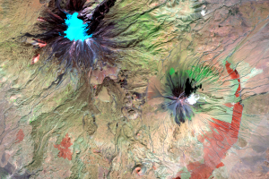
Alaska
One of the factors that improves on Landsat sensors over the project’s...
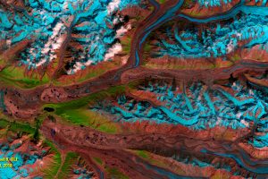
Mt. Ararat
Despite its problems, RBV data has been used in land change studies. R...
RBV Data
Roughly 138,000 images were taken by the RBV on Landsat 3. The data we...
RBV's Beginnings
Landsat’s RBV had an inauspicious beginning. It rode into orbit on Lan...
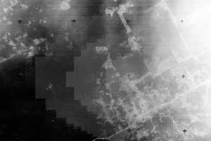
RBV's Problems
Because of RBV’s higher spatial resolution than MSS, glaciologists wer...