

Mount Rushmore
Earth Resources Observation and Science (EROS) Center - Earthshots
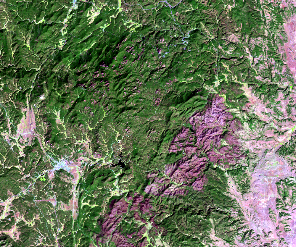
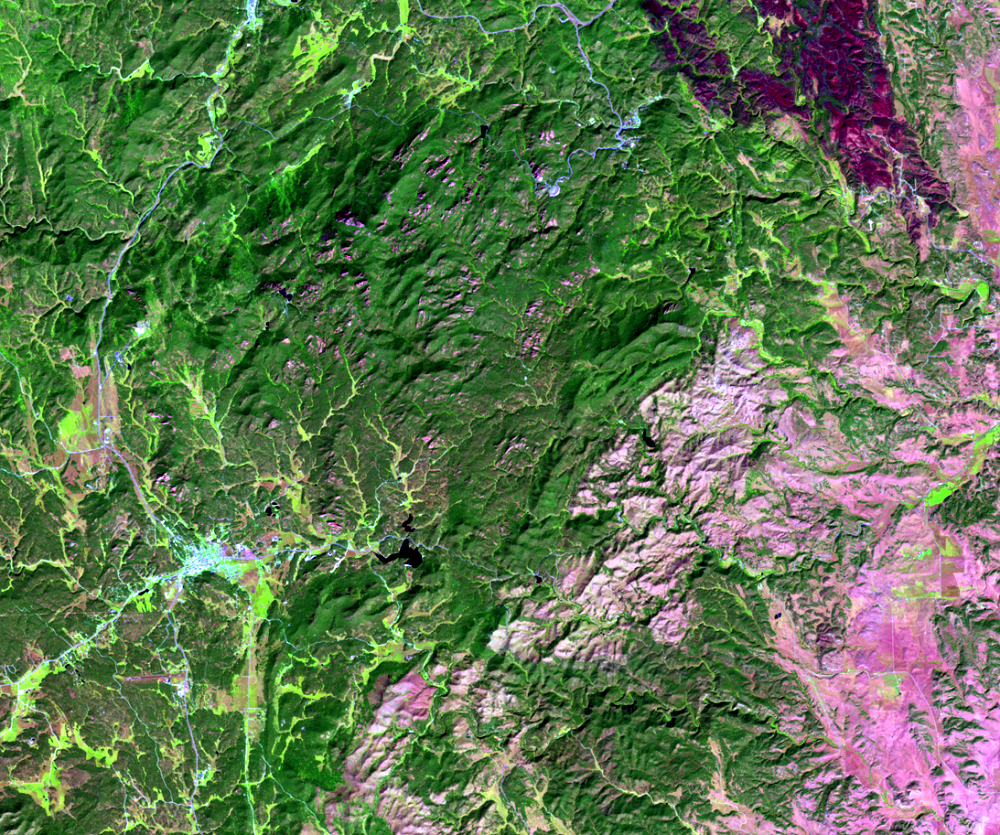
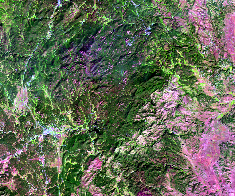
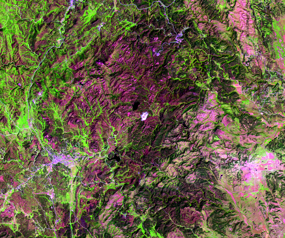
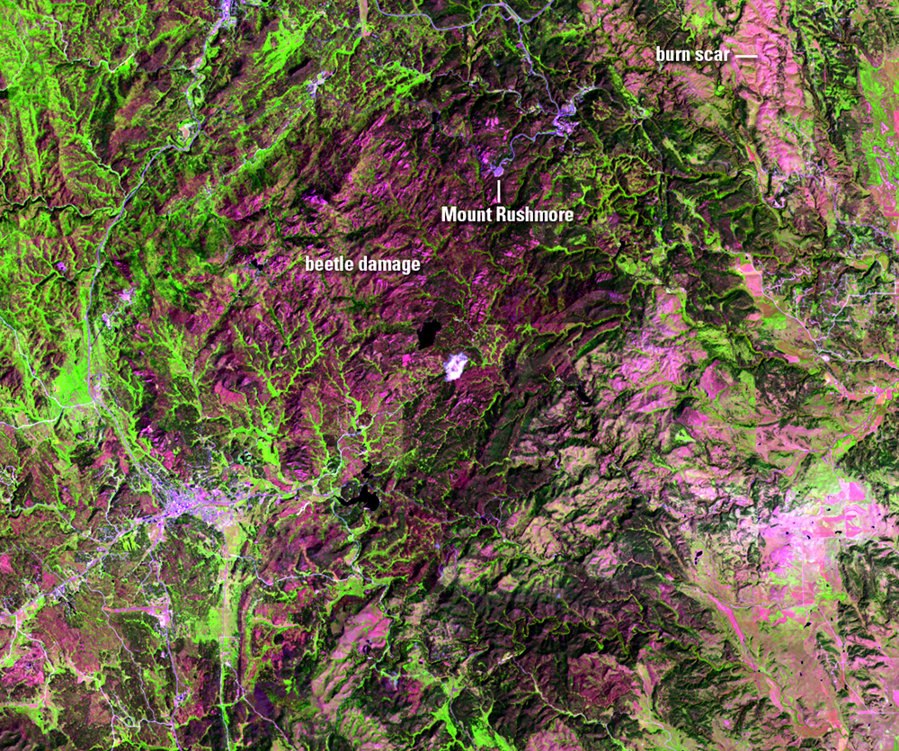
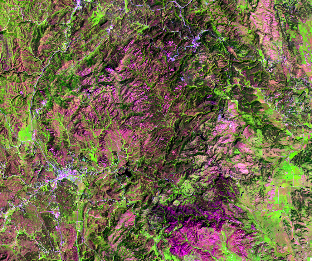
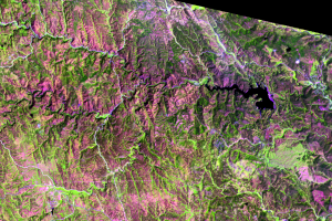
Another set of close-up images shows the area around Mount Rushmore National Memorial. The same pattern is apparent here—a decrease in green forest cover surrounding this popular tourist attraction.
Landsat is well suited to studying tree mortality over large areas. The Landsat record covers a long time period. Its infrared wavelengths help make forest disturbance events easier to detect. In most regions of the United States, Landsat provides several clear images per year, which can be useful for tracking the spread of the infestation. Best of all, Landsat data is freely available.
Monitoring a large-scale epidemic like this one is aided by the comprehensive coverage of Landsat imagery. Because field plots are expensive to implement over large areas, Landsat provides forest managers an affordable way to pinpoint where to break up stands of infested trees to try to minimize the spread and reduce fire risk.
The dense historical record that Landsat provides is also important because in some areas, other disturbances such as fire can obscure evidence of past disturbances. For example, the upper right of the 2002 image shows a maroon burn scar from a recent wildfire. Landsat enables scientists to better study the historical interaction between pine beetles and other types of disturbances which occur in complex landscapes.
Imagery
Downloads
Related Content
Black Hills, SD, USA
We can’t see bugs from space, but we can see the effects of insect inf...
Mount Rushmore
Another set of close-up images shows the area around Mount Rushmo...
The Beetles Attack
Mountain pine beetles, which are native to the pine forests of western...