

Pit Lakes
Earth Resources Observation and Science (EROS) Center - Earthshots
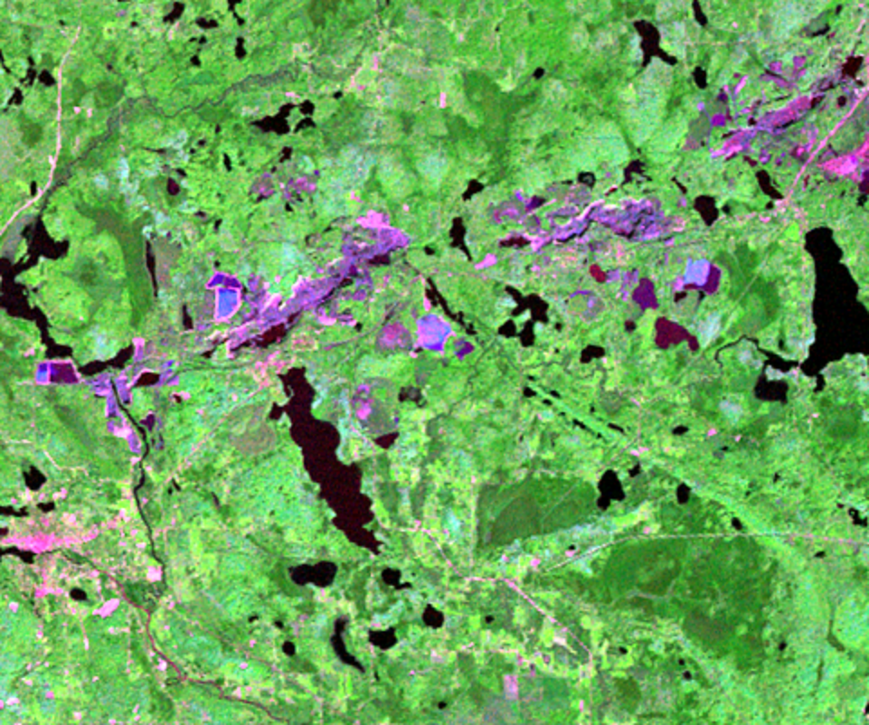
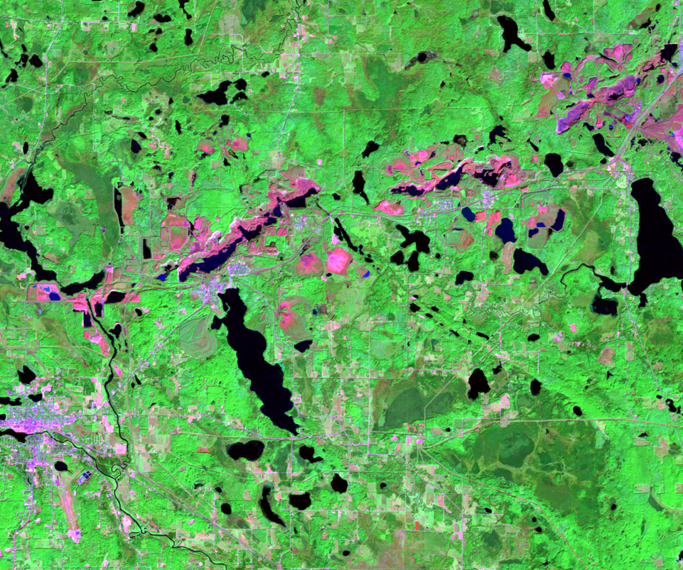
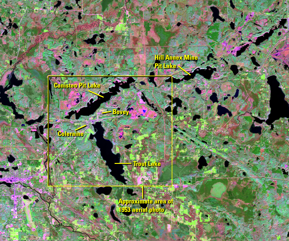
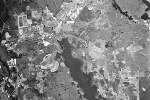
At the western end of the Mesabi Range is another consequence of the mining industry. Once mining operations halted in some parts of the Range, the deep open pits that were created were left to fill with rainwater and groundwater inflow. One of these lakes is the Canisteo pit lake.
At about 4.8 miles long and 0.5 mile wide, it’s about the same size as Trout Lake to the south, a natural lake. The Canisteo pit is actually a complex of 19 inactive mine pits. The lake is now an average of 100 feet deep, with its deepest point a remarkable 300 feet. (For comparison, the deepest point in Mille Lacs Lake, Minnesota’s second largest lake, is about 40 feet.)
The filling of this pit lake concerns residents of the adjacent small towns. Without some kind of intervention, these towns could eventually flood. The current temporary solution is a drain tile system to carry groundwater leaving the pit toward Trout Lake.
The Hill Annex Mine pit lake is also in this scene, just east of Canisteo pit lake. This lake is also very deep. Hill Annex Mine State Park is located on the lake’s shores.
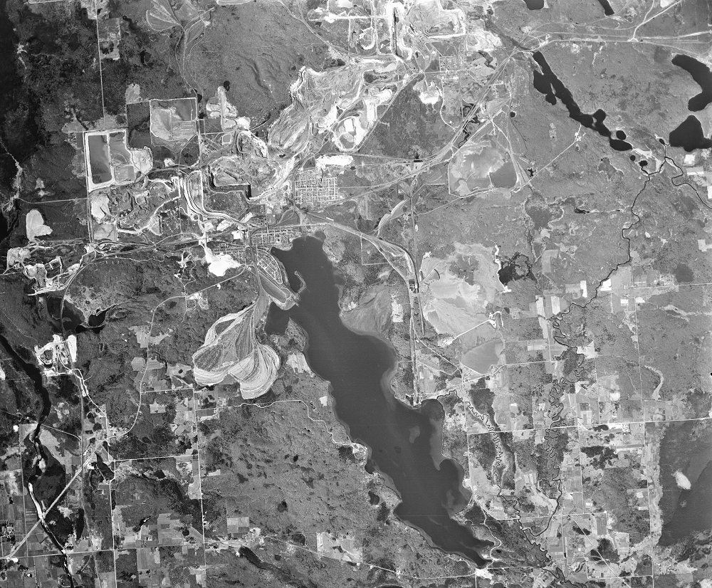
The USGS aerial image shows the open pit mines that are now Canisteo pit lake. The towns of Coleraine and Bovey sit between these mines and Trout Lake.
Imagery
Downloads
Related Content
Mesabi Range, Minnesota, USA
The boom times of iron ore mining in northern Minnesota are long gone,...
Grand Canyons
Other mines also continue to expand, even in the Landsat era. The Hull...
Pit Lakes
At the western end of the Mesabi Range is another consequence of the m...
Taconite
The mines on the Mesabi Range historically extracted hematite, a rusty...