

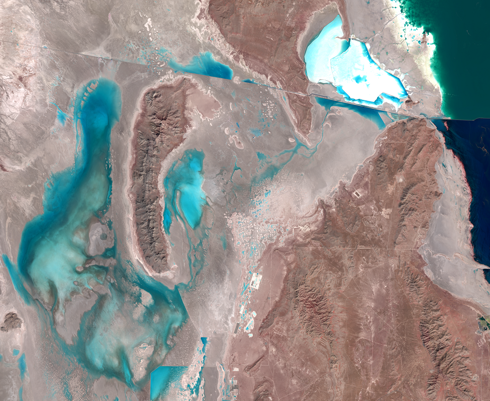
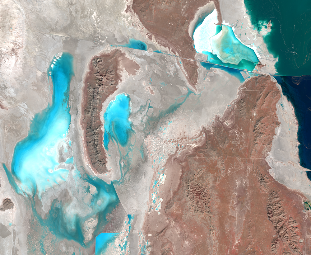
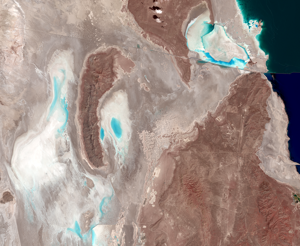
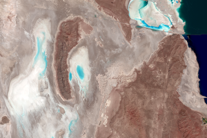
The Evaporation Basin
Earth Resources Observation and Science (EROS) Center - Earthshots
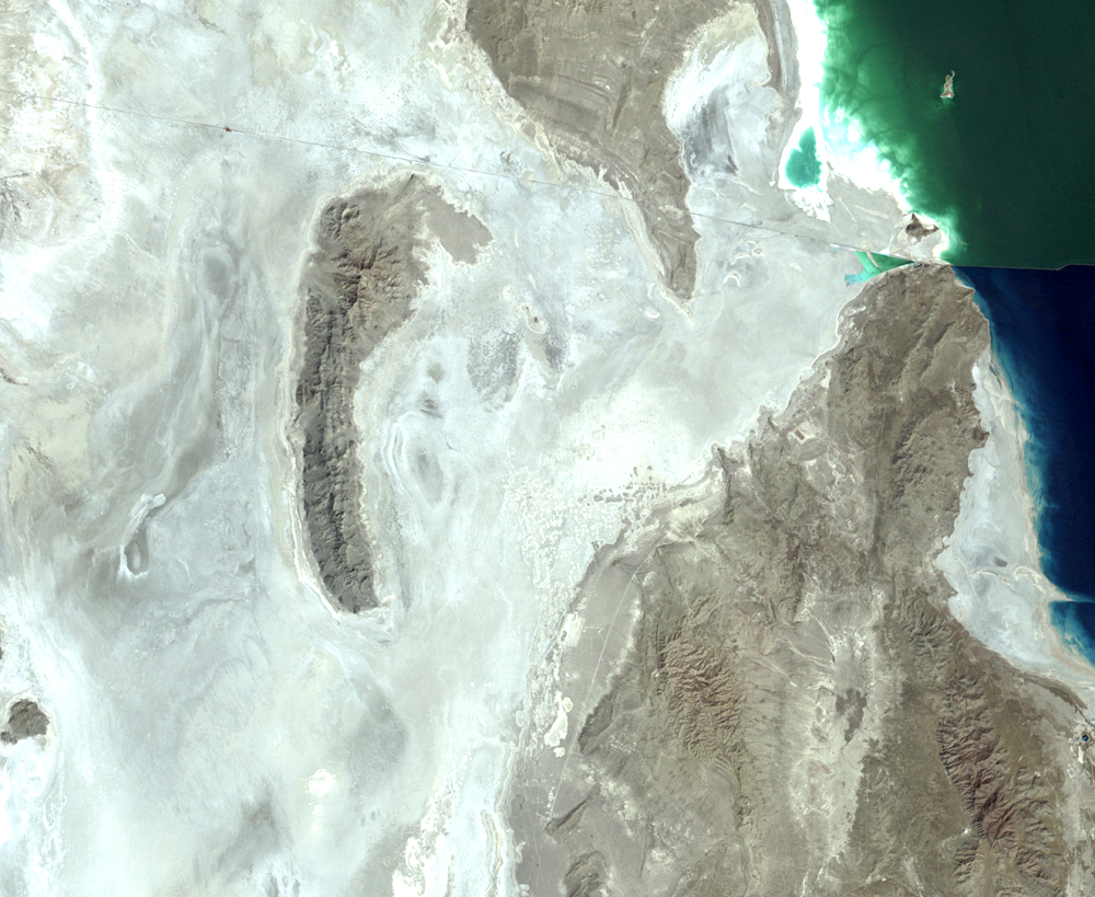
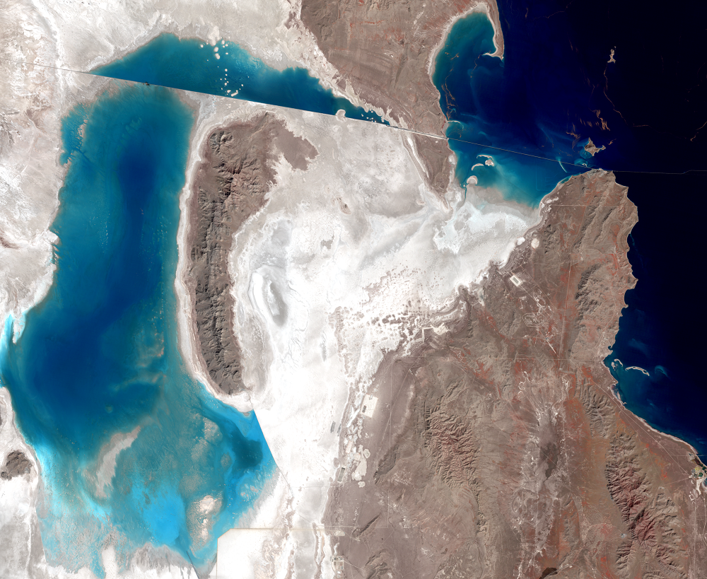
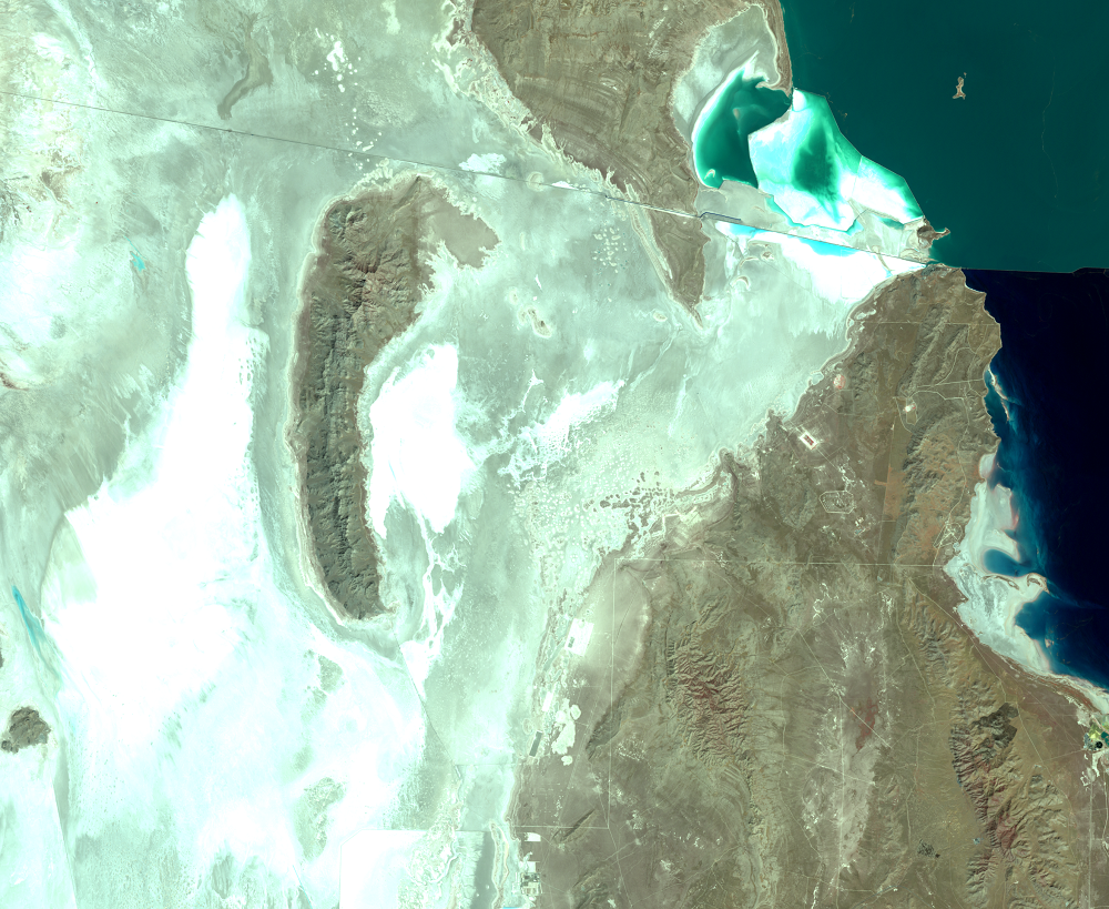
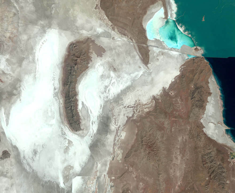
In June 1986, the State of Utah began construction of a system to pump excess water from the lake onto the Bonneville Salt Flats, creating the Newfoundland Evaporation Basin. This project included a pumping station at Hogup Ridge, inlet and outlet canals, four trestles, almost 25 miles of dikes, a 37-mile natural-gas pipeline, and a 10-mile access road between Lakeside and the pumping station. Pumps ran from April 1987 until June 1989, by which time the lake had dropped almost 6 feet. The pumping caused about 2 feet of that drop.
In the first year, about 1.5 million acre-feet of water was pumped into the evaporation basin (an acre-foot is a volume that would cover one acre with one foot of water). A dike was built at the southeast end of the basin to control the basin’s water level and let salt-rich water flow back into the lake. If the level of the basin rose high enough, some water would travel all the way around the Newfoundland Mountains and back into the lake. Over the course of the project about 264,000–283,000 acre-feet of water actually did so.
Imagery
Downloads
Related Content
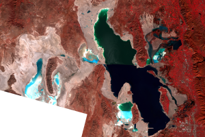
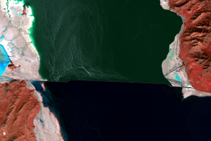
Great Salt Lake, Utah, USA
These images show the dramatic effects of the Great Salt Lake's high w...
The Causeway
One of the first flood-control measures involved the railroad causeway...
The Evaporation Basin
In June 1986, the State of Utah began construction of a system to pump...