

Landsat 7, which launched on April 15, 1999, has been continuing to acquire land images worldwide for 16 years. Landsat 5 may hold the Guinness World Record for longest Earth-observing satellite at 28+ years, but Landsat 7 also has an impressive track record. In fact, Landsat 7 has now acquired over 2 million images. They are all freely available online at USGS GloVis or EarthExplorer.
Landsat 7 and Landsat 8 acquire over 1,200 new images per day. This is more data than at any other time in the history of the Landsat program.
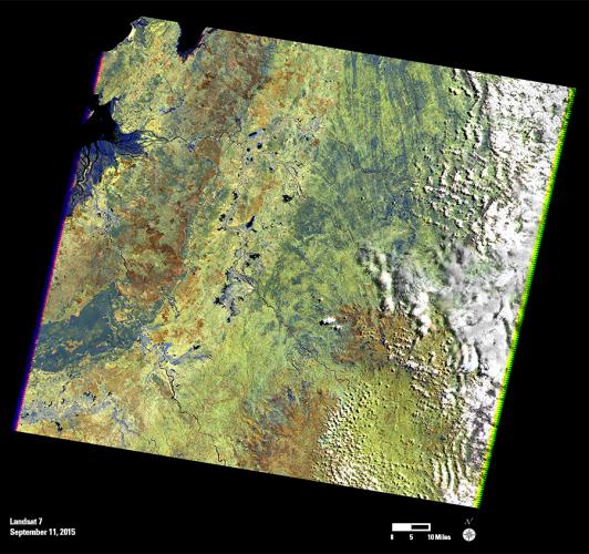
The 2 millionth Landsat 7 scene includes a portion of northwestern Madagascar, acquired on September 11, 2015. The dark region in the lower left is the Ankarafantsika Nature Reserve. This large area of deciduous forest, savannah, and wetland is protected as a national park. On the left edge of the scene is Mahajamba Bay. This shallow bay contains Madagascar’s largest mangrove ecosystem, with tidal mudflats along the edges of the mangroves.