

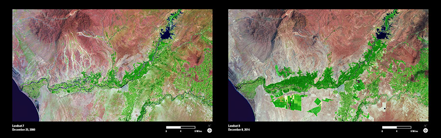
These two Landsat images show the expansion of agricultural fields along the Chira River in northern Peru. The green of irrigated fields contrasts against the arid background of the land in this coastal region. The main crops in this region include rice, cotton, maize, mangoes, and lemons.
The new agricultural areas in the second image (2014) are supported by irrigation from the Chira River and Poechos Reservoir in the upper right portion of the images. The reservoir and its system of dams were developed to generate electricity, control flooding, and support local irrigation needs.
Landsat imagery is often used to monitor the status and changes of agricultural land use and water resources over time.