

On September 27, 2016, the Cedar River surged to a crest of 22 feet at Cedar Rapids, Iowa—6 feet above the river’s major flood stage designation. This inundation was a result of quick-moving storms that dropped about 10 inches of rain in the eastern part of the state recently.
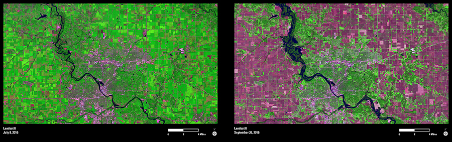
Images from Landsat 8’s Operational Land Imager sensor show the dramatic transformation of the river as it flows toward Cedar Rapids. On July 8, 2016, the shallow river meanders into the city, surrounded by green crops in the heart of the growing season. The September 26 image shows the overflowing river at a time when magenta tones around it speak to a countryside preparing for the harvest.
Emergency crews erected nearly 10 miles of temporary flood barricades and laid 250,000 sandbags in Cedar Rapids to prepare for rising waters in the city. Authorities advised as many as 10,000 residents to evacuate as the Cedar River surged to levels exceeded only by the flood of 2008, when the water crested at a record 31.12 feet.