

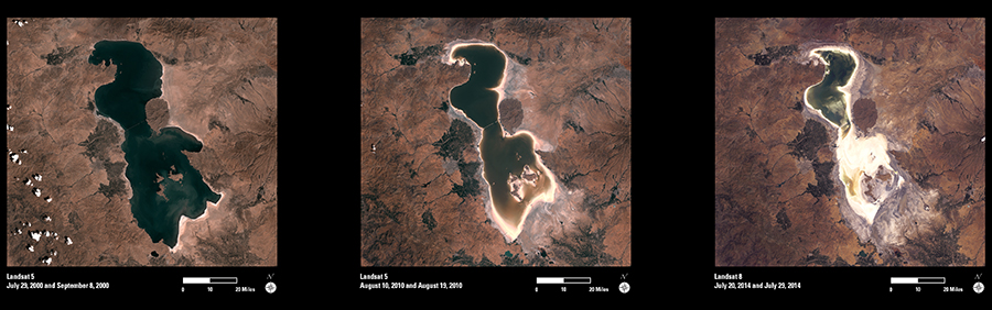
Lake Urmia, located in northwestern Iran, was once one of the largest saltwater lakes in the Middle East. It supports an important seasonal habitat for many species of migrating birds.
In recent years, the lake has diminished dramatically. Water enters Lake Urmia primarily from rainfall and inflowing rivers. The diversion of water from local rivers for agricultural use is one likely cause of Lake Urmia’s decline. Since 1996, drought has further contributed to the lower lake levels. The lake now covers about 10 percent of the area it covered in the 1970s.
These Landsat images show the changes to Lake Urmia’s surface area over the past fourteen years. Each image was created by mosaicking several individual Landsat scenes to show the full lake area. From 2000 to 2010, some changes can be seen. In the final image (2014), the entire southern portion of the salty lakebed is now exposed.
Future Landsat imagery will continue to be a useful tool for mapping and monitoring of further changes to Lake Urmia and its surrounding areas.