

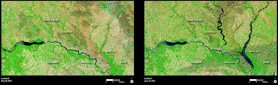
In June 2014, southeastern South Dakota received record amounts of rainfall, and parts of neighboring states also received excessive rainfall due to a series of severe storms. As rivers overran their banks, many roadways became impassable and the rising waters damaged many homes and businesses. This area is an important agricultural region, and the heavy rainfall and accompanying hail damaged many of the recently planted corn and soybean crops.
The second image clearly shows the Vermillion River and the Big Sioux River flooded over their banks. The lower right corner of the second image also has darker tones mixed throughout the agricultural areas (bright green). These darker tones suggest potential flood damage to the crops in this region.
Landsat images such as these can be an important tool for evaluating the damage to local crops and for monitoring the agricultural recovery and replanting efforts on a regional scale. The Landsat imagery will also be useful for monitoring the overall distribution oft floodwaters as they recede and move downstream.