

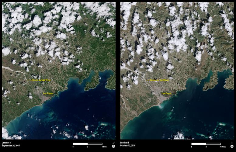
A week after Hurricane Matthew slammed through southwestern Haiti on October 4, 2016, Landsat 8’s Operational Land Imager sensor provided dramatic documentation of the scope of destruction in the Caribbean country.
In Haiti, land is often managed in small patches. A household may have subsistence crops in a number of locations, often on steep slopes. Data acquired on September 26 shows the landscape green with vegetation. On October 12, eight days after the storm, the hillsides are denuded after the Category 4 storm washed away crops and fallows.
Also evident in the post-storm image is a surge of sediment in the coastal waters at the mouth of the Ravine du Sud River near the seaport town of Les Cayes after Matthew went through. Geologists say the sediment likely comes from slopes that lacked protective tree cover.
The slow-moving storm dropped upwards of 30 inches of rain across parts of the impoverished nation. Hundreds of thousands of homes were damaged or destroyed. Meanwhile, public health authorities fear that the rush of rain will worsen a cholera epidemic that was already present.