

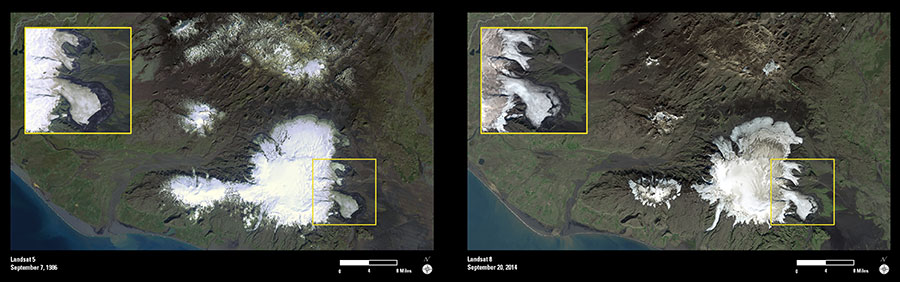
These two Landsat images show several of Iceland’s ice caps as they appeared in September 1986 and 2014.
The largest white area is the Mýrdalsjökull Ice Cap. Underneath this massive mound of ice sits the active Katla volcano. Katla erupts every 40–80 years and is accompanied by high-volume glacial outburst floods (jökulhlaups). The smaller ice cap to the west is Eyjafjallajökull. This ice cap also covers an active volcano, which last erupted in 2010 and disrupted air travel for several weeks.
The brown areas on both ice caps consist of accumulated volcanic ash and other deposits from past volcanic eruptions. The dark cover of volcanic ash from the 2010 eruption is especially prominent on the 2014 image of Eyjafjallajökull.
At first glance, there appears to be remarkable shrinkage of the ice caps by 2014, the situation for most of Iceland’s ice cover. However, the bright white areas in the 1986 image represent fresh snow cover, which is not present in the 2014 image. To monitor the actual changes in the extent of an ice cap, scientists measure changes in the position of the terminus of outlet glaciers.
Landsat is one of several important remote sensing tools being used by glaciologists to map and monitor changes in the Earth’s ice cover over time.