

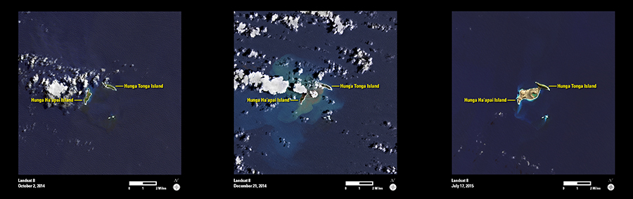
An undersea volcano between the two small islands of Hunga Tonga (right) and Hunga Ha’apai (left) began erupting in early December 2014. After about a month of eruptive activity, a new landmass had formed, nearly joining the two islands.
This series of Landsat 8 images shows the two islands in October 2014 (before eruptions), in December 2014 (during the eruptions), and in July 2015 (after the eruptions).
Along with creating new landmass, the volcanic activity has also radically changed the islands’ ecology. The first panel shows vegetation cover (green) on both of the original islands. The predominantly gray and brown colors in the third image now indicate bare land surface, especially on the southeastern island.
Landsat images are often useful for mapping changes to the Earth’s land surface. Future images will also allow scientists to monitor any changes and long-term recovery of vegetation and land cover