

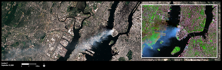
Landsat’s role in monitoring land use and land cover changes on Earth gives it a spectacular view of the planet’s most historic events. Such was the case with the September 11, 2001, attacks on New York City’s World Trade Center.
This true-color image was taken by the Enhanced Thematic Mapper Plus (ETM+) sensor aboard the Landsat 7 satellite on September 12, 2001, at roughly 11:30 a.m. Eastern Daylight Savings Time. A day after the attack, smoke continues to billow out of the collapsed Twin Towers.
The inset moves in closer on the same Landsat 7 image, but uses infrared bands to reveal burning that continues in the footprints of the towers.
Since it began acquiring imagery of Earth from space in 1972, Landsat has captured numerous other significant world events, such as the Chernobyl nuclear power plant disaster, Mount St. Helens volcanic eruption, and Hurricane Katrina.