

Wildfires in wilderness areas like Guadalupe Mountains National Park in west Texas are always a danger, but they can produce what land managers call a “good burn,” too. The Coyote Fire that scorched parts of Guadalupe Mountains from May 7, 2016, until June 17 is a prime example of that.
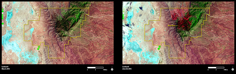
Pre- and post-fire images acquired with shortwave infrared (SWIR), near infrared (NIR), and red bands on Landsat 8’s Operational Land Imager sensor reveal a significant, 14,442-acre burn scar within the park’s high country. The burn scar appears red in the June 23 image. Lightning started the wildfire, and strong winds drove it to the Texas-New Mexico border.
As many as 300 firefighters worked to keep the blaze from encroaching on private lands or reaching park structures, while officials decided to let portions of the fire simply burn. The Guadalupe Mountains’ rugged backcountry makes firefighting dangerous. On top of that, areas of the densely wooded park hadn’t burned in almost a century. Unharnessed, the Coyote Fire consumed dead wood and saplings that could have fueled future catastrophic blazes. Land managers also avoided drenching the wilderness in retardants and scarring the landscape with lines dug by firefighters trying to cut off the fire.
In this 100th anniversary year of the National Park Service, new grass growing on charred ground at Guadalupe Mountains National Park is an important reminder that sometimes fire can be a good thing.