

A wildfire near Soberanes Creek along the Pacific coast of California started July 22, 2016, and spread to over 86,000 acres one month later.
California Department of Forest and Fire Protection officials say the blaze began after an illegal campfire was abandoned. By mid-August, it had destroyed 57 homes and was threatening 410 more structures in an area hugging the coast northwest of Big Sur.
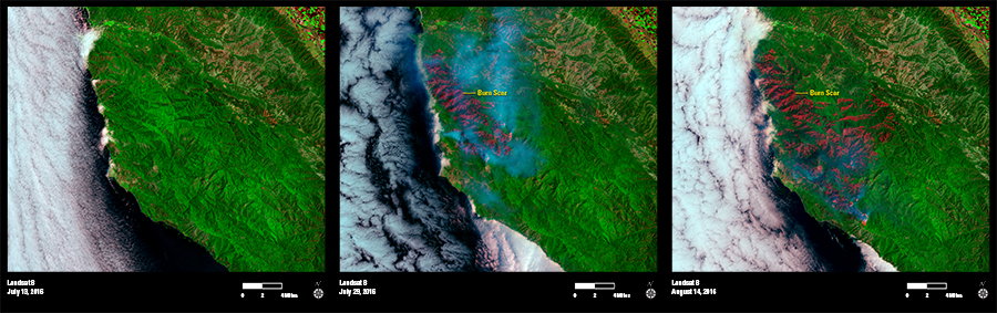
Landsat images from July 13, July 29, and August 14 show the dramatic progression as active fire burns orange in the latter two scenes, and smoke appears as a blue haze. Landsat 8’s Operational Land Imager sensor using shortwave infrared, near infrared, and red spectral bands reveals the growing red burn scar from a fire that was only 60 percent contained by mid-August.
The Soberanes Fire is one of the largest blazes in California’s 2016 fire season, with more than 4,100 firefighters battling it at various times.