

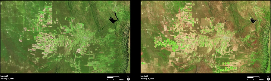
These Landsat images show portions of the Cordoba and San Luis provinces in central Argentina. The urban area to the right of image center is Villa Dolores. To the north and east of the urban area, the Embalse Allende (“Vineyard Dam”) can be seen in the two images.
This region has been long noted as an important center for potato production. In this semiarid climate, a double crop is possible when the potatoes are given enough moisture through irrigation. Other important local crops include wine grapes, olives, tobacco, walnuts, and jojoba.
These two images show 20 years of change to the agricultural landscape. The first image was acquired in January 1994 and shows areas of active cropland (bright green and lighter tones). The second image, from January 2014, shows apparent conversion of additional areas to agricultural use. The bright green circles indicate center pivot irrigation systems, which have been installed over the past two decades.
Since both images were acquired during the same time of year (mid-January) the overall difference in color tones also suggests a difference in weather conditions between the two years. The 1994 image (green) was likely a year of higher precipitation, compared to the 2014 image (brown) which has been relatively dry.
Landsat imagery is an important tool for monitoring change to the Earth’s landscape over time.