

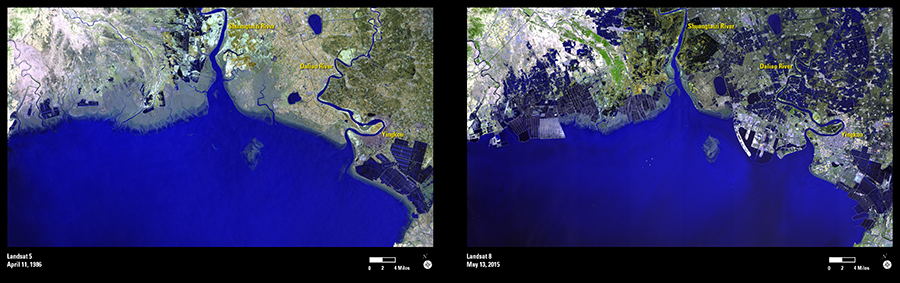
These Landsat images show the land use changes of the Liaodong Bay area in northeastern China. The Shuangtaizi River and the Daliao River carry large amounts of sediment from the loess plains and agricultural soil erosion upstream. The salt marshes on the river delta have been affected by an expanding aquaculture industry, visible as the dark geometrical shapes that have clearly expanded in the 2015 image. Also visible is the expanding city of Yingkou and ports extending into Liaodong Bay.
Salt marshes in this region decreased during the 1980s and early 2000s. Aquaculture ponds, and rice paddy and reed fields replaced the salt marsh; however, from 2004 to 2009, salt marshes showed a slow recovery. Researchers use Landsat imagery to monitor the recovery as well as human uses of this land to track salt marsh extent from year to year and how those changes affect habitats and wildlife.
Satellite images are necessary for this monitoring because large areas can be mapped relatively quickly where it is difficult to conduct field surveys. The 30-meter resolution of Landsat provides enough detail for remote sensing scientists to observe and quantify such changes.