

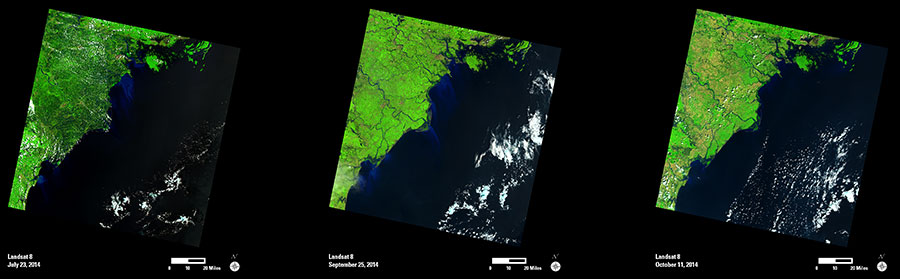
In July 2014, rains from Typhoon Rammasun triggered heavy flooding as it made landfall in northern Vietnam. Only two months later, Typhoon Kalmaegi made landfall along the same section of coast. While the rainfall was not as strong as it was from Rammasun, rivers were still swollen from the previous storm.
The first two Landsat images show the shoreline along the Gulf of Tonkin after each of these major storms. In the July image, the dark shades across the landscape indicate the extent of flooded land and potential crop damage due to Typhoon Rammasun. Increased flows of river sediment into the gulf are prominent in this image; bright shades of blue contrast with the surrounding waters.
The second image was acquired several days after Typhoon Kalmaegi made landfall. This image shows a less pronounced flood impact across the landscape, but sediment flows are still clearly visible from this storm. The October image shows the area in continued recovery after both typhoons, with normalized sediment flows into the gulf.
Landsat data provide an important source of pre- and post-event images that are often used to support disaster and recovery monitoring worldwide.