

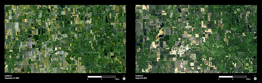
These Landsat images show the area around Tioga, North Dakota, in 2002 and again in 2014. Oil was first discovered near Tioga in 1951, and the town has experienced several episodes of rapid growth due to its location over the Williston Basin, a major North American geologic source of oil, natural gas, and other energy resources. The recent development of advanced drilling techniques has led to a new surge of production, particularly within the Bakken Formation, which has become an important source of oil within the United States.
These two Landsat images show the dramatic changes to the landscape near Tioga in recent years. Many new oil wells and related facilities (small bright features) are visible in the 2014 image compared to the earlier image. The rapid expansion of the town of Tioga can also be seen, as the town has grown to support an expanding workforce. The 2014 image also shows the development of new oil processing and transportation facilities along the western and eastern edges of Tioga.
The images from the Landsat archive span four decades and provide a consistent worldwide record of land use and land cover changes as they occur across the Earth’s surface.