

The Bone Valley region in Central Florida contains the largest known deposits of phosphate in the United States. These deposits were formed within layers of fossil-rich sediments that developed millions of years ago when the area was underwater. The rocks in this region contain phosphate minerals that are broken down for phosphorus, which is used to produce agricultural fertilizer and other applications.
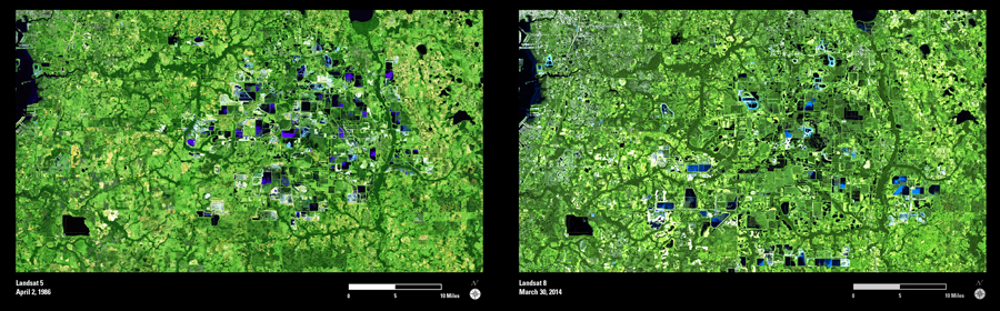
These Landsat images show an area with phosphate mining activity in 1986 and again in 2014. The two images show numerous changes to the landscape during this time interval. The surface mining process involves removal of the vegetation and top layers. The exposed phosphate ore is removed and scooped into a pit, then mixed with water to create “slurry”. The slurry is pumped to a processing plant where the phosphate is extracted. After processing, the remaining waste by-products are pumped into settling ponds, and the land undergoes a reclamation process.
The multiple stages of this process are apparent in these Landsat images. The bright areas indicate exposed rock and land surface. The black, blue, and purple tones indicate water combined with other components in varying compositions, within the slurry and settling ponds. The green shapes with geometric outlines (particularly toward the center of the second image) indicate reclaimed areas with new vegetation.