

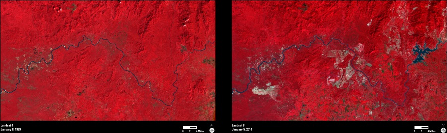
These Landsat images show the Sesan River (Tonlé San), which runs through the boundary region between northeast Cambodia and Vietnam. The river forms an important tributary to the Mekong River, which lies to the west (not shown). The two images were acquired in 1989 (left) and again in 2014 (right).
These images are “false-color composites.” The red tones are due to a strong signal from Landsat’s near-infrared (NIR) band, which is often used by landscape scientists to monitor the presence and condition of vegetation and forested areas. The lighter tones in the 2014 image show where vegetation has been cleared for logging, mining, or other land use purposes.
The Yali (Yaly) Falls Dam was built in 1993–1996, and its associated reservoir can be seen on the right side of the 2014 image.
The information contained in images such as these can be used to understand the landscape conditions at any location worldwide, and the 40-year record of Landsat allows scientists and others to monitor changes to this landscape over time.