

Nauru is the world’s smallest island country, with only 21 square kilometers (8 square miles) of land area. Since the early 1900s, the tiny island has been mined for its rich phosphate reserves. By 2000, most of the phosphate deposits had been exhausted, and the strip mining and associated activities had denuded up to 80% of Nauru’s surface. The mining left extensive damage to Nauru’s surface and ecology, but in recent years there have been efforts to rehabilitate the affected areas.
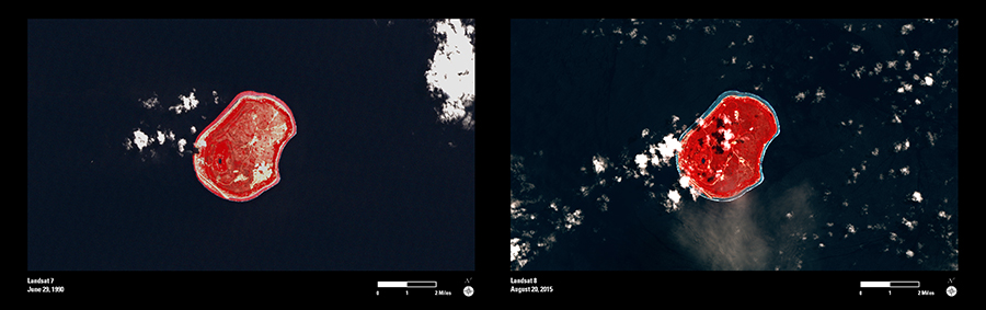
These two Landsat images are false-color composites. The red tones indicate a strong signal from Landsat's near-infrared (NIR) band, which is used by landscape scientists to monitor the presence and condition of vegetation and forested areas. In this type of image, a deep red color indicates actively growing vegetation and forest, while non-vegetated or poorly vegetated areas will have less red tone.
The 1999 Landsat image (left) shows the bright mine scars along with dull, mixed color tones across the landscape, indicating a generally poor condition for the island’s vegetation. The deep red colors throughout the 2015 image (right) suggest an overall increase in vegetation and forest cover.
Landsat imagery can be a valuable tool to help document the history of the mining impacts and track the progress of restoration activities as Nauru works to revitalize their island nation.