

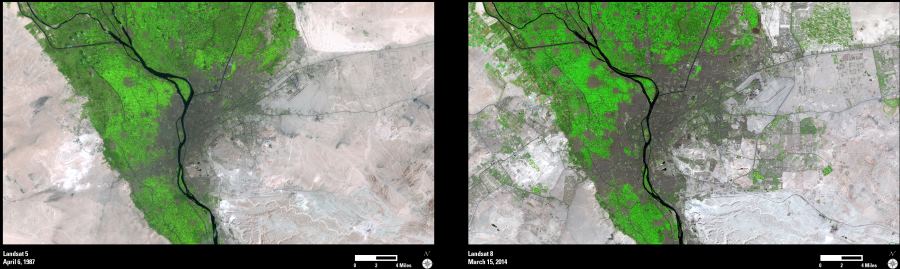
Egypt’s capital city of Cairo lies in the fertile Nile River Valley. Historically, Cairo and its agricultural areas have been geographically limited by natural desert borders, but these patterns are changing due to recent reclamation of surrounding desert land.
These two images were acquired by the Landsat satellites in 1987 and 2014. During this time period, Cairo’s population has increased from an estimated 6 million in 1986 to over 15 million in 2014.
The recent population growth has caused the city and its associated urban areas to expand into the surrounding desert, as seen in the second image. Within the main Nile River Valley, these two images also show an overall increase in developed urban area (grey/brown) versus previous agricultural land use (green).
As new urban and agricultural areas are being developed in the desert, they require diversion of water supplies from the main Nile River Valley. This expanded irrigation is indicated by the numerous bright green areas throughout the second image.
The Landsat data archive spans more than 40 years and provides a valuable record of changes on the Earth’s surface, including urbanization and agricultural land use change.