

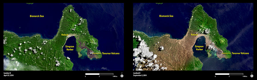
Mount Tavurvur erupted on August 29, 2014, sending ash over surrounding areas on Papua New Guinea’s New Britain Island. The stratovolcano is located along the eastern edge of the Rabaul Volcanic Complex, and its last major eruption was in 1994.
These two Landsat images were acquired in April and September 2014. In both images, Mount Tavurvur can be seen to the east side of Simpson Harbor. This harbor forms part of the much larger (mostly submerged) Rabaul Caldera.
The second image was acquired a few days after the August 2014 eruption. This image shows the extent of ashfall (gray-brown), while the forested areas that were less affected by ash remain green.
Images acquired by the Landsat satellites are useful for monitoring land changes and recovery after natural disasters such as volcanoes.