

After the Gulf War
Earth Resources Observation and Science (EROS) Center - Earthshots
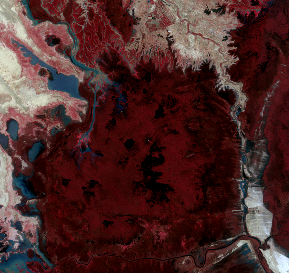
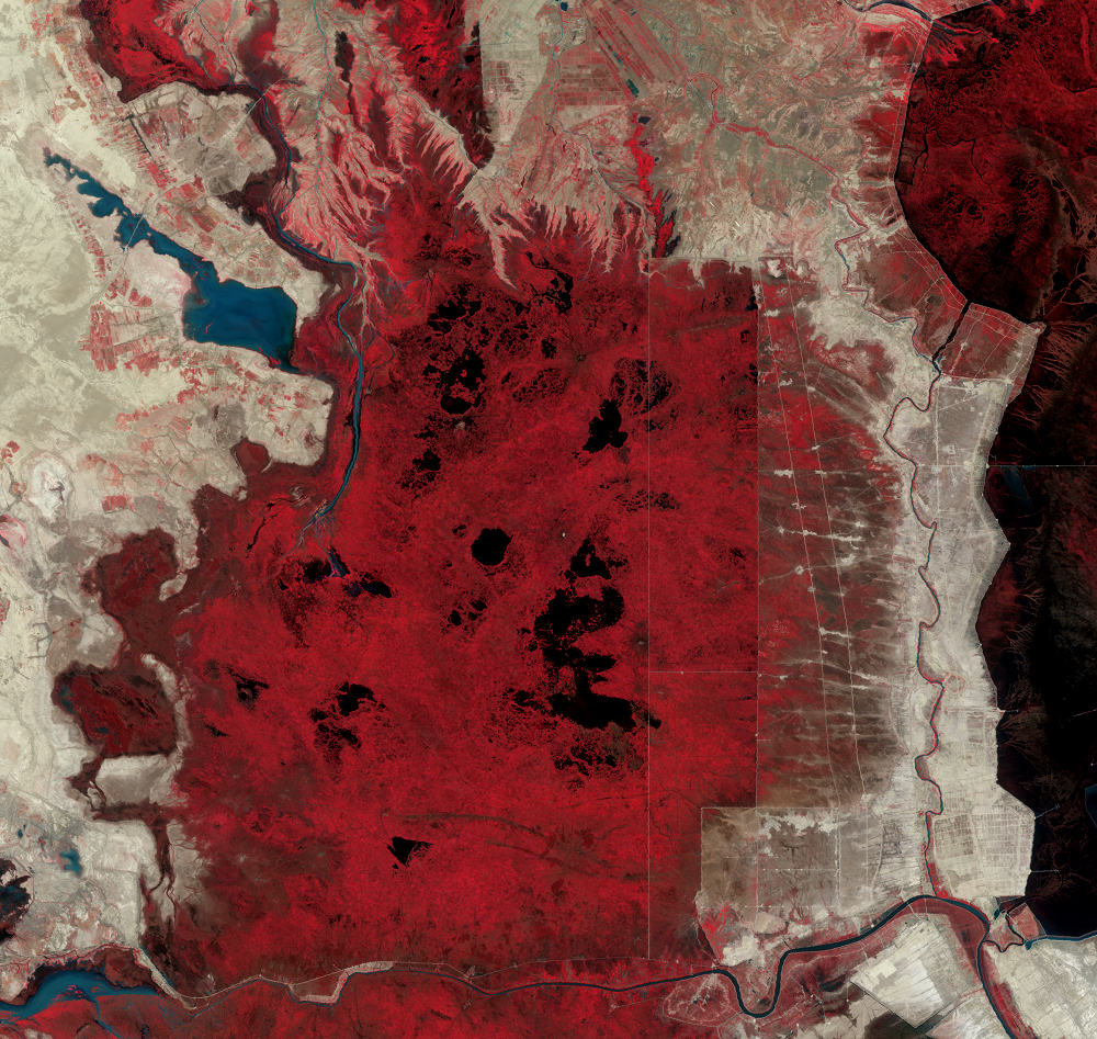
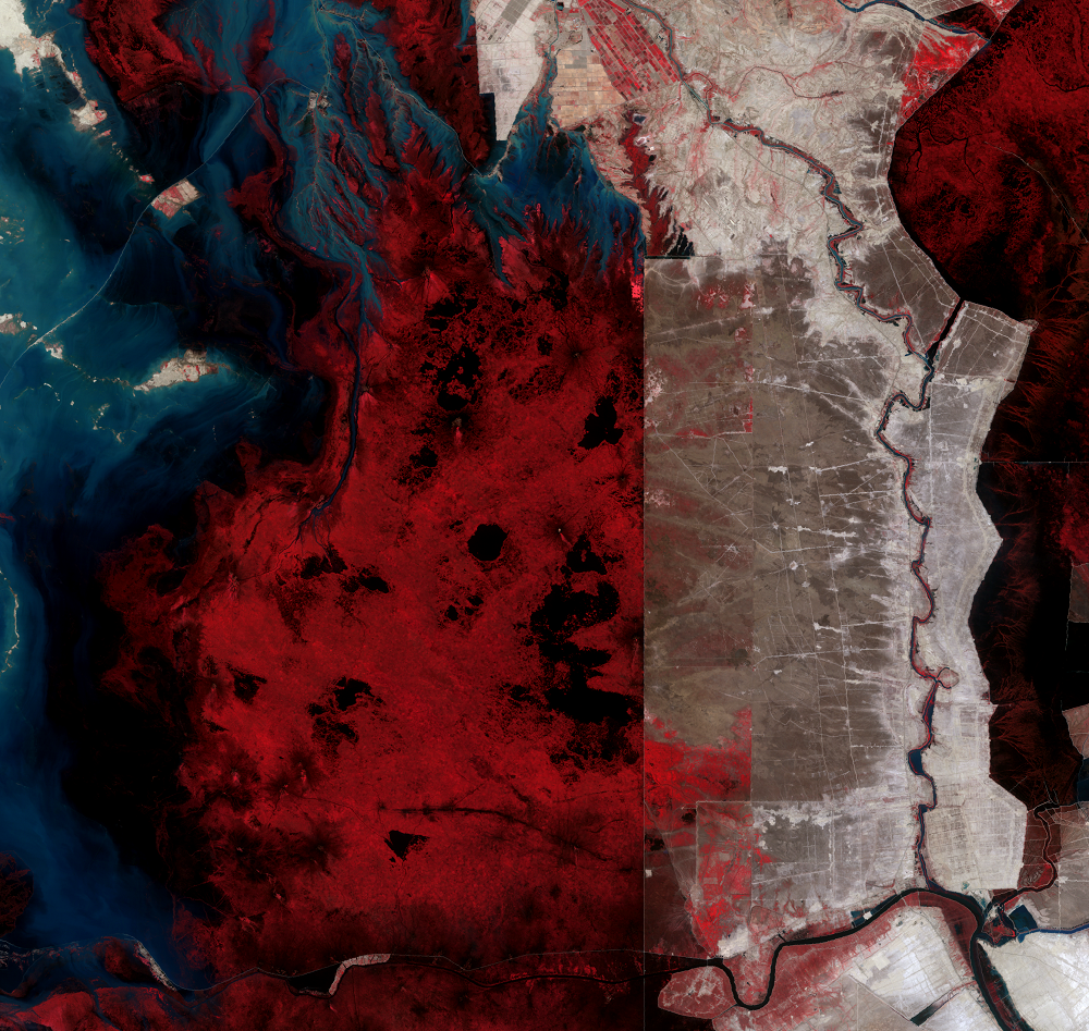
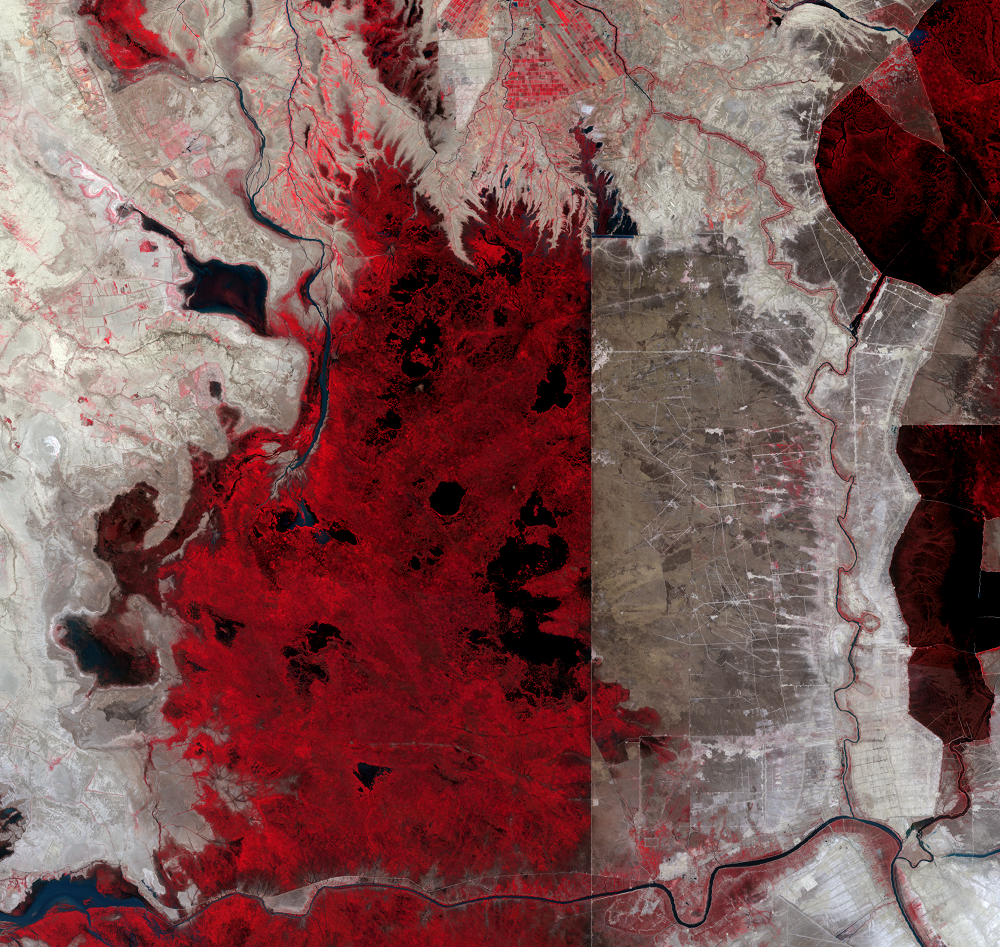
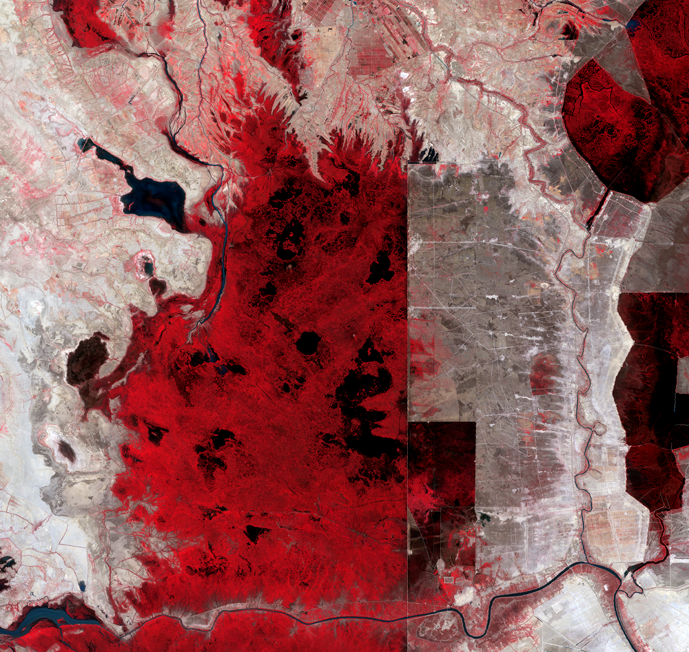
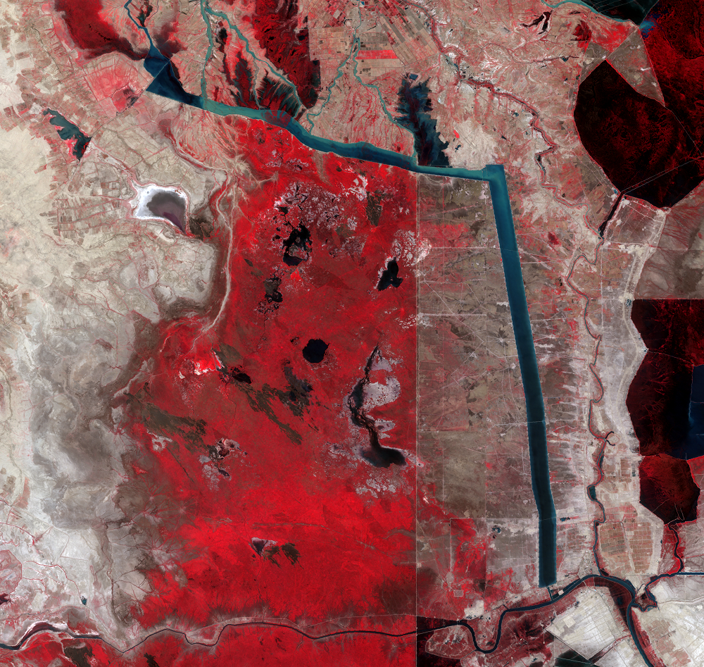
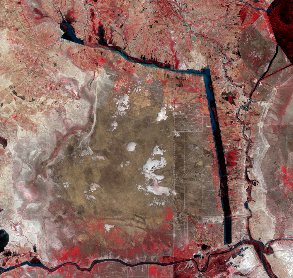
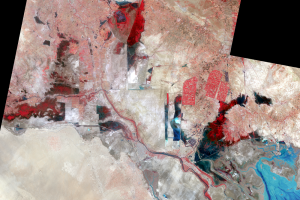
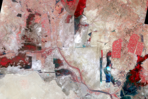
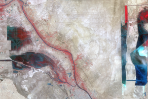
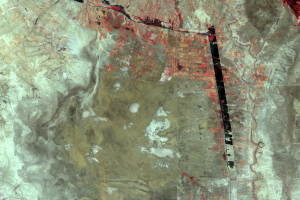
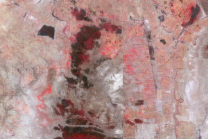
Large-scale draining of the marshes began in earnest after the Gulf War of 1991. Water from the Tigris and Euphrates rivers was redirected to bypass the marshes. A west-east canal, 40 kilometers long and 1–2 kilometers wide, connected to the north-south Prosperity River, the prominent canal in the middle of these images. Even wider than the west-east canal, the Prosperity River is basically a massive moat that captures water from the rivers and tributaries and prevents it from flowing into the marshes.
Throughout the 1990s, the marshes declined dramatically. The loss of vegetation and water is widespread and clear to see in the images. The extent of the marshland was reduced by about 85% by 2000.
Imagery
Downloads
Related Content
Mesopotamian Marshes, Iraq
Fifty years of observing the Earth means Landsat has witnessed many la...
About the Marshes
All of the water that keeps the Mesopotamian Marshes alive comes from ...
War Comes to the Marshes
The marsh wetlands supported the traditional lifestyles of an estimate...
After the Gulf War
Large-scale draining of the marshes began in earnest after the Gulf Wa...
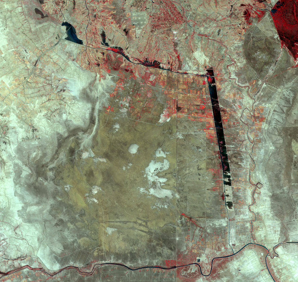
The Water Returns
After the large-scale draining throughout the 1990s, the Mesopotamian ...