

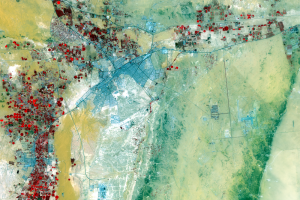
Al Kharj
Earth Resources Observation and Science (EROS) Center - Earthshots
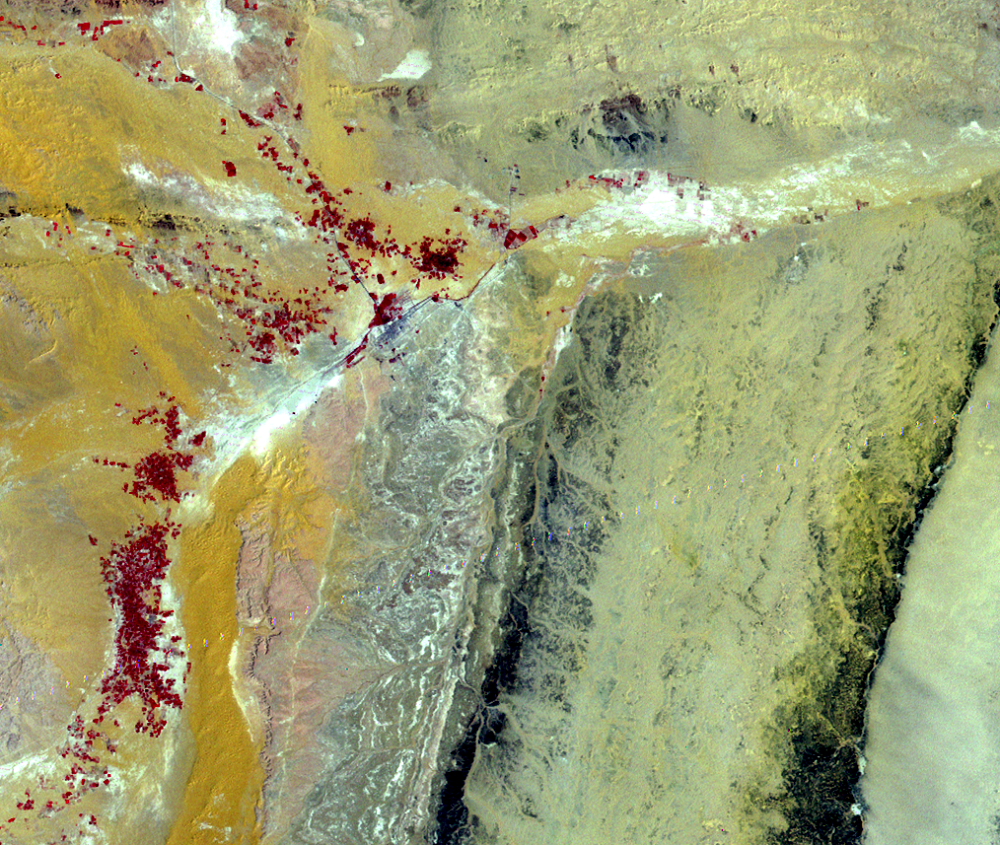
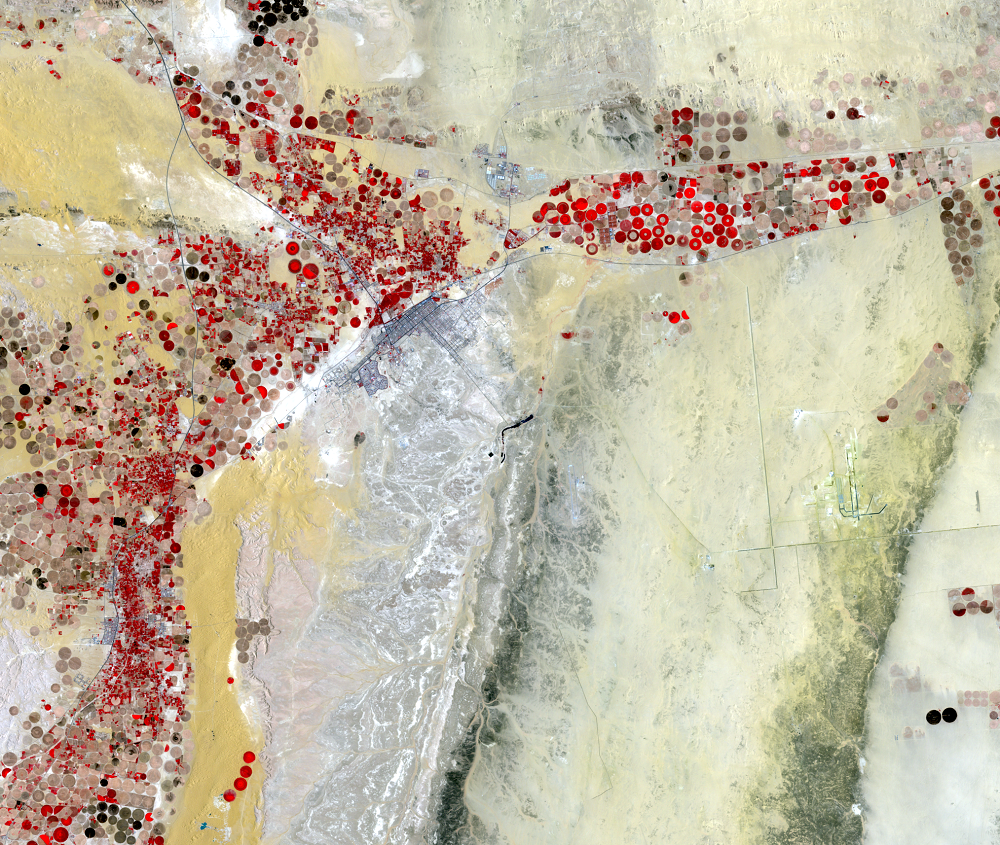
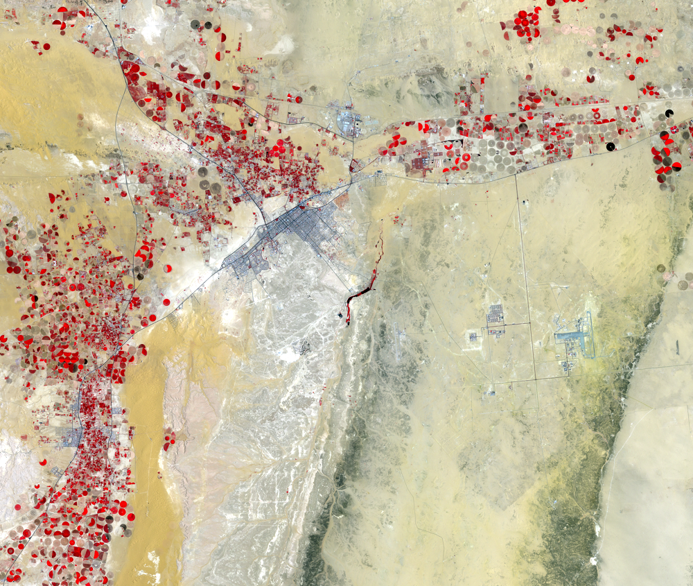
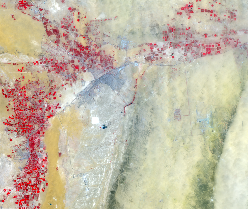
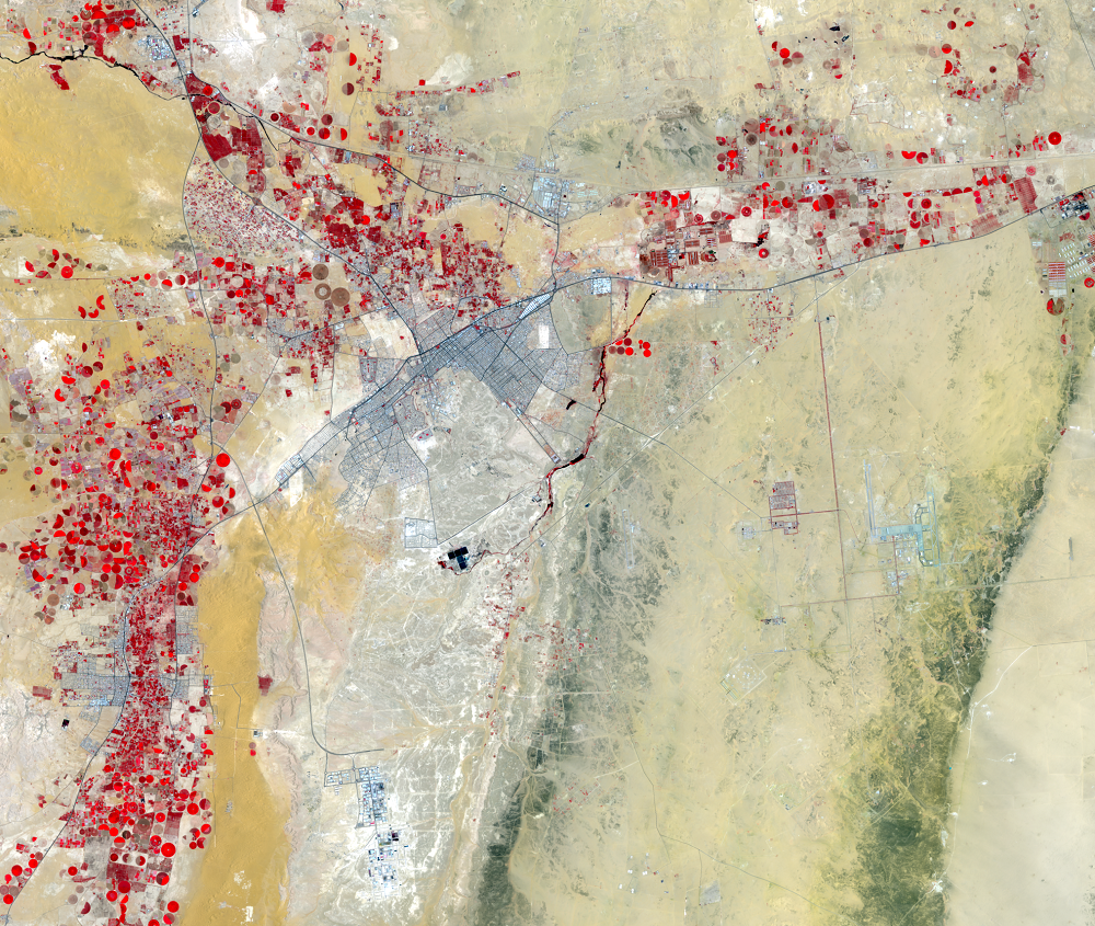
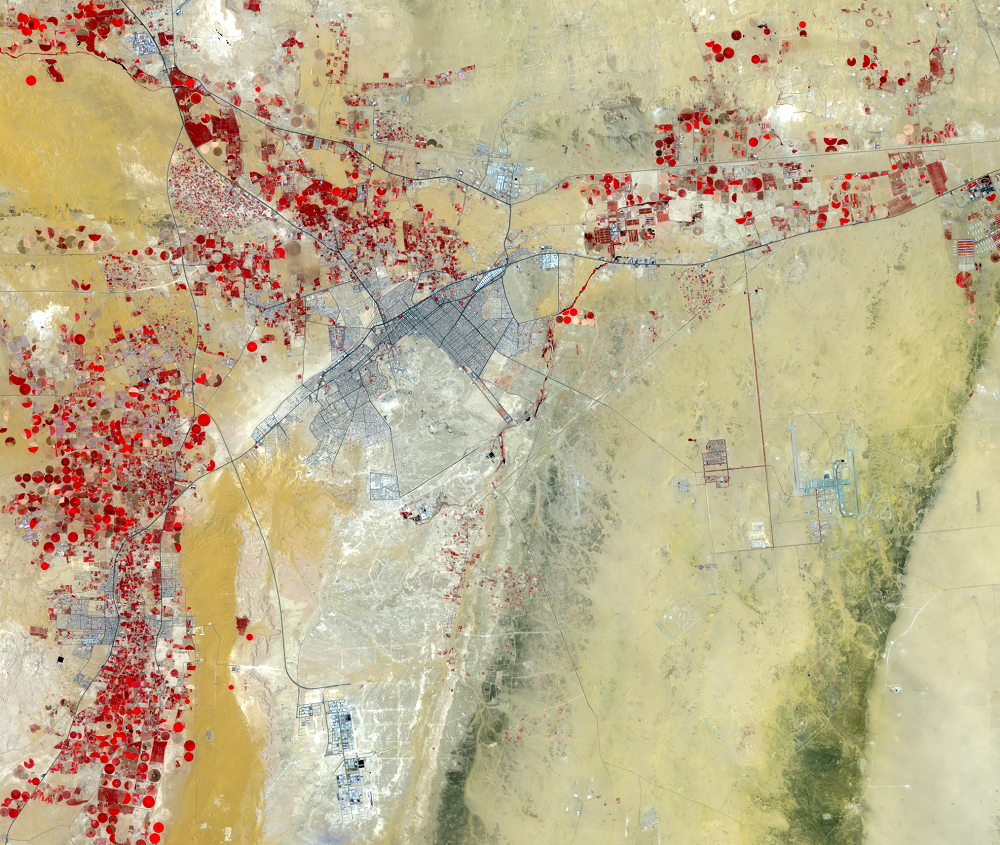
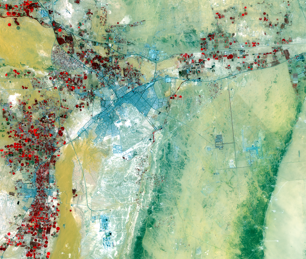
Southeast of Riyadh, irrigation has clearly increased over time, particularly around the city of Al Kharj. The red circles are fields with center-pivot irrigation systems, drawing water from Saudi Arabia’s aquifers. This irrigation development resulted from the investment of part of Saudi Arabia’s oil revenues in an effort to modernize agriculture.
Imagery
Downloads
Related Content
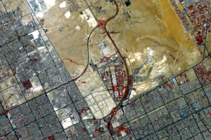
Riyadh, Saudi Arabia
The modernization of Saudi Arabia has been a recent and rapid phenomen...
Al Kharj
Southeast of Riyadh, irrigation has clearly increased over time, parti...
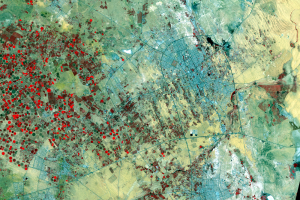
Buraydah
The smaller city of Buraydah, northwest of Riyadh, shows the same patt...
University
Princess Nora Bint Abdul Rahman University opened in 2011 just north o...